Category:Cherry Cobb Sands
Jump to navigation
Jump to search
Subcategories
This category has the following 3 subcategories, out of 3 total.
Media in category "Cherry Cobb Sands"
The following 49 files are in this category, out of 49 total.
-
 After the Harvest - geograph.org.uk - 1453662.jpg 640 × 416; 103 KB
-
 Alternative Transport - geograph.org.uk - 296016.jpg 476 × 640; 114 KB
-
 Cherry Cobb Sands - geograph.org.uk - 296011.jpg 640 × 475; 93 KB
-
 Cherry Cobb Sands - geograph.org.uk - 296014.jpg 483 × 640; 79 KB
-
 Cherry Cobb Sands - geograph.org.uk - 296017.jpg 640 × 477; 69 KB
-
 Cherry Cobb Sands - geograph.org.uk - 296020.jpg 454 × 640; 86 KB
-
 Cherry Cobb Sands Bank - geograph.org.uk - 295767.jpg 475 × 640; 76 KB
-
 Cherry Cobb Sands Bank - geograph.org.uk - 295775.jpg 640 × 479; 122 KB
-
 Cherry Cobb Sands Bank - geograph.org.uk - 296012.jpg 640 × 474; 75 KB
-
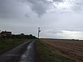 Cherry Cobb Sands Road - geograph.org.uk - 1473717.jpg 640 × 480; 35 KB
-
 Cherry Cobb Sands Road - geograph.org.uk - 1473722.jpg 640 × 480; 31 KB
-
 Cherry Cobb Sands Road - geograph.org.uk - 1473742.jpg 640 × 480; 36 KB
-
 Cherry Cobb Sands Road - geograph.org.uk - 1473753.jpg 640 × 480; 39 KB
-
 Cherry Cobb Sands Road - geograph.org.uk - 295730.jpg 640 × 465; 92 KB
-
 Cherry Cobb Sands Road - geograph.org.uk - 339426.jpg 640 × 480; 89 KB
-
 Cherry Cobb Sands Road - geograph.org.uk - 52134.jpg 640 × 480; 130 KB
-
 Cherry Cobb Sands.jpg 2,074 × 2,692; 1.03 MB
-
 Drain and Fields west of Sands Farm - geograph.org.uk - 1084599.jpg 640 × 480; 75 KB
-

-
 Flood Bank Drain and Fields - geograph.org.uk - 1084607.jpg 640 × 480; 77 KB
-
 Holderness Farmland - geograph.org.uk - 1324714.jpg 640 × 471; 118 KB
-
 Humber bank and saltmarsh - geograph.org.uk - 1084593.jpg 640 × 480; 81 KB
-

-
 Light tower, Cherry Cobb - geograph.org.uk - 2418077.jpg 1,600 × 1,259; 307 KB
-
 Lighthouse legs, Paull - geograph.org.uk - 2743487.jpg 426 × 640; 220 KB
-
 Lighthouse, Cherry Cobb Sand Bank - geograph.org.uk - 2418068.jpg 1,600 × 1,200; 349 KB
-
 Marshland at Cherry Cob Sands - geograph.org.uk - 2151172.jpg 3,519 × 2,664; 2.5 MB
-
 Marshland at Cherry Cob Sands - geograph.org.uk - 2151183.jpg 2,736 × 3,648; 2.41 MB
-
 New House Farm, Cherry Cobb Sands - geograph.org.uk - 295713.jpg 640 × 465; 110 KB
-
 Newlands Lane - geograph.org.uk - 1473773.jpg 640 × 321; 15 KB
-
 Power from Afar - geograph.org.uk - 657646.jpg 640 × 480; 65 KB
-
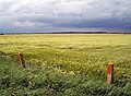
 Recently Harvested Field - geograph.org.uk - 520037.jpg 640 × 413; 110 KB
-
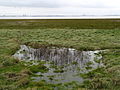 Riverside Pond at Cherry Cobb Sands - geograph.org.uk - 663731.jpg 640 × 480; 101 KB
-
 Riverside Pool - geograph.org.uk - 663918.jpg 640 × 480; 40 KB
-
 Riverside track to Thorney Crofts - geograph.org.uk - 985819.jpg 541 × 640; 145 KB
-
 Self Portrait, Cherry Cobb Sands - geograph.org.uk - 295734.jpg 478 × 640; 70 KB
-
 Sunset over Cherry Cobb Sands - geograph.org.uk - 193792.jpg 480 × 640; 56 KB
-
 The beginning of next year's crop - geograph.org.uk - 986551.jpg 640 × 480; 239 KB
-
 The Humber Bank, Cherry Cobb Sands - geograph.org.uk - 769053.jpg 640 × 410; 94 KB
-
 The Road to Thorngumbald - geograph.org.uk - 417732.jpg 640 × 480; 56 KB
-

-
 The track to Sands House - geograph.org.uk - 663721.jpg 640 × 480; 69 KB
-

-
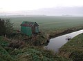
 Tin Hut and Drain - geograph.org.uk - 663736.jpg 640 × 480; 68 KB
-
 Track to road from riverbank - geograph.org.uk - 1084616.jpg 640 × 480; 77 KB
-
 Track to Sands Farm - geograph.org.uk - 1473732.jpg 640 × 480; 51 KB
-

-
 Track to the Humber River Bank - geograph.org.uk - 472756.jpg 640 × 480; 90 KB
-


