Category:Chiswell Green
Jump to navigation
Jump to search
English: Chiswell Green is an area, originally a village, in St Albans, Hertfordshire with a population of approximately 2,800, in the City and District of St Albans.
village in Hertfordshire, England  | |||||
| Upload media | |||||
| Instance of | |||||
|---|---|---|---|---|---|
| Location | St Stephen, St Albans, Hertfordshire, East of England, England | ||||
 | |||||
Media in category "Chiswell Green"
The following 18 files are in this category, out of 18 total.
-
 A road in Chiswell Green - geograph.org.uk - 26589.jpg 640 × 480; 31 KB
-
 Changing times - geograph.org.uk - 1721068.jpg 800 × 517; 101 KB
-
-
 Chiswell Green, Farmland - geograph.org.uk - 92083.jpg 640 × 425; 78 KB
-
 Chiswell Green, The Three Hammers - geograph.org.uk - 566462.jpg 640 × 480; 98 KB
-
 Daneswick farm buildings - geograph.org.uk - 1262.jpg 640 × 480; 48 KB
-

-
 Farmland close to the M25 - geograph.org.uk - 1721083.jpg 800 × 600; 82 KB
-
 Gardens of the Rose.jpg 2,560 × 1,920; 1.51 MB
-
 Gateway to suburbia - geograph.org.uk - 1264.jpg 640 × 480; 37 KB
-
 M25 Junction with M1 - geograph.org.uk - 613308.jpg 640 × 487; 136 KB
-
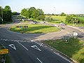
 Noke Roundabout, Chiswell Green - geograph.org.uk - 149809.jpg 640 × 480; 78 KB
-
 Parked lorry in Noke Lane. - geograph.org.uk - 39616.jpg 640 × 480; 23 KB
-
 Rose Arch Pergola at Gardens of the Rose, RNRS.JPG 3,000 × 4,000; 4.16 MB
-
 Shell Car Wash - geograph.org.uk - 1721098.jpg 640 × 434; 60 KB
-
 Three Hammers, Chiswell Green.jpg 639 × 277; 52 KB
-
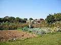 Watford Road Allotments - geograph.org.uk - 245086.jpg 640 × 480; 122 KB
-
 Watford Road, Chiswell Green - geograph.org.uk - 201444.jpg 640 × 480; 77 KB


