Category:Chrastava II
Jump to navigation
Jump to search
| Upload media | |||||
| Instance of | |||||
|---|---|---|---|---|---|
| Location | Chrastava, Liberec District, Liberec Region, Czechia | ||||
| Population |
| ||||
| Area |
| ||||
 | |||||
Čeština: Katastrální území Chrastava II (základní sídelní jednotka Na hůrce) je exklávou místní části Chrastava města Chrastava.
Subcategories
This category has the following 7 subcategories, out of 7 total.
Media in category "Chrastava II"
The following 8 files are in this category, out of 8 total.
-
 Chrastava II, Nádražní 371, továrna Bremi.jpg 3,190 × 2,344; 692 KB
-
 Chrastava II, socha svatého Jana Nepomuckého u Ještědské ulice.jpg 2,448 × 3,264; 3 MB
-
 Chrastava, Andělohorská 56, Lipová 393.jpg 3,264 × 2,448; 1.81 MB
-
 Chrastava, Andělohorská, zastávka autobusu.jpg 2,448 × 3,264; 1.17 MB
-
 Chrastava, telekomunikační věž.jpg 2,448 × 3,264; 654 KB
-
 Chrastava, vodárna.jpg 3,070 × 2,110; 797 KB
-
 Ještědsko, Velký Vápenný (asi).jpg 3,264 × 2,448; 883 KB
-
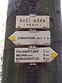 Ovčí hora, rozcestník.jpg 2,448 × 3,264; 1.12 MB


.jpg)
