Category:Christian & Missionary Alliance Sun Kei Primary School
Jump to navigation
Jump to search
| Object location | | View all coordinates using: OpenStreetMap |
|---|
primary school in Hong Kong | |||||
| Upload media | |||||
| Instance of | |||||
|---|---|---|---|---|---|
| Location |
| ||||
| Inception |
| ||||
| official website | |||||
 | |||||
Media in category "Christian & Missionary Alliance Sun Kei Primary School"
The following 21 files are in this category, out of 21 total.
-
 2021年9月-宣小及尚德邨邨路.jpg 3,264 × 2,448; 2.01 MB
-
 2022年9月-宣基小學A.jpg 4,000 × 2,250; 3.98 MB
-
 2022年9月-宣基小學B.jpg 4,000 × 2,250; 3.77 MB
-
 2022年9月-宣基小學C.jpg 4,000 × 2,250; 3.93 MB
-
 2022年9月-宣基小學D.jpg 9,248 × 6,936; 11.9 MB
-
 2022年9月-宣基小學E.jpg 9,248 × 6,936; 11.67 MB
-
 2022年9月-尚德邨內兩所小學.jpg 4,000 × 2,250; 3.94 MB
-
 2022年9月-陳國威小學、宣基小學及圓玄三中.jpg 4,000 × 2,250; 3.85 MB
-
 2023年9月-宣基小學A.jpg 3,947 × 2,960; 3.49 MB
-
 2023年9月-宣基小學B.jpg 3,968 × 2,976; 3.5 MB
-
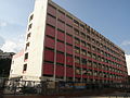 C&MA Sun Kei Primary School.JPG 3,648 × 2,736; 2.12 MB
-
 HK SKD TKO 將軍澳 Tseung Kwan O 寶順路 Po Shun Road path school July 2022 Px3 15.jpg 4,000 × 3,000; 6.49 MB
-
 HK SKD TKO 將軍澳 Tseung Kwan O 寶順路 Po Shun Road path school July 2022 Px3 16.jpg 4,000 × 3,000; 6.39 MB
-
 HK SKD TSO 將軍澳 Tseung Kwan O 寶順路 Po Shun Road 廣明苑 Kwong Ming Court May 2022 Px3 01.jpg 4,000 × 3,000; 5.37 MB
-
 HK SKD TSO 將軍澳 Tseung Kwan O 寶順路 Po Shun Road 廣明苑 Kwong Ming Court May 2022 Px3 02.jpg 4,000 × 3,000; 4.17 MB
-
 HK SKD TSO 將軍澳 Tseung Kwan O 寶順路 Po Shun Road 廣明苑 Kwong Ming Court May 2022 Px3 03.jpg 3,264 × 2,448; 3.75 MB
-
 HK SKD TSO 將軍澳 Tseung Kwan O 寶順路 Po Shun Road 廣明苑 Kwong Ming Court May 2022 Px3 04.jpg 4,000 × 3,000; 5.28 MB
-
 HK SKD TSO 將軍澳 Tseung Kwan O 寶順路 Po Shun Road 廣明苑 Kwong Ming Court May 2022 Px3 05.jpg 4,000 × 3,000; 5.16 MB
-
 Kwong Ming Court and Po Ming Court 2015 07 part1.jpg 4,912 × 3,264; 5.94 MB
-
 Po Ming Court 2015 07 part1.jpg 4,912 × 3,264; 5.69 MB
-
 Sheung Tak 2011.jpg 4,608 × 3,456; 4.94 MB


