Category:Christuskirche (Groß Köris)
Jump to navigation
Jump to search
| Object location | | View all coordinates using: OpenStreetMap |
|---|
church building in Germany  | |||||
| Upload media | |||||
| Instance of | |||||
|---|---|---|---|---|---|
| Named after | |||||
| Location |
| ||||
| Heritage designation | |||||
 | |||||
English: Christ church, Groß Köris municipality, Dahme-Spreewald district, Brandenburg state, Germany
Media in category "Christuskirche (Groß Köris)"
The following 8 files are in this category, out of 8 total.
-
 Gross Koeris Brandenburg evangelische Kirche.jpg 3,040 × 4,048; 2.67 MB
-
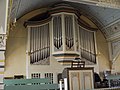 Groß Köris, Christuskirche, Orgel.jpg 2,048 × 1,536; 1.08 MB
-
 Groß-Köris Christuskirche Kirchenschiff Nordansicht.JPG 2,592 × 1,944; 2.86 MB
-
 Groß-Köris Christuskirche Nordostansicht.JPG 2,592 × 1,944; 2.82 MB
-
 Groß-Köris Christuskirche Nordportal.JPG 2,592 × 1,944; 2.84 MB
-
 Groß-Köris Christuskirche Südansicht.JPG 1,901 × 1,579; 2.23 MB
-
 Groß-Köris Christuskirche Westturm Nordwestansicht.JPG 1,944 × 2,592; 3.35 MB
-
 Groß-Köris Christuskirche Westturm Westansicht.JPG 1,944 × 2,592; 3.24 MB


