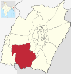
Category:Churachandpur district
Jump to navigation
Jump to search
District of Manipur, India | |||||
| Upload media | |||||
| Instance of | |||||
|---|---|---|---|---|---|
| Location | Manipur, India | ||||
| Population |
| ||||
| Area |
| ||||
| Elevation above sea level |
| ||||
| official website | |||||
 | |||||
Subcategories
This category has the following 6 subcategories, out of 6 total.
Media in category "Churachandpur district"
The following 16 files are in this category, out of 16 total.
-
Douglas Memorial High School Wide View.jpg 1,600 × 1,200; 358 KB
-
Location of the Salangthel Hill in Manipur.png 1,200 × 849; 523 KB
-
Manipur Churachandpur district.png 749 × 661; 108 KB
-
ManipurChurachandpur.png 744 × 632; 104 KB
-
Ngaloi Waterfall.jpg 3,648 × 2,163; 1.6 MB
-
Synod Office.jpg 3,630 × 2,334; 4.55 MB
-
Thangjing-Hill-area-SoI-1944.jpg 697 × 926; 355 KB
-
The Great Mormon, Papilio memnon, Male, seen mud-puddling in a ditch.jpg 3,264 × 2,448; 3.63 MB


