Category:Church Stretton
Jump to navigation
Jump to search
town and civil parish in Shropshire, England  | |||||
| Upload media | |||||
| Instance of | |||||
|---|---|---|---|---|---|
| Location | Shropshire, West Midlands, England | ||||
| Population |
| ||||
| Said to be the same as | Church Stretton (Wikimedia duplicated page, civil parish) | ||||
| official website | |||||
 | |||||
English: Church Stretton is a small town in southern Shropshire, England
Subcategories
This category has the following 16 subcategories, out of 16 total.
B
- Bodbury Ring (3 F)
C
- Carding Mill Valley (141 F)
- Church Stretton Fire Station (5 F)
- Church Stretton Library (4 F)
H
L
M
- Minton, Shropshire (11 F)
P
S
- Shops in Church Stretton (62 F)
T
- The Priory, Church Stretton (4 F)
W
Media in category "Church Stretton"
The following 200 files are in this category, out of 1,325 total.
(previous page) (next page)-
 'Unsuitable for Motor vehicles' - geograph.org.uk - 2486802.jpg 896 × 672; 383 KB
-
 1 High Street, Church Stretton - geograph.org.uk - 6054838.jpg 640 × 474; 121 KB
-
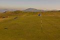 10th Green, Church Stretton Golf Club - geograph.org.uk - 696701.jpg 640 × 426; 48 KB
-
 17-19 The Square, Church Stretton - geograph.org.uk - 6054831.jpg 640 × 480; 162 KB
-
 2 High Street, Church Stretton - geograph.org.uk - 6054842.jpg 640 × 479; 138 KB
-

-
 4-6 Shrewsbury Road, Church Stretton - geograph.org.uk - 6054909.jpg 505 × 640; 180 KB
-

-
 50-52 High Street, Church Stretton - geograph.org.uk - 6054858.jpg 464 × 640; 148 KB
-
 9th Tee, Church Stretton Golf Course - geograph.org.uk - 5015470.jpg 6,000 × 4,000; 4.05 MB
-
 A brace of banks .... - geograph.org.uk - 5078508.jpg 3,271 × 1,769; 1.23 MB
-

-
 A field of sheep at Little Stretton - geograph.org.uk - 5018709.jpg 6,000 × 4,000; 4.43 MB
-
 A footpath to Church Stretton - geograph.org.uk - 2168699.jpg 640 × 480; 88 KB
-
 A Herd of Horses - geograph.org.uk - 5785773.jpg 640 × 427; 246 KB
-

-

-
 A rocky step - geograph.org.uk - 5960507.jpg 637 × 478; 296 KB
-
 A short cut - geograph.org.uk - 5963106.jpg 640 × 480; 300 KB
-
 A Sign Of Work In Progress - geograph.org.uk - 830132.jpg 640 × 425; 37 KB
-
 A small gauging weir - geograph.org.uk - 2255705.jpg 640 × 430; 177 KB
-
 A spring on the NW side of Ragleth - geograph.org.uk - 2486868.jpg 896 × 672; 386 KB
-

-
 A summer stroll in Churchill Road - geograph.org.uk - 1449094.jpg 640 × 480; 86 KB
-
 A summer stroll in Easthope Road - geograph.org.uk - 1449221.jpg 640 × 480; 79 KB
-
 A temporary campsite at New House Farm - geograph.org.uk - 3043620.jpg 979 × 734; 437 KB
-
 A varied trade - geograph.org.uk - 3826156.jpg 1,748 × 1,158; 1.02 MB
-

-
 A very reluctant 'Sit^' on Ragleth - geograph.org.uk - 2486878.jpg 1,152 × 864; 271 KB
-
 A view of Ragleth Hill - geograph.org.uk - 4097644.jpg 640 × 360; 242 KB
-
 A view south west from Ragleth - geograph.org.uk - 2237254.jpg 640 × 480; 104 KB
-
 A49 at Gorsty Bank - geograph.org.uk - 3545302.jpg 640 × 480; 26 KB
-
 A49 at Little Oakwood - geograph.org.uk - 3546160.jpg 626 × 467; 209 KB
-

-

-
 A49 east of All Stretton - geograph.org.uk - 2957702.jpg 640 × 481; 45 KB
-
 A49 east of All Stretton - geograph.org.uk - 2957706.jpg 640 × 481; 33 KB
-
 A49 in Church Stretton - geograph.org.uk - 2125432.jpg 576 × 385; 163 KB
-
 A49 in Church Stretton - geograph.org.uk - 2957690.jpg 640 × 480; 44 KB
-
 A49 junction with B5477 - geograph.org.uk - 3773920.jpg 3,648 × 2,736; 1.33 MB
-
 A49 near All Stretton - geograph.org.uk - 3545294.jpg 640 × 480; 32 KB
-
 A49 near High Leyes - geograph.org.uk - 2957694.jpg 640 × 481; 37 KB
-
 A49 near Little Stretton - geograph.org.uk - 6109901.jpg 1,024 × 768; 276 KB
-

-
 A49 passes the Lazy Trout Cafe - geograph.org.uk - 3773925.jpg 3,648 × 2,736; 1.44 MB
-
 A49 south of Dudgeley Mill - geograph.org.uk - 3773891.jpg 3,648 × 2,736; 1.5 MB
-
 A49 southeast of Brockhurst Castle - geograph.org.uk - 3773917.jpg 3,648 × 2,736; 1.47 MB
-
 A49 west of Botvyle Farm - geograph.org.uk - 3773866.jpg 3,648 × 2,736; 1.78 MB
-
 A49 west of Caradoc Coppice - geograph.org.uk - 3773902.jpg 3,544 × 2,652; 1.22 MB
-
 Abandoned cottage called Nettless - geograph.org.uk - 4942968.jpg 640 × 480; 77 KB
-
 Above Callow Hollow - geograph.org.uk - 5134257.jpg 1,920 × 1,280; 536 KB
-
 Above Ragleth Wood - geograph.org.uk - 2486861.jpg 1,152 × 864; 342 KB
-
 Access point for Rectory Wood.jpg 1,600 × 1,200; 911 KB
-

-

-
 Acid moorland atop the Long Mynd - geograph.org.uk - 3718651.jpg 4,000 × 3,000; 1.84 MB
-

-
 Across Carding Mill Valley - geograph.org.uk - 5280684.jpg 1,000 × 665; 681 KB
-
 Across the Long Mynd - geograph.org.uk - 927352.jpg 640 × 427; 131 KB
-
 Aerial photo of Church Stretton in 2008.jpg 640 × 480; 108 KB
-
 All Saints Church, Little Stretton - geograph.org.uk - 5019304.jpg 6,000 × 4,000; 5.15 MB
-
 All Saints Church, Little Stretton - geograph.org.uk - 6026166.jpg 5,184 × 3,456; 6.45 MB
-
 All Stretton from Caer Caradoc. - geograph.org.uk - 687946.jpg 640 × 480; 71 KB
-

-
 Along Ashes Hollow - geograph.org.uk - 6022548.jpg 5,184 × 3,456; 3.52 MB
-
 Along Carding Mill Valley - geograph.org.uk - 6073488.jpg 5,184 × 3,456; 3.58 MB
-
 Along the summit ridge of Ashlet - geograph.org.uk - 1917418.jpg 819 × 614; 185 KB
-
 Along Townbrook Valley - geograph.org.uk - 6026101.jpg 5,184 × 3,456; 3.07 MB
-
 An icy byway to Church Stretton - geograph.org.uk - 2309777.jpg 640 × 430; 52 KB
-
 An odd tree, Old Rectory Wood - geograph.org.uk - 2261927.jpg 640 × 430; 117 KB
-
 Animal pen - geograph.org.uk - 750733.jpg 640 × 480; 114 KB
-
 Appleby ^ Shaw, Church Stretton - geograph.org.uk - 3809836.jpg 800 × 648; 147 KB
-
 Approaching a spur in Essex Road - geograph.org.uk - 1449179.jpg 640 × 480; 69 KB
-
 Approaching Callow Hollow - geograph.org.uk - 4091204.jpg 640 × 360; 55 KB
-

-

-
-

-

-

-

-
 Approaching the Owlets - geograph.org.uk - 6026058.jpg 5,184 × 3,456; 3.54 MB
-
 Aqua Gas, Church Stretton - geograph.org.uk - 2268071.jpg 640 × 317; 68 KB
-
 Arable land, Hollyhurst - geograph.org.uk - 415195.jpg 640 × 480; 56 KB
-
 Arden House B^B, Church Stretton - geograph.org.uk - 3723771.jpg 800 × 710; 172 KB
-

-

-
 Ascent of Caer Caradoc Hill - geograph.org.uk - 5028540.jpg 6,000 × 4,000; 3.37 MB
-
 Ashbrook Court, Church Stretton - geograph.org.uk - 3723898.jpg 800 × 683; 143 KB
-
-
 Ashes Hollow - geograph.org.uk - 2085337.jpg 640 × 480; 113 KB
-
 Ashes Hollow - geograph.org.uk - 2085354.jpg 640 × 480; 89 KB
-
 Ashes Hollow - geograph.org.uk - 3442469.jpg 3,240 × 4,320; 2.36 MB
-
 Ashes Hollow - geograph.org.uk - 5026684.jpg 6,000 × 4,000; 6.06 MB
-
 Ashes Hollow - geograph.org.uk - 5738286.jpg 5,184 × 3,888; 5.98 MB
-
 Ashes Hollow - geograph.org.uk - 6022561.jpg 3,456 × 5,184; 3.6 MB
-
 Ashes Hollow - geograph.org.uk - 6022562.jpg 3,456 × 5,184; 3.9 MB
-
 Ashes Hollow near Little Stretton - geograph.org.uk - 6022545.jpg 5,184 × 3,456; 4.65 MB
-

-

-
 Ashes Hollow, confluence of streams - geograph.org.uk - 5738287.jpg 5,184 × 3,888; 5.41 MB
-
 At Church Stretton railway station - geograph.org.uk - 5305410.jpg 640 × 480; 60 KB
-
 At the foot of Light Spout Hollow - geograph.org.uk - 5960508.jpg 478 × 637; 343 KB
-
 At the foot of Ragleth Hill - geograph.org.uk - 3980149.jpg 1,600 × 1,000; 394 KB
-
 Autumn colour - geograph.org.uk - 4196009.jpg 2,000 × 3,001; 5.99 MB
-

-
 B4371 is Sandford Avenue - geograph.org.uk - 3718535.jpg 3,093 × 2,491; 1.78 MB
-
 B5477 near All Stretton - geograph.org.uk - 4927209.jpg 1,280 × 960; 261 KB
-
 B5477 north of the town centre - geograph.org.uk - 2253353.jpg 640 × 430; 110 KB
-
 B5477 road sign at Church Stretton, Shropshire, England.jpg 640 × 426; 97 KB
-
 B5477, Church Stretton - geograph.org.uk - 2253352.jpg 640 × 430; 121 KB
-
 B5477, Church Stretton - geograph.org.uk - 2253361.jpg 640 × 430; 116 KB
-
 Baler and Priors Holt Hill - geograph.org.uk - 440929.jpg 640 × 480; 107 KB
-
 Bantams and Call Ducks for Sale - geograph.org.uk - 4181731.jpg 683 × 1,024; 261 KB
-
 Barclays Bank in Church Stretton - geograph.org.uk - 3724201.jpg 800 × 595; 152 KB
-
 Barclays Bank in Sandford Avenue - geograph.org.uk - 1452421.jpg 480 × 640; 61 KB
-
 Barclays Bank, Church Stretton - geograph.org.uk - 4895138.jpg 1,200 × 798; 448 KB
-
 Barclays Bank, Church Stretton - geograph.org.uk - 5077473.jpg 3,264 × 2,064; 1.5 MB
-
 Bare tree and woolly sheep - geograph.org.uk - 1189804.jpg 640 × 426; 79 KB
-

-
 Barn Lane, Church Stretton - geograph.org.uk - 5082518.jpg 2,265 × 3,292; 1.38 MB
-

-
 Barns at The Hough - geograph.org.uk - 3468726.jpg 640 × 427; 192 KB
-
 Base of the Burway - geograph.org.uk - 5063288.jpg 800 × 534; 224 KB
-
 Battered warning sign - geograph.org.uk - 1593157.jpg 640 × 428; 46 KB
-
 Battlefield near Church Stretton - geograph.org.uk - 6135393.jpg 640 × 480; 40 KB
-
 Bears in the wood at the Long Mynd Hotel - geograph.org.uk - 2493526.jpg 1,940 × 2,504; 3.65 MB
-
 Beaumont Court - geograph.org.uk - 1449306.jpg 640 × 452; 82 KB
-
 Beaumont Rd - geograph.org.uk - 2267914.jpg 640 × 430; 122 KB
-
 Beaumont Rd off Sandford Avenue - geograph.org.uk - 2253335.jpg 640 × 430; 121 KB
-
 Beijing Restaurant, Sandford Avenue - geograph.org.uk - 2267904.jpg 640 × 430; 137 KB
-

-
 Below Long Synalds - geograph.org.uk - 6026148.jpg 5,184 × 3,456; 4.37 MB
-

-
 Bend in Central Avenue - geograph.org.uk - 1448829.jpg 640 × 480; 88 KB
-
 Bend in Cunnery Lane (1) - geograph.org.uk - 1448964.jpg 640 × 480; 68 KB
-
 Bend in Cunnery Lane (2) - geograph.org.uk - 1448962.jpg 640 × 480; 90 KB
-
 Bend in Cunnery Lane (3) - geograph.org.uk - 1448971.jpg 640 × 480; 94 KB
-
 Bend in Cunnery Lane (6) - geograph.org.uk - 1448987.jpg 640 × 480; 93 KB
-
 Bend in Ludlow Road - geograph.org.uk - 1448905.jpg 640 × 480; 88 KB
-
 Bend in Ragleth Road - geograph.org.uk - 1448736.jpg 480 × 640; 80 KB
-

-
 Bird carvings - geograph.org.uk - 5960514.jpg 478 × 637; 381 KB
-
 Bird nest in Callow Hollow - geograph.org.uk - 4091356.jpg 640 × 360; 93 KB
-
 Black and White in Church Street - geograph.org.uk - 5085142.jpg 3,248 × 2,160; 1.8 MB
-
 Bluebell woods on Helmeth Hill - geograph.org.uk - 1866067.jpg 640 × 480; 154 KB
-
 Bluebell woods on Helmeth Hill in May - geograph.org.uk - 1866078.jpg 640 × 480; 164 KB
-

-

-

-

-

-

-

-

-

-

-
-

-

-

-
 Bodbury Close - geograph.org.uk - 1449110.jpg 640 × 480; 74 KB
-

-

-
 Bodbury Ring Hillfort (geograph 7383352).jpg 1,600 × 900; 725 KB
-
 Bottom end of Essex Road - geograph.org.uk - 1448005.jpg 640 × 480; 78 KB
-
 Botvyle - geograph.org.uk - 5567147.jpg 1,024 × 683; 380 KB
-
 Botvyle farm from the A49 - geograph.org.uk - 3401305.jpg 4,752 × 3,168; 3.06 MB
-

-
 Bowling Green at Church Stretton - geograph.org.uk - 2086280.jpg 640 × 435; 72 KB
-
 Box framing and the painted version, The Square - geograph.org.uk - 5082673.jpg 3,248 × 2,160; 1.9 MB
-

-
 Bracken clad slope, Carding Mill Valley - geograph.org.uk - 2253394.jpg 640 × 430; 140 KB
-

-
 Bracken on the hillside - geograph.org.uk - 2297628.jpg 640 × 430; 84 KB
-
 Bracken slopes, Light Spout Hollow - geograph.org.uk - 2259288.jpg 640 × 430; 145 KB
-
 Bridge over the railway south of Little Stretton - geograph.org.uk - 5167646.jpg 1,600 × 962; 497 KB
-
 Bridleway to Burway Hill - geograph.org.uk - 2260752.jpg 640 × 430; 158 KB
-
 Bridleway under the beech trees - geograph.org.uk - 5961011.jpg 637 × 478; 434 KB
-
 Brook Cottage, Church Stretton - geograph.org.uk - 5749196.jpg 2,774 × 2,081; 2.08 MB
-

-

-
 Brooksbury - geograph.org.uk - 1452379.jpg 640 × 480; 63 KB
-

-
 Buck's Head - geograph.org.uk - 5785769.jpg 640 × 427; 292 KB
-
 Buck's Head, Church Stretton - geograph.org.uk - 5498167.jpg 1,024 × 684; 267 KB
-
 Bur Way on the Long Mynd - geograph.org.uk - 4895167.jpg 1,200 × 799; 415 KB
-

-
 Burial mound on Minton Hill - geograph.org.uk - 3113154.jpg 640 × 480; 74 KB
-
 Burial mound on Minton Hill - geograph.org.uk - 3113167.jpg 640 × 480; 43 KB
-
 Burway approaching junction with The Port Way - geograph.org.uk - 3718675.jpg 3,787 × 2,771; 1.44 MB
-
 Burway Books and Maps, Church Stretton - geograph.org.uk - 3900701.jpg 800 × 503; 100 KB
-
 Burway Hill - geograph.org.uk - 6005775.jpg 640 × 480; 132 KB
-
 Burway Hill, Long Mynd - geograph.org.uk - 1415189.jpg 640 × 414; 38 KB
-
 Burway House, Church Stretton (geograph 3984524).jpg 800 × 569; 109 KB
-
 Burway junction with lane to Ratlinghope - geograph.org.uk - 3718662.jpg 4,000 × 3,000; 2.45 MB
-
 Burway Rd - geograph.org.uk - 2261922.jpg 640 × 430; 144 KB
-

-
 Burway Road near Church Stretton - geograph.org.uk - 6005774.jpg 479 × 640; 200 KB
-
 Burway Road north of Old Rectory Wood - geograph.org.uk - 3718548.jpg 3,617 × 2,695; 1.96 MB


_-_geograph.org.uk_-_1448964.jpg)
_-_geograph.org.uk_-_1448962.jpg)
_-_geograph.org.uk_-_1448971.jpg)
_-_geograph.org.uk_-_1448987.jpg)


.jpg)


.jpg)


