Category:Church Whitfield
Jump to navigation
Jump to search
English: Church Whitfield is a village just north of Dover in Kent, England. It is virtually part of the larger area of Whitfield and, like it, part of the town area of Dover. Part of the village is called Pineham. St. Peter's Church is a 10th Century Saxon Church largely rebuilt in Norman times, though the church is first mentioned in 762 AD.
village in Kent, United Kingdom  | |||||
| Upload media | |||||
| Instance of | |||||
|---|---|---|---|---|---|
| Location | Whitfield, Dover, Kent, South East England, England | ||||
 | |||||
Subcategories
This category has only the following subcategory.
P
Media in category "Church Whitfield"
The following 13 files are in this category, out of 13 total.
-
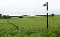 Footpath sign Church Whitfield ks01.jpg 2,195 × 1,372; 1.09 MB
-
 Winston Churchill As Prime Minister 1940-45 H3512.jpg 2,276 × 1,772; 1.16 MB
-
 Eastling Down Farm from the Sandwich Road - geograph.org.uk - 653158.jpg 640 × 480; 210 KB
-

-
 Industrial estate at Whitfield - geograph.org.uk - 355148.jpg 640 × 480; 33 KB
-

-
 Road to Great Napchester Farm - geograph.org.uk - 425726.jpg 640 × 480; 49 KB
-
 St Margaret's Farm, Napchester Road - geograph.org.uk - 425751.jpg 640 × 480; 57 KB
-
 View across farmland - geograph.org.uk - 387369.jpg 640 × 480; 52 KB
-
 View across farmland to field margin - geograph.org.uk - 438782.jpg 640 × 480; 65 KB
-

-

-
 View S along the Sandwich Road - geograph.org.uk - 438780.jpg 640 × 480; 62 KB


