Category:Church of the Assumption of the Blessed Virgin Mary in Wojcieszów
Jump to navigation
Jump to search
| Object location | | View all coordinates using: OpenStreetMap |
|---|
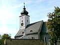
Polski: Wojcieszów, ul. Bolesława Chrobrego - rzymskokatolicki kościół parafialny pw. Wniebowzięcia NMP, pocz. XIV, XVI w.
church in Wojcieszów, Lower Silesian Voivodeship, Poland .JPG) | |||||
| Upload media | |||||
| Instance of | |||||
|---|---|---|---|---|---|
| Named after | |||||
| Location | Wojcieszów, Złotoryja County, Lower Silesian Voivodeship, Poland | ||||
| Street address |
| ||||
| Architectural style | |||||
| Heritage designation |
| ||||
| Inception |
| ||||
 | |||||
Media in category "Church of the Assumption of the Blessed Virgin Mary in Wojcieszów"
The following 57 files are in this category, out of 57 total.
-
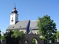 Wojcieszów Wniebiowzięcia NMP (09 2008).JPG 1,280 × 960; 840 KB
-
 Epitafia Wojcieszów (09 2008).JPG 1,280 × 960; 1.07 MB
-
 Koronacja Matki Bożej Wojcieszowskiej .jpg 4,608 × 3,456; 3.58 MB
-
 Koronacja Matki Bożej Wojcieszowskiej 1.jpg 4,608 × 3,456; 3.64 MB
-

-
 Rzymskokatolicki kościół parafialny pw. Wniebowzięcia NMP, epitafium.jpg 2,257 × 2,074; 3.12 MB
-
 Rzymskokatolicki kościół parafialny pw. Wniebowzięcia NMP, fragment epitafium.jpg 1,891 × 2,837; 1.72 MB
-
 Sanktuarium Matki Bożej w Wojcieszowie (1).jpg 4,608 × 3,456; 3.63 MB
-
 Sanktuarium Matki Bożej w Wojcieszowie (2).jpg 4,608 × 3,456; 3.49 MB
-
 Sanktuarium Matki Bożej w Wojcieszowie (3).jpg 4,608 × 3,456; 3.56 MB
-
 Sanktuarium Matki Bożej w Wojcieszowie (4).jpg 4,608 × 3,456; 3.38 MB
-
 Sanktuarium Matki Bożej w Wojcieszowie (5).jpg 3,456 × 4,608; 3.43 MB
-
 Sanktuarium Matki Bożej w Wojcieszowie (6).jpg 4,608 × 3,456; 3.27 MB
-
 Sanktuarium Matki Bożej Wojcieszowskiej ( 2015 ).jpg 4,608 × 3,456; 3.42 MB
-
 Sanktuarium Matki Bożej Wojcieszowskiej 1.jpg 4,608 × 3,456; 3.51 MB
-
 Sanktuarium Matki Bożej Wojcieszowskiej 2.jpg 4,608 × 3,456; 3.54 MB
-
 Sanktuarium Matki Bożej Wojcieszowskiej.jpg 4,608 × 3,456; 3.44 MB
-
 Widok z ulicy Kolejowej - panoramio.jpg 800 × 600; 484 KB
-
 Wojcieszów dolny 1.jpg 4,608 × 3,456; 3.37 MB
-
 Wojcieszów dolny 2.jpg 4,608 × 3,456; 3.42 MB
-
 Wojcieszów dolny.jpg 4,608 × 3,456; 3.46 MB
-
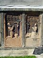 Wojcieszów epitafium (09 2008).JPG 960 × 1,280; 1.02 MB
-
 Wojcieszów kościoły.jpg 1,200 × 1,800; 1.66 MB
-
 Wojcieszów mur cmentarny 0142G.jpg 4,422 × 2,750; 6.38 MB
-
 Wojcieszów, figura Chrystusa w kościele pw. Wniebowzięcia NMP (Aw58).JPG 555 × 800; 214 KB
-

-

-
 Wojcieszów, fresk na suficie kościoła pw. Wniebowzięcia NMP (Aw58).JPG 800 × 553; 196 KB
-
 Wojcieszów, kościół parafialny pw. Wniebowzięcia NMP (Aw58) P9090088.JPG 600 × 800; 242 KB
-
 Wojcieszów, kościół parafialny pw. Wniebowzięcia NMP (Aw58) P9090102.JPG 553 × 800; 208 KB
-
 Wojcieszów, kościół parafialny pw. Wniebowzięcia NMP (Aw58) P9090104.JPG 556 × 800; 198 KB
-
 Wojcieszów, kościół parafialny pw. Wniebowzięcia NMP (Aw58) P9090105.JPG 553 × 800; 225 KB
-
 Wojcieszów, kościół parafialny pw. Wniebowzięcia NMP (Aw58) P9090106.JPG 800 × 553; 231 KB
-
 Wojcieszów, kościół parafialny pw. Wniebowzięcia NMP - 9.09.2012 r..JPG 554 × 800; 198 KB
-

-
 Wojcieszów, kościół parafialny pw. Wniebowzięcia NMP -Aw58-.JPG 555 × 800; 213 KB
-
 Wojcieszów, kościół parafialny pw. Wniebowzięcia NMP P9090104.JPG 800 × 600; 225 KB
-
 Wojcieszów, kościół parafialny pw. Wniebowzięcia NMP P9090138.JPG 554 × 800; 176 KB
-

-

-

-

-

-
 Wojcieszów, kościół pw. W@niebowzięcia NMP, fresk (Aw58) P9090112.JPG 554 × 800; 222 KB
-
 Wojcieszów, kościół pw. Wniebowzięcia NMP, fragment sufitu (Aw58).JPG 555 × 800; 178 KB
-
 Wojcieszów, kościół pw. Wniebowzięcia NMP, krzyż (Aw58).JPG 554 × 800; 192 KB
-
 Wojcieszów, kościół pw. Wniebowzięcia NMP, ołtarz boczny (Aw58).JPG 555 × 800; 221 KB
-
 Wojcieszów, kropielnica w kościele pw. Wniebowzięcia NMP (Aw58).JPG 553 × 800; 217 KB
-

-

-
 Wojcieszów, organy w kościele pw. Wniebowzięcia NMP (Aw58).JPG 800 × 553; 202 KB
-

-
 Wojcieszów, ołtarz główny w kościele pw. Wniebowzięcia NMP (Aw58).JPG 555 × 800; 198 KB
-

-

-

-
 Wojcieszów, Zespół epitafiów (09 2008).JPG 1,280 × 960; 1.1 MB
.JPG)


.jpg)
.jpg)
.jpg)
.jpg)
.jpg)
.jpg)
.jpg)


.JPG)


.JPG)

.JPG)
.JPG)
_P9090088.JPG)
_P9090102.JPG)
_P9090104.JPG)
_P9090105.JPG)
_P9090106.JPG)


_P9090112.JPG)
.JPG)
.JPG)
.JPG)
.JPG)
.JPG)

.JPG)
.JPG)
.JPG)
.JPG)
.JPG)
_DSCF1903.JPG)
.JPG)