Category:Claremount, Halifax
Jump to navigation
Jump to search
Subcategories
This category has the following 6 subcategories, out of 6 total.
Media in category "Claremount, Halifax"
The following 21 files are in this category, out of 21 total.
-
 Belgrave Gardens - Bell Street - geograph.org.uk - 3493479.jpg 640 × 480; 71 KB
-
 Claremount and Ovenden Wind Farm, from Barrowclough Lane (3059772186).jpg 2,407 × 1,592; 3.26 MB
-

-

-
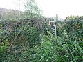
 Former gateway on Halifax FP408 - geograph.org.uk - 5340987.jpg 2,000 × 1,500; 1,011 KB
-
 Halifax FP408 at Hollin Greaves Lane - geograph.org.uk - 5340986.jpg 1,462 × 2,000; 1,005 KB
-
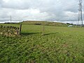
 Halifax FP409 - geograph.org.uk - 5340975.jpg 2,000 × 1,500; 1.65 MB
-
 Halifax FP584 at a bend - geograph.org.uk - 5340427.jpg 2,000 × 1,500; 1.72 MB
-
 Halifax FP584 at Portland Street - geograph.org.uk - 5340408.jpg 1,500 × 2,000; 1.52 MB
-
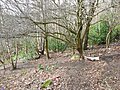
 Halifax FP584 climbing through evergreens - geograph.org.uk - 5340423.jpg 1,500 × 2,000; 1.47 MB
-
 Halifax FP749 at Turner Lane - geograph.org.uk - 5340959.jpg 2,000 × 1,500; 1.12 MB
-
 High Sunderland Lane, Halifax - geograph.org.uk - 5340989.jpg 2,000 × 1,500; 746 KB
-
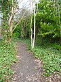
 Hollin Greaves Lane, Halifax - geograph.org.uk - 5340980.jpg 2,000 × 1,500; 1,017 KB
-
 Jerwood Hill Road - Turner Lane - geograph.org.uk - 3493730.jpg 640 × 480; 125 KB
-
 Old Milestone by Shibden Hall Road (geograph 6047984).jpg 315 × 420; 104 KB
-
 Overgrown part of Shibden Fold Footpath, Halifax FP739 - geograph.org.uk - 5605828.jpg 2,000 × 1,500; 1.13 MB
-
 Shibden Fold Footpath, Northowram - geograph.org.uk - 5605802.jpg 1,474 × 2,000; 1.05 MB
-
 Stile and gate on Halifax FP408 at High Sunderland Lane - geograph.org.uk - 5340988.jpg 2,000 × 1,500; 1.08 MB
-
 Track - off Turner Lane - geograph.org.uk - 3493736.jpg 480 × 640; 81 KB
-

-
 Waymark on Halifax FP584 at the top of the hill, Claremount - geograph.org.uk - 5340432.jpg 2,000 × 1,500; 1.27 MB

.jpg)


.jpg)


