Category:Cleator
Jump to navigation
Jump to search
English: Cleator is a village in the English county of Cumbria and within the boundaries of the traditional county of Cumberland.
village in Cumbria, United Kingdom  | |||||
| Upload media | |||||
| Instance of | |||||
|---|---|---|---|---|---|
| Location | Cleator Moor, Copeland, Cumbria, North West England, England | ||||
 | |||||
Subcategories
This category has only the following subcategory.
L
- St Leonard’s Church, Cleator (1 F)
Media in category "Cleator"
The following 36 files are in this category, out of 36 total.
-
 Between Dent and Flat Fell - geograph.org.uk - 1622545.jpg 640 × 480; 83 KB
-
 Ennerdale and Kinniside, UK - panoramio (1).jpg 3,264 × 2,448; 2.23 MB
-
 Ennerdale and Kinniside, UK - panoramio (2).jpg 3,264 × 2,448; 2.28 MB
-
 Ennerdale and Kinniside, UK - panoramio (3).jpg 3,264 × 2,448; 1.99 MB
-
 Ennerdale and Kinniside, UK - panoramio (4).jpg 3,264 × 2,448; 2.3 MB
-
 Ennerdale and Kinniside, UK - panoramio (5).jpg 3,264 × 2,448; 2.62 MB
-
 Ennerdale Valley Head - panoramio.jpg 3,072 × 1,728; 3.14 MB
-
 Ennerdale YHA - panoramio.jpg 3,072 × 1,728; 1.08 MB
-
 Frosty Wall - geograph.org.uk - 1622548.jpg 640 × 480; 81 KB
-
 Loweswater CA13, UK - panoramio.jpg 3,264 × 2,448; 2.28 MB
-
 Main St, Cleator - geograph.org.uk - 1496999.jpg 640 × 480; 60 KB
-
 On Flat Fell - geograph.org.uk - 1621395.jpg 640 × 480; 89 KB
-
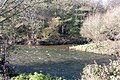
 River Ehen, Cleator - geograph.org.uk - 269191.jpg 640 × 480; 159 KB
-
 St Leonard's Church, Cleator.jpg 1,600 × 1,200; 518 KB
-
 The Keekle meets the Ehen - geograph.org.uk - 78632.jpg 640 × 427; 91 KB
-
 Black How. - geograph.org.uk - 90001.jpg 640 × 480; 63 KB
-
 Bridge and footpath. - geograph.org.uk - 89998.jpg 640 × 480; 101 KB
-
 Coast-to-Coast Path, near Cleator - geograph.org.uk - 269862.jpg 640 × 480; 164 KB
-
 Cobble Hall - geograph.org.uk - 89999.jpg 640 × 480; 75 KB
-
 Cobra Castle. - geograph.org.uk - 97324.jpg 640 × 391; 71 KB
-
 Egremont Cemetery. - geograph.org.uk - 89997.jpg 640 × 480; 45 KB
-
 Egremont Ruins - geograph.org.uk - 32510.jpg 640 × 480; 138 KB
-
 Forest on the north-eastern slopes of Dent - geograph.org.uk - 9168.jpg 640 × 480; 157 KB
-
 High House Farm - geograph.org.uk - 91499.jpg 640 × 427; 95 KB
-
 Large Barn Conversion, Wilton - geograph.org.uk - 91502.jpg 640 × 427; 100 KB
-
 Limekiln and Quarry - geograph.org.uk - 152397.jpg 640 × 459; 94 KB
-
 Limekiln Entrance Mousegill Quarry - geograph.org.uk - 152413.jpg 640 × 480; 140 KB
-
 Longlands Lake - geograph.org.uk - 78635.jpg 640 × 427; 38 KB
-
 Public Footpath, Wilton - geograph.org.uk - 91504.jpg 640 × 427; 123 KB
-
 Reservoir - geograph.org.uk - 91500.jpg 640 × 427; 71 KB
-
 Site of Wilton School - geograph.org.uk - 161038.jpg 640 × 471; 100 KB
-
 The start of Black Beck. - geograph.org.uk - 97317.jpg 640 × 480; 98 KB
-
 Uldale - geograph.org.uk - 161813.jpg 640 × 472; 76 KB
-
 Uldale - geograph.org.uk - 269886.jpg 640 × 480; 157 KB
-
 Uldale Valley - geograph.org.uk - 155726.jpg 640 × 480; 150 KB
-
 Woodend - geograph.org.uk - 78636.jpg 640 × 560; 64 KB

.jpg)
.jpg)
.jpg)
.jpg)
.jpg)


