Category:Cleobury North
Jump to navigation
Jump to search
English: Cleobury North is a village and civil parish in south east Shropshire, England. It is situated on the B4364 southwest of the market town of Bridgnorth. To the north is the village of Ditton Priors and to the west is Brown Clee Hill, the county's highest hill.
village in Shropshire, United Kingdom  | |||||
| Upload media | |||||
| Instance of | |||||
|---|---|---|---|---|---|
| Location | Shropshire, West Midlands, England | ||||
 | |||||
Subcategories
This category has the following 3 subcategories, out of 3 total.
B
C
- Cleobury North War Memorial (1 F)
Media in category "Cleobury North"
The following 96 files are in this category, out of 96 total.
-
 A fine example of the breed - a Limousin - geograph.org.uk - 4632980.jpg 1,306 × 979; 600 KB
-
 A very cold pond on Abdon Burf - geograph.org.uk - 2764754.jpg 1,024 × 667; 184 KB
-
-
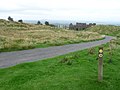
 B4364 out of Cleobury North - geograph.org.uk - 4630291.jpg 1,142 × 857; 393 KB
-
 Bend in the B4364 - geograph.org.uk - 2212453.jpg 1,024 × 768; 304 KB
-

-
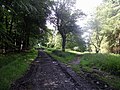
 Bridleway on Burwarton estate - geograph.org.uk - 4345857.jpg 1,142 × 857; 454 KB
-
 British Blondes after the show - geograph.org.uk - 4628296.jpg 1,142 × 857; 515 KB
-
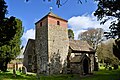
 Church of St Peter ^ St Paul - geograph.org.uk - 2212422.jpg 1,024 × 765; 288 KB
-
 Cleobury Mill - geograph.org.uk - 3368428.jpg 427 × 640; 84 KB
-
 Cleobury Mill - geograph.org.uk - 3368448.jpg 427 × 640; 135 KB
-
 Cleobury Mill - geograph.org.uk - 3368466.jpg 427 × 640; 91 KB
-
 Cleobury Mill - geograph.org.uk - 4469302.jpg 1,600 × 1,064; 494 KB
-
 Cleobury Mill - wooden gears - geograph.org.uk - 3368460.jpg 427 × 640; 72 KB
-
 Cleobury Mill -hurst frame - geograph.org.uk - 3368409.jpg 640 × 427; 81 KB
-
 Cleobury Mill, Cleobury North - geograph.org.uk - 2942564.jpg 427 × 640; 104 KB
-
 Cleobury Mill, Cleobury North - geograph.org.uk - 2942574.jpg 427 × 640; 78 KB
-

-
 Cleobury Mill, Mill Farm, Cleobury North - geograph.org.uk - 2942550.jpg 640 × 427; 100 KB
-
 Cleobury North - geograph.org.uk - 2267653.jpg 640 × 480; 114 KB
-
 Cleobury North football ground - geograph.org.uk - 5607111.jpg 1,024 × 768; 212 KB
-
 Cleobury North one way system - geograph.org.uk - 4326652.jpg 800 × 600; 539 KB
-
 Cleobury North Post Office - geograph.org.uk - 242388.jpg 640 × 480; 91 KB
-
 Cleobury North Tea Rooms and Village Store - geograph.org.uk - 5607102.jpg 1,024 × 768; 284 KB
-
 David Brown lightweight tug - geograph.org.uk - 4627068.jpg 923 × 734; 360 KB
-
 Down the hill to Cleobury North - geograph.org.uk - 2262973.jpg 640 × 480; 91 KB
-
 Entering Cleobury North - geograph.org.uk - 2438848.jpg 800 × 600; 277 KB
-
 Entering Neenton - geograph.org.uk - 2438858.jpg 800 × 600; 227 KB
-
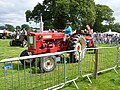
 Ferguson 35 tractor - geograph.org.uk - 4627059.jpg 1,217 × 1,087; 520 KB
-
 Field, Cleobury North - geograph.org.uk - 4326647.jpg 800 × 600; 357 KB
-
 Field-Marshall tractor - geograph.org.uk - 4625316.jpg 1,142 × 857; 425 KB
-
 Fields, Charlcotte - geograph.org.uk - 5851969.jpg 1,024 × 683; 415 KB
-
 Finish, Brown Clee - geograph.org.uk - 1072685.jpg 640 × 480; 160 KB
-
 Flooded quarry workings - geograph.org.uk - 2269024.jpg 640 × 480; 125 KB
-

-
 Footpath near Brown Clee Hill - geograph.org.uk - 2081134.jpg 640 × 480; 113 KB
-
 Ford at Cleobury North - geograph.org.uk - 4596555.jpg 1,084 × 725; 464 KB
-
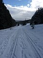
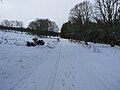
 Fresh snow over a muddy path on Brown Clee - geograph.org.uk - 4346071.jpg 1,142 × 857; 425 KB
-
 Grassland at Cleobury North - geograph.org.uk - 6227681.jpg 3,648 × 2,056; 3.81 MB
-
 Harewood Plantation - geograph.org.uk - 4346068.jpg 1,102 × 1,469; 340 KB
-
 Impressive mature conifers, Brown Clee - geograph.org.uk - 1072655.jpg 640 × 480; 102 KB
-
 Ironbridge power station chimney - geograph.org.uk - 2267647.jpg 640 × 495; 67 KB
-
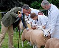 Judging the sheep at the Burwarton Show - geograph.org.uk - 1998126.jpg 3,160 × 2,592; 3.26 MB
-
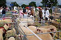 Livestock at the Burwarton Show - geograph.org.uk - 1998118.jpg 3,872 × 2,592; 4.66 MB
-
 Massey Ferguson 2130 tractor - geograph.org.uk - 4625366.jpg 1,142 × 857; 423 KB
-
 McCormick International B-614 tractor - geograph.org.uk - 4627045.jpg 1,142 × 857; 539 KB
-
 McCormick-Deering tractor - geograph.org.uk - 4625337.jpg 1,142 × 857; 506 KB
-
 Meadow at Cleobury North - geograph.org.uk - 2212437.jpg 1,024 × 768; 343 KB
-
 Oakwood, Brown Clee - geograph.org.uk - 2267603.jpg 640 × 480; 181 KB
-
 Old Rectory, Cleobury North.jpg 3,437 × 2,284; 2.58 MB
-

-
 Ordnance Survey Cut Mark - geograph.org.uk - 4761017.jpg 480 × 640; 114 KB
-
 OS benchmark - Cleobury North, Glebe Farm - geograph.org.uk - 4630289.jpg 857 × 1,142; 496 KB
-
 Parking for the Burwarton Show 2015 - geograph.org.uk - 4625293.jpg 1,142 × 857; 388 KB
-

-
 Pasture, Great Leasows - geograph.org.uk - 4057382.jpg 640 × 480; 256 KB
-
 Pond near the masts - geograph.org.uk - 2764762.jpg 1,024 × 742; 206 KB
-
 Pool in the fields near Mill Farm - geograph.org.uk - 4628289.jpg 1,142 × 857; 635 KB
-
 Quarry ruin, Brown Clee - geograph.org.uk - 2269017.jpg 640 × 480; 76 KB
-
 Ride, Harewood - geograph.org.uk - 1072651.jpg 640 × 480; 147 KB
-
 Road junction in Cleobury North, Shropshire, England.jpg 640 × 480; 105 KB
-
 Series II Land Rover diesel - geograph.org.uk - 4633825.jpg 1,469 × 1,102; 456 KB
-
 Sheep pasture, Cleobury North - geograph.org.uk - 5607128.jpg 1,024 × 768; 166 KB
-
 St Peter and St Paul, Cleobury North - geograph.org.uk - 4899831.jpg 3,489 × 2,320; 2.58 MB
-
 St Peter and St Paul, Cleobury North - geograph.org.uk - 4899836.jpg 3,489 × 2,320; 2.36 MB
-
 St Peter and St Paul, Cleobury North - geograph.org.uk - 4900362.jpg 3,489 × 2,320; 1.87 MB
-
 St Peter and St Paul, Cleobury North - geograph.org.uk - 4900368.jpg 3,467 × 2,437; 2.39 MB
-
 St Peter ^ St Paul, Cleobury North - geograph.org.uk - 2246448.jpg 1,000 × 664; 158 KB
-
 St Peter ^ St Paul, Cleobury North - geograph.org.uk - 2246450.jpg 664 × 1,000; 143 KB
-
 Start of the path for Brown Clee Hill - geograph.org.uk - 2764774.jpg 1,600 × 1,118; 1.04 MB
-
 Stone crushing plant (ruins) - geograph.org.uk - 690217.jpg 640 × 480; 110 KB
-
 Stone crushing plant, Brown Clee - geograph.org.uk - 2267629.jpg 640 × 480; 139 KB
-
 The Dairy Farm - geograph.org.uk - 2267659.jpg 640 × 392; 74 KB
-
 The Decorated Horse competition - geograph.org.uk - 4628286.jpg 1,142 × 857; 483 KB
-
 Track, Brown Clee - geograph.org.uk - 2267592.jpg 640 × 480; 193 KB
-
 Tracks in the woods - geograph.org.uk - 2472040.jpg 640 × 480; 149 KB
-
 Uphill towards Harewood and Stanbroughs Wood - geograph.org.uk - 4346062.jpg 1,306 × 979; 365 KB
-

-
-
 Wall of stone crushing plant (ruins) - geograph.org.uk - 690238.jpg 480 × 640; 127 KB
-
 Woodland, Brown Clee - geograph.org.uk - 2267613.jpg 640 × 480; 127 KB
-
 Woodland, Brown Clee - geograph.org.uk - 2267635.jpg 640 × 480; 124 KB
-
-
 Brown Clee picnic area - geograph.org.uk - 575928.jpg 640 × 480; 100 KB
-
 Zetor 3011 tractor - geograph.org.uk - 4625350.jpg 1,142 × 857; 515 KB
-
 Farm track to Great Leasows - geograph.org.uk - 242389.jpg 640 × 480; 107 KB
-
 Footpath south - geograph.org.uk - 575947.jpg 480 × 640; 112 KB
-

-

-
 Northern edge of Harewood - geograph.org.uk - 575935.jpg 480 × 640; 77 KB
-
 Poultry units - geograph.org.uk - 535684.jpg 640 × 480; 306 KB
-
 Shropshire Farmhouse near Cleobury North - geograph.org.uk - 615685.jpg 640 × 453; 119 KB
-
 Shropshire Farmhouse near Cleobury North - geograph.org.uk - 617546.jpg 640 × 474; 122 KB
-
 Shropshire Farmland - geograph.org.uk - 615676.jpg 640 × 480; 129 KB
-
 Shropshire Farmland - geograph.org.uk - 615678.jpg 640 × 480; 147 KB
-
 Southern edge of Bellowspipe Wood - geograph.org.uk - 575919.jpg 640 × 480; 105 KB


_-_geograph.org.uk_-_690217.jpg)


_-_geograph.org.uk_-_690238.jpg)


