Category:Clifton, York
Jump to navigation
Jump to search
Clifton is a suburb of York. Formerly a rural, medieval village, it is now an area bounded by the River Ouse to the south, Bootham to the east, Clifton Ings and 1930s development to the west and 19th century development to the north.
human settlement in York, United Kingdom  | |||||
| Upload media | |||||
| Instance of | |||||
|---|---|---|---|---|---|
| Location | York, City of York, North Yorkshire, Yorkshire and the Humber, England | ||||
 | |||||
Subcategories
This category has the following 11 subcategories, out of 11 total.
C
- Clifton Bridge, York (19 F)
- Clifton Long Reach, York (28 F)
- Clifton Short Reach (4 F)
H
- Homestead Park, York (10 F)
J
L
P
Media in category "Clifton, York"
The following 13 files are in this category, out of 13 total.
-
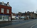
 Approaching Sutton Way - geograph.org.uk - 1728295.jpg 640 × 480; 210 KB
-
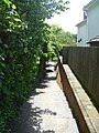
 Blue Beck Outfall - geograph.org.uk - 431738.jpg 640 × 480; 156 KB
-
 Clifton Garage - geograph.org.uk - 737430.jpg 640 × 480; 59 KB
-

-
 Clifton vicarage - geograph.org.uk - 2829924.jpg 2,354 × 1,632; 1.09 MB
-

-
 Former Rowntrees Factory - geograph.org.uk - 1705588.jpg 640 × 427; 94 KB
-
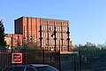 Nestle factory York - geograph.org.uk - 1705613.jpg 640 × 427; 65 KB
-
 Path to the river - geograph.org.uk - 5051101.jpg 3,240 × 4,320; 2.78 MB
-
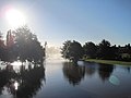
 River Ouse - geograph.org.uk - 2488932.jpg 1,600 × 1,200; 618 KB
-
 Sustrans route - geograph.org.uk - 2791963.jpg 640 × 478; 89 KB
-
 T.V 15 (5184868915).jpg 1,471 × 1,938; 3.69 MB
-
 York floods - geograph.org.uk - 3200150.jpg 800 × 600; 64 KB


.jpg)
