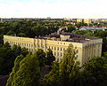
Category:Clinic at Lecznicza Street
Jump to navigation
Jump to search
| Object location | | View all coordinates using: OpenStreetMap |
|---|
 | |||||
| Upload media | |||||
| Instance of | |||||
|---|---|---|---|---|---|
| Made from material | |||||
| Location |
| ||||
| Street address |
| ||||
| Heritage designation |
| ||||
| Inception |
| ||||
 | |||||
Media in category "Clinic at Lecznicza Street"
The following 4 files are in this category, out of 4 total.
-
 Przychodnia Miejska przy ul. Leczniczej.JPG 3,072 × 2,304; 1.55 MB
-
 Przychodnia Miejska ul. Lecznicza w Łodzi (patio).JPG 3,072 × 2,304; 1.52 MB
-
 Przychodnia na ul. Leczniczej.JPG 1,513 × 1,222; 336 KB
-
 Ignacy Płażewski, Przychodnia Lekarska przy ul. Leczniczej 6 w Łodzi, I-4710-2.jpg 1,808 × 2,500; 397 KB

.JPG)
