Category:Clouds in Taitung
Jump to navigation
Jump to search
| NO WIKIDATA ID FOUND! Search for Clouds in Taitung on Wikidata | |
| Upload media |
中文(臺灣):臺東縣的雲
Subcategories
This category has the following 2 subcategories, out of 2 total.
M
S
- Clouds at sunset in Taitung (5 F)
Media in category "Clouds in Taitung"
The following 42 files are in this category, out of 42 total.
-
 08.03 總統出席「臺東熱氣球光雕音樂會」 (48447639366).jpg 5,740 × 3,198; 9.72 MB
-
 2010 07 15520 5508, Chintsun Taiwan.JPG 4,218 × 2,811; 3.24 MB
-
 2010 07 15530 5509, Chintsun Taiwan.JPG 4,251 × 2,832; 3.38 MB
-
 2010 07 16560 5714 Taitung City, Taiwan, Fugang Fishing Harbor.JPG 4,272 × 2,848; 4.32 MB
-
 2010 07 19020 5996 Chenggong Township, Highway 11, Hotels, Parks, Taiwan.JPG 4,251 × 2,832; 5.87 MB
-
 956, Taiwan, 台東縣關山鎮豐泉里 - panoramio.jpg 4,608 × 3,456; 12.3 MB
-

-
 Chaikou beach.jpg 4,288 × 2,848; 1.69 MB
-
 Chihshang Sugar Factory04.jpg 3,936 × 5,248; 4.55 MB
-
-
 Da-Wu Port02.jpg 5,248 × 3,936; 5.87 MB
-
 Dawushan Nature Reserve Chen Tu Chen 04.jpg 4,000 × 3,000; 3.24 MB
-
 Dog Trainers at the Seaside 海邊馴狗師 - panoramio.jpg 3,484 × 2,612; 2.53 MB
-
 Dulan - panoramio (2).jpg 3,648 × 2,432; 3.59 MB
-
 Dulan - panoramio (6).jpg 2,432 × 3,648; 3.18 MB
-
 Dulan - panoramio (7).jpg 3,648 × 2,432; 3.78 MB
-
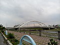 Fongli Bridge.jpg 5,248 × 3,936; 5.57 MB
-
 Jinlun Bridge.jpg 2,408 × 1,252; 170 KB
-
 Jinlun Bridge04.jpg 6,000 × 4,000; 6.13 MB
-
 Makabahai Park beach, August 2017.jpg 2,368 × 4,208; 1.64 MB
-
 Rain falling from cloud near Taitung Seaside Park.jpg 4,000 × 2,250; 1.1 MB
-
 Ri-Kuang Bridge.jpg 5,248 × 3,936; 4.66 MB
-
 Straight road on Taiwan Provincial Highway 9.jpg 3,544 × 2,440; 7.81 MB
-
 Summer Clouds (234060063) (cropped).jpeg 2,047 × 292; 105 KB
-
 Summer Clouds (234060063).jpeg 2,048 × 1,280; 566 KB
-
 Sunset at Orchid Island 20100911 04.jpg 4,032 × 3,024; 5.48 MB
-
-
 Taitung Farm.jpg 4,032 × 3,024; 4.27 MB
-
 Taiwan Taitung City New Kai-Feng Bridge.jpg 5,248 × 3,936; 4.75 MB
-
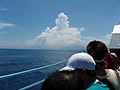 View of coast of Taitung from a ferry 2008.jpg 2,816 × 2,112; 1.17 MB
-
 台東東峯高中現況01.jpg 4,032 × 3,024; 2.53 MB
-
 台東縣卑南鄉 花凍縱谷公路 初鹿 - panoramio.jpg 4,000 × 3,000; 1.43 MB
-
 台東縣大武鄉 南迴公路 - panoramio (4).jpg 4,000 × 3,000; 1.85 MB
-
 台東縣池上鄉 池上大橋 - panoramio.jpg 4,000 × 3,000; 911 KB
-
 台灣台東縣鹿野鄉 - panoramio (11).jpg 3,872 × 2,592; 3.28 MB
-
 大武渔港附近的消波块 - Wavebreakers near Dawu Fishing Port - 2012.02 - panoramio.jpg 3,200 × 2,400; 3.01 MB
-
 康橋商旅 Comfort Hotel - panoramio.jpg 2,824 × 2,118; 679 KB
-
 成功長老教會 Chenggong Presbyterian Church - panoramio (1).jpg 3,920 × 2,204; 2.13 MB
-
 東56線7.jpg 6,000 × 3,376; 8.13 MB
-
 瑞和車站-1.JPG 4,928 × 3,264; 4.29 MB
-
 臺灣嘉明湖日出 - panoramio.jpg 2,144 × 1,424; 1 MB
-
 蘭嶼國小操場.jpg 3,264 × 2,448; 3.14 MB
.jpg)


.jpg)
.jpg)
.jpg)


.jpeg)


.jpg)

.jpg)


.jpg)


_(cropped).jpeg)