Category:Coatbridge
Перейти к навигации
Перейти к поиску
town in North Lanarkshire, Scotland, UK   | |||||
| Медиафайл | |||||
| Это частный случай понятия | |||||
|---|---|---|---|---|---|
| Местонахождение |
| ||||
| Численность населения |
| ||||
| Площадь |
| ||||
 | |||||
Dansk: Coatbridge er en by i det centrale Skotland, med et indbyggertal (pr. 2001) på cirka 41.000. Byen ligger i kommunen North Lanarkshire, ca. 15 kilometer øst for Glasgow.
Deutsch: Coatbridge ist eine schottische Stadt in North Lanarkshire, in der Nähe von Glasgow. Die etwa 53.000 zählende Stadt bildet das Zentrum der schottischen Eisenindustrie.
English: Coatbridge is a Lanarkshire town set in the central Lowlands of Scotland. It was awarded the trophy for the Best Small City in Scotland in September 2009 in the Beautiful Scotland environmental and horticultural competition. The first settlement of the area stretches back to the Stone Age era. Foundations of the town can be traced back to the 12th century when the area was gifted by Royal Charter to the Monks of Newbattle Abbey by Malcolm IV. It was during the last years of the 18th century that the area developed from a loose collection of hamlets into the town of Coatbridge. The town's development and growth has been intimately connected with the technological advances of the industrial revolution, and in particular with the hot blast process. Coatbridge was a major Scottish centre for iron works and coal mining during the 19th century and in this period Coatbridge was described as “the industrial heartland of Scotland” and the "Iron Burgh". Coatbridge also had a notorious reputation for air pollution and the worst excesses of industry. By the time of the 1920s however coal seams were exhausted and the iron industry in Coatbridge was in rapid terminal decline. After the Great Depression the Gartsherrie ironwork was the last remaining iron works in the town.
Gaeilge: Is baile é Drochaid an Chóta atá suite in Albain. Tá sé i ngar do Glaschú. Tá pobal mór Éireannach ann.
Gàidhlig: Tha Drochaid a' Chòta na bhaile ann an Alba mheadhonach. Tha 41,170 daoine a' fuireach ann.
Подкатегории
В этой категории отображается 30 подкатегорий из имеющихся 30.
A
B
- Blairhill railway station (5 Ф)
C
- The Clock Bar, Coatbridge (2 Ф)
- Coatbridge abattoir (2 Ф)
- Coatbridge College (2 Ф)
- Coatbridge Fire Station (3 Ф)
D
- Dundyvan Church (2 Ф)
E
- Events in Coatbridge (3 Ф)
F
- Faraday Retail Park (3 Ф)
H
- Heatherbell level crossing (4 Ф)
J
- Jackson Court, Coatbridge (3 Ф)
M
- McNairn's Of Coatbridge (1 Ф)
P
Q
S
- Sheepford Boiler Works (12 Ф)
T
- Time Capsule, Coatbridge (6 Ф)
W
- Whitelaw memorial fountain (3 Ф)
Файлы в категории «Coatbridge»
Показаны 87 файлов из 87, находящихся в данной категории.
-
 A 89 leaving Coatbridge - geograph.org.uk - 1124133.jpg 640 × 480; 94 КБ
-
 A hedgerow in a field - geograph.org.uk - 462949.jpg 640 × 427; 85 КБ
-
 A8 between Coatbridge and Bellshill - geograph.org.uk - 2258836.jpg 640 × 480; 60 КБ
-
 Airdrie Savings Bank in Coatbridge - geograph.org.uk - 1811938.jpg 3648 × 2736; 3,99 МБ
-
 Allied Forces in the United Kingdom 1939-45 H5431.jpg 793 × 800; 67 КБ
-
 Allied Forces in the United Kingdom 1939-45 H5451.jpg 800 × 792; 64 КБ
-
 Allied Forces in the United Kingdom 1939-45 H5453.jpg 800 × 794; 90 КБ
-
 Allied Forces in the United Kingdom 1939-45 H5454.jpg 797 × 800; 85 КБ
-
 Avoiding the traffic at Shawhead (geograph 6785866).jpg 1024 × 768; 223 КБ
-
 Bank Street - geograph.org.uk - 3572536.jpg 640 × 480; 91 КБ
-
 Bank Street Basin sign - geograph.org.uk - 1811237.jpg 2736 × 3648; 4 МБ
-
 Barrowfield.JPG 1551 × 1034; 477 КБ
-
 Bridge across the North Calder Water (geograph 6785860).jpg 1024 × 768; 255 КБ
-
 Buchanan Centre Coatbridge - geograph.org.uk - 3572471.jpg 640 × 480; 102 КБ
-
 Calder Street roundabout - geograph.org.uk - 3572521.jpg 640 × 480; 80 КБ
-
 California Cake Company, Coatbridge - geograph.org.uk - 242111.jpg 640 × 524; 73 КБ
-
 Centrum Office Block, Coatbridge - geograph.org.uk - 242107.jpg 640 × 446; 53 КБ
-
 Clifton parish church.jpg 1296 × 1936; 432 КБ
-
 Coatbridge Airdrie line at Greenside Junction geograph-2841449-by-Ben-Brooksbank.jpg 2394 × 1415; 1,48 МБ
-
 Coatbridge Baptist Church - geograph.org.uk - 1222215.jpg 640 × 481; 63 КБ
-
 Coatbridge coat arms.jpg 912 × 1407; 431 КБ
-
 Coatbridge Cyclepath - geograph.org.uk - 3572503.jpg 640 × 480; 117 КБ
-
 Coatbridge Cyclepath 2 - geograph.org.uk - 3572507.jpg 640 × 480; 100 КБ
-
 Coatbridge from the air (geograph 2519017).jpg 640 × 480; 107 КБ
-
 Coatbridge from the air (geograph 2519022).jpg 640 × 480; 136 КБ
-
 Coatbridge from the air (geograph 5681545).jpg 640 × 480; 195 КБ
-
 Coatbridge High School (geograph 3033746).jpg 640 × 480; 60 КБ
-
 Coatbridge High School - geograph.org.uk - 1033039.jpg 640 × 481; 106 КБ
-
 Coatbridge Library.jpg 4032 × 3024; 3,59 МБ
-
 Coatbridge Outdoor Sports Centre - geograph.org.uk - 1124131.jpg 640 × 480; 123 КБ
-
 Coatbridge2map1858.jpg 514 × 333; 70 КБ
-
 Coatbridgelibraryb.jpg 1012 × 1258; 353 КБ
-
 Coatbridgeskyline.jpg 1844 × 307; 196 КБ
-
 CoatbridgeTownCentre.JPG 1920 × 2560; 3,23 МБ
-
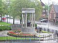 CoatbridgeWarMemorial.JPG 2560 × 1920; 3,38 МБ
-
 Coatfromairdrie.jpg 1936 × 1296; 425 КБ
-
 Coltswood Cemetery - geograph.org.uk - 153102.jpg 640 × 480; 169 КБ
-
 Derelict factory - geograph.org.uk - 1396398.jpg 640 × 480; 67 КБ
-
 District Court in Coatbridge - geograph.org.uk - 1328439.jpg 640 × 480; 68 КБ
-
 Dunbeth Park, Coatbridge - geograph.org.uk - 457632.jpg 640 × 427; 96 КБ
-
 Factory Roofs Near Coatbridge - geograph.org.uk - 154521.jpg 640 × 478; 169 КБ
-
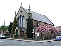 Former Church - geograph.org.uk - 412065.jpg 640 × 480; 75 КБ
-
 Gartsherrie Burn - geograph.org.uk - 153094.jpg 480 × 640; 132 КБ
-
 High flats, Coatbridge (geograph 2242872).jpg 1024 × 640; 143 КБ
-
 Home Bargains, Main Street Coatbridge - geograph.org.uk - 1443752.jpg 640 × 480; 110 КБ
-
 Kirkstyle Cottages.JPG 4000 × 2248; 3,65 МБ
-
 Landscapecoatbridge.jpg 1300 × 2296; 436 КБ
-
 Langloan School - geograph.org.uk - 1518508.jpg 640 × 480; 67 КБ
-
 Lefroy street.JPG 3872 × 2592; 12,42 МБ
-
 Main Street Coatbridge - geograph.org.uk - 3572473.jpg 640 × 480; 96 КБ
-
 Main Street East - geograph.org.uk - 3572483.jpg 640 × 480; 74 КБ
-
 Map of Lanarkshire Sheet 007, Ordnance Survey, 1863-1865.tiff 10 677 × 7165; 218,87 МБ
-
 Marble bench - geograph.org.uk - 3572509.jpg 2304 × 1728; 1 МБ
-
 McDonalds Coatbridge - geograph.org.uk - 3572482.jpg 640 × 480; 113 КБ
-
 MonklandCanalArt1.JPG 2560 × 1920; 3,27 МБ
-
 MonklandCanalBlairRoad.JPG 2560 × 1920; 1,55 МБ
-
 Monklands canal - geograph.org.uk - 1017575.jpg 640 × 480; 53 КБ
-
 National Cycle Network milepost - geograph.org.uk - 1219662.jpg 480 × 640; 58 КБ
-
 National Cycle Network milepost - geograph.org.uk - 1221003.jpg 480 × 640; 124 КБ
-
 Ordnance Survey One-Inch Sheet 73 Falkirk & Motherwell, Published 1947.jpg 12 178 × 11 648; 17,57 МБ
-
 OS old series Scotland 1 63360 31 (monklands).jpg 3132 × 2452; 2,29 МБ
-
 Otiorhynchus.jpg 897 × 673; 271 КБ
-
 Pitch unplayable - geograph.org.uk - 1417008.jpg 640 × 480; 96 КБ
-
 Railway near Rosehall, Coatbridge - geograph.org.uk - 142598.jpg 640 × 480; 134 КБ
-

-
 Room with a view - geograph.org.uk - 571723.jpg 640 × 481; 35 КБ
-
 Roundabout Sculpture - geograph.org.uk - 3572519.jpg 640 × 480; 62 КБ
-
 School Street (geograph 2019504).jpg 640 × 480; 105 КБ
-
 Shiel Place, Coatbridge - geograph.org.uk - 1219652.jpg 640 × 480; 79 КБ
-

-
 Skyline3b.jpg 3872 × 805; 804 КБ
-
 Small bridge - geograph.org.uk - 3572514.jpg 640 × 480; 149 КБ
-
 Sorting office, Coatbridge - geograph.org.uk - 1124123.jpg 640 × 480; 99 КБ
-
 Stating the obvious - geograph.org.uk - 1417033.jpg 640 × 480; 59 КБ
-
 Sunnyside, Coatbridge (geograph 2803802).jpg 640 × 480; 104 КБ
-

-
 The M8 motorway from the air (geograph 5681536).jpg 640 × 480; 183 КБ
-
 The Royal, Coatbridge - geograph.org.uk - 1303214.jpg 640 × 480; 58 КБ
-
 Three Coatbridge schools from the air (geograph 5679274).jpg 640 × 480; 179 КБ
-
 Tower Block UK photo cl1-41 (Coatbridge Langloan 1983).jpg 1759 × 2626; 1,07 МБ
-
 Tower Block UK photo cl1-42 (Coatbridge Townhead 1983).jpg 1759 × 2634; 1,04 МБ
-
 Tower Block UK photo cl1-44 (Coatbridge Sunnyside 1983).jpg 2599 × 1782; 959 КБ
-

-
 The Vulcan Restaurant - geograph.org.uk - 3572475.jpg 640 × 480; 101 КБ
-
 Waste ground - geograph.org.uk - 1396413.jpg 640 × 480; 71 КБ
-
 Whinhall from top of Park St. Brae - geograph.org.uk - 1140808.jpg 640 × 480; 49 КБ
-
 Witchwood Court , Coatbridge - geograph.org.uk - 222426.jpg 640 × 461; 61 КБ


.jpg)


.jpg)


.jpg)
.jpg)
.jpg)
.jpg)


.jpg)


.jpg)


.jpg)


.jpg)

.jpg)

.jpg)
.jpg)
.jpg)
.jpg)
_(lo-res_crop).jpg)


