Category:Col de Serre
Jump to navigation
Jump to search
| Object location | | View all coordinates using: OpenStreetMap |
|---|
Français : Le col de Serre, haut de 1364 mètres, est un col français du département du Cantal mettant en relation les communes de Lavigerie (vallée de l'Impradine, affluent de la Santoire) et du Claux (vallée de la Petite Rhue).
mountain pass in Cantal, France  | |||||
| Upload media | |||||
| Instance of | |||||
|---|---|---|---|---|---|
| Location | Cantal, Auvergne-Rhône-Alpes, Metropolitan France, France | ||||
 | |||||
Media in category "Col de Serre"
The following 11 files are in this category, out of 11 total.
-
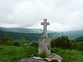 Col de Serre croix Gilbert Le Claux.jpg 3,078 × 2,307; 1.14 MB
-
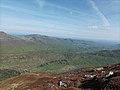 Col de Serre depuis le puy de Peyre-Arse.jpg 4,000 × 2,992; 4.41 MB
-
 Col de Serre Impradine vallée (1).jpg 2,992 × 2,247; 998 KB
-
 Col de Serre Impradine vallée (2).jpg 3,264 × 2,295; 1.48 MB
-
 Col de Serre Impradine vallée.jpg 3,052 × 2,292; 1.07 MB
-
 Col de Serre Petite Rhue vallée Cheylade.jpg 3,137 × 2,351; 1.07 MB
-
 Col de Serre.jpg 2,999 × 2,251; 1.33 MB
-
 FR-15-Cheylade Valley.JPG 1,200 × 1,600; 394 KB
-
 Puy Mary from Col de Serre.jpg 2,560 × 1,920; 545 KB
-
 Vallées Petite Rhue et Impradine depuis Pas de Peyrol (1).jpg 2,973 × 2,232; 1.08 MB
-
 Vallées Petite Rhue et Impradine depuis Pas de Peyrol.jpg 2,958 × 2,221; 947 KB


.jpg)
.jpg)


.jpg)
