Category:Countryside in Powys
Jump to navigation
Jump to search
Media in category "Countryside in Powys"
The following 200 files are in this category, out of 340 total.
(previous page) (next page)-
 A distant windmill - geograph.org.uk - 240522.jpg 1,024 × 768; 403 KB
-
 Abergwesyn Common - geograph.org.uk - 391588.jpg 640 × 427; 118 KB
-
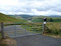 Access gate to Llyn Clywedog - geograph.org.uk - 217435.jpg 640 × 480; 93 KB
-
 Access land at Wylfa - geograph.org.uk - 240496.jpg 640 × 480; 88 KB
-
 Access land at Wylfa - geograph.org.uk - 240500.jpg 640 × 480; 153 KB
-
 Across the fields to Brynsifiog - geograph.org.uk - 589880.jpg 640 × 295; 46 KB
-

-
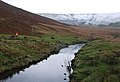
 Afon Elan - geograph.org.uk - 746309.jpg 1,000 × 666; 1.02 MB
-
 Afon Elan - geograph.org.uk - 781773.jpg 1,024 × 768; 446 KB
-
 Afon Elan above Abergwngu - geograph.org.uk - 1180017.jpg 1,000 × 750; 440 KB
-
 Afon Elan below Pont ar Elan - geograph.org.uk - 1027585.jpg 640 × 440; 93 KB
-
 Afon Elan, Pont ar Elan - geograph.org.uk - 675645.jpg 640 × 480; 70 KB
-

-
 B4404 Road - geograph.org.uk - 240564.jpg 640 × 480; 126 KB
-
 Beacons View - geograph.org.uk - 520361.jpg 640 × 543; 77 KB
-
 Beilibedw Mawn Pool - geograph.org.uk - 391079.jpg 640 × 480; 62 KB
-
 Bracken clearance on the common - geograph.org.uk - 644139.jpg 640 × 480; 73 KB
-
 Bridge over Afon Cerist, near Caersws - geograph.org.uk - 200526.jpg 640 × 480; 110 KB
-
 Bush and road - geograph.org.uk - 815911.jpg 640 × 427; 68 KB
-
 Buttercup meadow near Llandegley - geograph.org.uk - 838372.jpg 640 × 359; 70 KB
-
 Bwlchgwyn - geograph.org.uk - 248226.jpg 640 × 480; 141 KB
-
 By the side of the Afon Twymyn - geograph.org.uk - 809512.jpg 479 × 640; 79 KB
-
 Byway heading to Soar - geograph.org.uk - 798929.jpg 640 × 480; 89 KB
-
 Cae'r-mynach - geograph.org.uk - 839594.jpg 640 × 427; 92 KB
-
 Cattle grazing at Colfryn - geograph.org.uk - 548934.jpg 640 × 480; 89 KB
-
 Clear fell on Esgair Cloddiad, Powys - geograph.org.uk - 1508600.jpg 640 × 383; 116 KB
-
 Confluence of Rivers Rhiw and Severn - geograph.org.uk - 1474039.jpg 640 × 480; 80 KB
-
 Confluence of the Elan and the Wye - geograph.org.uk - 902689.jpg 640 × 480; 103 KB
-

-
 Countryside near Godor - geograph.org.uk - 552259.jpg 640 × 427; 72 KB
-
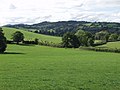
 Countryside near Meifod - geograph.org.uk - 552256.jpg 640 × 427; 151 KB
-
 Coxhead Bank Common - geograph.org.uk - 839054.jpg 640 × 480; 76 KB
-
 Coxhead Bank Common - geograph.org.uk - 839062.jpg 640 × 480; 53 KB
-
 Coxhead Bank Common - geograph.org.uk - 839070.jpg 640 × 480; 59 KB
-
 Cwm Ffrydlan - geograph.org.uk - 242068.jpg 640 × 480; 221 KB
-
 Cwm Ffrydlan - geograph.org.uk - 242072.jpg 640 × 480; 106 KB
-
 Cwm Ffrydlan - geograph.org.uk - 242075.jpg 640 × 480; 149 KB
-
 Cwm Maen Gwynedd.jpg 4,032 × 3,024; 5.13 MB
-
 Disgwylfa Hill - geograph.org.uk - 86080.jpg 640 × 430; 87 KB
-
 Dol-afallen, River Elan - geograph.org.uk - 1243142.jpg 640 × 513; 94 KB
-
 Down from the hills - geograph.org.uk - 633096.jpg 640 × 427; 45 KB
-
 Down the valley - geograph.org.uk - 1336544.jpg 640 × 426; 96 KB
-
 Dyffryn Dyfi - geograph.org.uk - 240562.jpg 640 × 480; 81 KB
-
 Dyffryn Dyfi - geograph.org.uk - 240931.jpg 640 × 480; 143 KB
-
 Dyffryn Dyfi - geograph.org.uk - 240937.jpg 640 × 480; 103 KB
-
 Dyffryn Dyfi - geograph.org.uk - 242085.jpg 640 × 480; 98 KB
-
 Entrance to Bryntudur - geograph.org.uk - 243434.jpg 640 × 480; 127 KB
-
 Farm gate at Hendreseifion - geograph.org.uk - 240557.jpg 640 × 480; 189 KB
-
 Farm Gate beside the A493 - geograph.org.uk - 214676.jpg 640 × 480; 131 KB
-
 Farm Gate, Near Red House, Trefeglwys - geograph.org.uk - 200523.jpg 640 × 480; 118 KB
-
 Farm Gate, Pen-y-ffynyon Farm - geograph.org.uk - 200514.jpg 640 × 480; 112 KB
-
 Farm land near Abergwesyn, Powys - geograph.org.uk - 1506114.jpg 640 × 421; 130 KB
-
 Farm track to Pen-y-fedw - geograph.org.uk - 1324011.jpg 640 × 426; 108 KB
-

-
 Footpath descent towards minor road - geograph.org.uk - 574111.jpg 640 × 407; 50 KB
-
 Forestry Walk - geograph.org.uk - 232219.jpg 640 × 480; 131 KB
-
 Furrow Hill - geograph.org.uk - 68480.jpg 640 × 480; 43 KB
-
 Glacial drainage channel - geograph.org.uk - 482811.jpg 640 × 480; 111 KB
-
 Glacial overflow channel - geograph.org.uk - 421216.jpg 640 × 480; 134 KB
-
 Hendreseifion - geograph.org.uk - 240538.jpg 640 × 480; 139 KB
-
 Hivron turning - geograph.org.uk - 867328.jpg 640 × 480; 75 KB
-
 Lane at Nannerth - geograph.org.uk - 248225.jpg 640 × 480; 137 KB
-
 Lane in Dyffryn Dyfi - geograph.org.uk - 242090.jpg 640 × 480; 131 KB
-
 Llanddewi'r Cwm Hamlet - geograph.org.uk - 1546687.jpg 640 × 360; 82 KB
-
 Llandegley - geograph.org.uk - 838383.jpg 640 × 480; 67 KB
-
 Llandegley Rocks - geograph.org.uk - 614849.jpg 600 × 400; 55 KB
-
 Llangattock Church.jpg 640 × 426; 122 KB
-
 Llanymynech Hill depuis le canal de Montgomery.jpg 591 × 405; 295 KB
-
 Llyn Y Fan from Gwernwyddog - geograph.org.uk - 723153.jpg 640 × 480; 46 KB
-

-
 Looking east along the Beacons Way - geograph.org.uk - 756021.jpg 640 × 457; 50 KB
-
 Looking east to Fishpool Farm - geograph.org.uk - 712376.jpg 640 × 480; 129 KB
-
 Looking South - geograph.org.uk - 720990.jpg 427 × 640; 122 KB
-
 Looking the other way - geograph.org.uk - 740751.jpg 640 × 427; 87 KB
-
 Looking towards the Beacons - geograph.org.uk - 737538.jpg 640 × 480; 77 KB
-
 Looking towards Tyle Mawr - geograph.org.uk - 80082.jpg 640 × 480; 140 KB
-
 Looking up at Alison's seat - geograph.org.uk - 742020.jpg 640 × 427; 51 KB
-
 Low flying over the Usk Valley - geograph.org.uk - 724236.jpg 640 × 480; 35 KB
-
 Lower Neuadd Reservoir - geograph.org.uk - 754091.jpg 640 × 480; 107 KB
-
 Marshland near Howey - geograph.org.uk - 752669.jpg 640 × 480; 100 KB
-
 Minor road from Ystradfellte - geograph.org.uk - 756678.jpg 640 × 480; 82 KB
-
 Minor road to Ystradfellte - geograph.org.uk - 756680.jpg 480 × 640; 71 KB
-
 Minor roadway near Libanus - geograph.org.uk - 754566.jpg 640 × 480; 88 KB
-
 Mixed weather over Dolymynach - geograph.org.uk - 774656.jpg 1,000 × 750; 978 KB
-

-
 Montgomery Canal looking towards Wern - geograph.org.uk - 806164.jpg 640 × 426; 57 KB
-
 Montgomery Canal near Four Crosses - geograph.org.uk - 833178.jpg 640 × 480; 98 KB
-

-
 Mynydd Pen-y-fâl - geograph.org.uk - 1299281.jpg 640 × 425; 175 KB
-
 Nant Hirin joining the River Elan - geograph.org.uk - 1521629.jpg 640 × 480; 89 KB
-
 Nant-ddu - geograph.org.uk - 735790.jpg 639 × 479; 189 KB
-
 Nant-y-brain - geograph.org.uk - 748754.jpg 640 × 480; 59 KB
-
 Nantymynach Farm and Cwm Rhiwiau - geograph.org.uk - 713178.jpg 640 × 480; 107 KB
-
 Near Pentwyn farm in upper Usk valley - geograph.org.uk - 382117.jpg 640 × 425; 187 KB
-
 Near the Gospel Pass - geograph.org.uk - 743420.jpg 639 × 479; 210 KB
-
 Near Ty'n-y-fedw - geograph.org.uk - 205836.jpg 640 × 480; 95 KB
-
 New belt of trees near Cui Parc - geograph.org.uk - 734307.jpg 640 × 480; 70 KB
-
 New chalets at Pen Offa - geograph.org.uk - 438532.jpg 640 × 480; 57 KB
-
 New fence - geograph.org.uk - 553924.jpg 640 × 480; 59 KB
-
 New pond or Quarry - geograph.org.uk - 768589.jpg 640 × 480; 82 KB
-
 Newly laid hedgerow - geograph.org.uk - 768602.jpg 640 × 480; 114 KB
-
 No trace of a right of way - geograph.org.uk - 750985.jpg 640 × 480; 264 KB
-
 Northern corner of Allt Lom - geograph.org.uk - 760554.jpg 640 × 480; 119 KB
-
 Not the M25^ - geograph.org.uk - 795759.jpg 640 × 480; 103 KB
-
 Noyadd Sharmon 815656.jpg 640 × 427; 71 KB
-
 Off Track - geograph.org.uk - 711632.jpg 640 × 388; 108 KB
-
 Offa's Dyke Path outside Forden - geograph.org.uk - 827049.jpg 640 × 480; 96 KB
-
 Old wall and hedge - geograph.org.uk - 670839.jpg 480 × 640; 124 KB
-
 On Cefn Moel - geograph.org.uk - 739400.jpg 639 × 479; 188 KB
-
 On Clipyn Du. - geograph.org.uk - 741725.jpg 640 × 427; 50 KB
-
 On the Beacons Way - geograph.org.uk - 733738.jpg 640 × 480; 103 KB
-
 Open moorland at Ffos-lwyd - geograph.org.uk - 247616.jpg 640 × 480; 64 KB
-
 Overgrown hedgerows, Pen-y-bryn - geograph.org.uk - 838388.jpg 640 × 480; 138 KB
-
 Pant-y-maen farmstead - geograph.org.uk - 732373.jpg 640 × 425; 79 KB
-
 Parc Bach - geograph.org.uk - 738995.jpg 640 × 480; 66 KB
-
 Pasture at Llanwrin - geograph.org.uk - 240659.jpg 640 × 480; 106 KB
-
 Pasture in Dyffryn Dyfi - geograph.org.uk - 240573.jpg 640 × 480; 78 KB
-
 Pasture in Dyffryn Dyfi - geograph.org.uk - 240924.jpg 640 × 480; 152 KB
-
 Pasture in Dyffryn Dyfi - geograph.org.uk - 242034.jpg 640 × 480; 123 KB
-
 Pasture in Dyffryn Dyfi - geograph.org.uk - 242050.jpg 640 × 480; 131 KB
-
 Pasture in Dyffryn Dyfi - geograph.org.uk - 242096.jpg 640 × 480; 101 KB
-
 Pasture, Bwlchau - geograph.org.uk - 748594.jpg 640 × 480; 61 KB
-
 Pasture, Farm And Wood - geograph.org.uk - 315388.jpg 640 × 480; 103 KB
-
 Pastures of the Usk valley - geograph.org.uk - 724464.jpg 640 × 480; 62 KB
-
 Path south from Llandefalle Common - geograph.org.uk - 714403.jpg 640 × 480; 91 KB
-
 Penygarreg reservoir - geograph.org.uk - 760351.jpg 640 × 428; 112 KB
-
 Pont ar Ddyfi - geograph.org.uk - 240512.jpg 1,024 × 768; 593 KB
-
 Radio masts on Aran - geograph.org.uk - 234277.jpg 640 × 480; 71 KB
-
 Re-instated land - geograph.org.uk - 754643.jpg 640 × 416; 44 KB
-
 Rhiw Goch - geograph.org.uk - 668127.jpg 640 × 427; 56 KB
-
 Rhiw Trumau - geograph.org.uk - 743303.jpg 639 × 479; 191 KB
-
 Rhos - geograph.org.uk - 748599.jpg 640 × 480; 90 KB
-
-
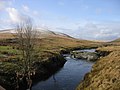
 River Elan - geograph.org.uk - 1521467.jpg 640 × 480; 131 KB
-
 River Elan - geograph.org.uk - 1521500.jpg 640 × 480; 86 KB
-
 River Elan meanders - geograph.org.uk - 1521568.jpg 640 × 480; 109 KB
-
 River Severn flood plain - geograph.org.uk - 710568.jpg 635 × 368; 25 KB
-
 River Severn flood plain - geograph.org.uk - 710574.jpg 637 × 432; 40 KB
-
 River Teme, Crug-y-byddar - geograph.org.uk - 300336.jpg 640 × 480; 121 KB
-

-
 Road near Bagbury - geograph.org.uk - 762729.jpg 640 × 480; 111 KB
-
 Road To Llanfyllin - geograph.org.uk - 726608.jpg 640 × 388; 82 KB
-
 Road to The Cwm - geograph.org.uk - 719260.jpg 640 × 427; 62 KB
-
 Rocks in the River Elan - geograph.org.uk - 1521483.jpg 640 × 480; 132 KB
-
 Rolling farmland - geograph.org.uk - 719061.jpg 640 × 454; 85 KB
-
 Rolling Hills - geograph.org.uk - 710206.jpg 427 × 640; 65 KB
-
 Rough woodland - geograph.org.uk - 738200.jpg 639 × 479; 189 KB
-
 Round the bend - geograph.org.uk - 743594.jpg 640 × 427; 83 KB
-
 Shed by the line - geograph.org.uk - 1336279.jpg 640 × 426; 82 KB
-
 Sheep and the A44 - geograph.org.uk - 695856.jpg 640 × 480; 100 KB
-
 Sheep country 2 - geograph.org.uk - 927190.jpg 640 × 480; 81 KB
-
 Snowing again - geograph.org.uk - 743408.jpg 639 × 479; 200 KB
-
 Snowing again - geograph.org.uk - 743414.jpg 639 × 479; 225 KB
-
 South from Pen y Darren - geograph.org.uk - 668237.jpg 640 × 427; 62 KB
-
 Stile at the edge of the wood - geograph.org.uk - 248229.jpg 640 × 480; 164 KB
-

-
 Tanat Valley - geograph.org.uk - 547357.jpg 640 × 482; 142 KB
-
 The Begwns, highland common - geograph.org.uk - 55788.jpg 640 × 427; 105 KB
-
 The Campsite - geograph.org.uk - 740695.jpg 640 × 427; 65 KB
-
 The Ithon, Pen-y-bont - geograph.org.uk - 838393.jpg 640 × 480; 107 KB
-
 The other end of Yardro - geograph.org.uk - 1551275.jpg 640 × 427; 75 KB
-
 The River Elan - geograph.org.uk - 1523122.jpg 640 × 480; 115 KB
-

-
 The Severn Way, looking south - geograph.org.uk - 534021.jpg 640 × 515; 129 KB
-
 The Usk Valley - geograph.org.uk - 1323717.jpg 640 × 426; 77 KB
-
 The View To The East - geograph.org.uk - 314008.jpg 640 × 480; 97 KB
-
 The wooded slopes of Yr Allt - geograph.org.uk - 520609.jpg 640 × 480; 132 KB
-
 This is the view - geograph.org.uk - 739322.jpg 639 × 479; 217 KB
-
 Through the gap - geograph.org.uk - 233831.jpg 640 × 480; 80 KB
-
 Tidily-laid hedge - geograph.org.uk - 724620.jpg 640 × 480; 95 KB
-
 Tir-mynach - geograph.org.uk - 486083.jpg 640 × 480; 68 KB
-
 Tor y Foel viewed from the north - geograph.org.uk - 1377843.jpg 640 × 426; 107 KB
-
 Towards Castle Bank - geograph.org.uk - 743602.jpg 640 × 427; 53 KB
-
 Towards the Beacons - geograph.org.uk - 739351.jpg 639 × 479; 190 KB
-
 Tower of Pencelli church - geograph.org.uk - 1381418.jpg 640 × 426; 119 KB
-
 Track ascending Llandefalle Common - geograph.org.uk - 714409.jpg 640 × 462; 77 KB
-
 Track at Botalog - geograph.org.uk - 247604.jpg 640 × 480; 85 KB
-
 Track down to the ford at Rhyd - geograph.org.uk - 527875.jpg 640 × 480; 154 KB
-
 Track from Gigrin Farm - geograph.org.uk - 1523598.jpg 640 × 480; 83 KB
-

-

-
 Trackway To Carnau Gwynion - geograph.org.uk - 481750.jpg 640 × 593; 138 KB
-
 Trallong From Abercamlais - geograph.org.uk - 486769.jpg 640 × 480; 104 KB
-
 Tredomen road over the Afon Llynfi bridge - geograph.org.uk - 538909.jpg 640 × 425; 113 KB
-
 Tree house - geograph.org.uk - 502626.jpg 480 × 640; 130 KB
-
 Tree line above Nant Cwm Llwch - geograph.org.uk - 507061.jpg 640 × 480; 134 KB
-
 Tree lined track - geograph.org.uk - 553671.jpg 640 × 480; 98 KB
-
 Tree-lined lane - geograph.org.uk - 486170.jpg 640 × 480; 85 KB
-
 Trees above Tyleheulog - geograph.org.uk - 559994.jpg 640 × 426; 135 KB
-
 Trees around the quarry - geograph.org.uk - 571044.jpg 640 × 480; 108 KB
-
 Tregunter farm - geograph.org.uk - 539903.jpg 640 × 425; 84 KB
-
 Trelydan Farm - geograph.org.uk - 569486.jpg 640 × 479; 114 KB
-
 Tributary of the Dyfi - geograph.org.uk - 240569.jpg 640 × 480; 119 KB
-
 Trickling Stream - geograph.org.uk - 740261.jpg 640 × 427; 90 KB
-
 Two long distance paths - geograph.org.uk - 588644.jpg 640 × 436; 75 KB
-
 Tyle-glas Wood - geograph.org.uk - 588291.jpg 640 × 480; 124 KB
-
 Upland Meadows Near Crai - geograph.org.uk - 487277.jpg 640 × 480; 107 KB
-
 Upland pasture, Y Byrwydd - geograph.org.uk - 600301.jpg 640 × 480; 86 KB
-
 Upper Farm - geograph.org.uk - 586842.jpg 640 × 480; 90 KB
-
 Upper reaches of the Afon Twrch - geograph.org.uk - 560020.jpg 640 × 480; 135 KB


