Category:Covered bridges in New Brunswick
Jump to navigation
Jump to search
Wikimedia category | |||||
| Upload media | |||||
| Instance of | |||||
|---|---|---|---|---|---|
| Category combines topics | |||||
| New Brunswick | |||||
province of Canada     | |||||
| Instance of |
| ||||
| Named after | |||||
| Location | Canada | ||||
| Located in or next to body of water | |||||
| Capital | |||||
| Basic form of government |
| ||||
| Legislative body |
| ||||
| Executive body | |||||
| Official language | |||||
| Currency |
| ||||
| Head of state |
| ||||
| Head of government |
| ||||
| Inception |
| ||||
| Highest point |
| ||||
| Population |
| ||||
| Area |
| ||||
| Replaces |
| ||||
| Different from | |||||
| official website | |||||
 | |||||
Subcategories
This category has the following 8 subcategories, out of 8 total.
B
F
- Florenceville Bridge (7 F)
H
- Hartland Covered Bridge (39 F)
L
P
- Point Wolfe Bridge (12 F)
R
- Pont du ruisseau Baker No 2 (7 F)
V
Media in category "Covered bridges in New Brunswick"
The following 14 files are in this category, out of 14 total.
-
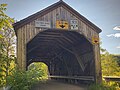 20210705Carlislecovered bridge.jpg 3,647 × 2,735; 5.59 MB
-
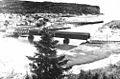 Alma 1930.jpg 500 × 331; 31 KB
-
 Covered Bridge Canaan River New Brunswick (8437238219).jpg 3,648 × 2,736; 3.86 MB
-
 Covered Bridge Inside (15603376275).jpg 3,648 × 2,424; 1.4 MB
-
 Covered Bridge of Coverdale Road near Salisbury, NB (8203635075).jpg 1,500 × 1,125; 134 KB
-
 Covered Bridge, High Marsh Road, Middle Sackville, NB (43351520090).jpg 4,608 × 3,456; 3.72 MB
-
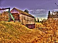 Gayton Covered Bridge.jpg 3,247 × 2,431; 8.39 MB
-
 High-marsh-rd-covered-bridge.jpg 1,571 × 1,178; 434 KB
-
 Melvin Perez Moncton Tidal Bore (15458207550).jpg 2,400 × 1,367; 475 KB
-
 Memramcook River No. 4.jpg 3,042 × 2,282; 886 KB
-
 Pont couvert rivière Forty Five.jpg 2,951 × 1,972; 1.19 MB
-
 Pont de Starkey.jpg 1,280 × 960; 229 KB
-
 Quisibis River No. 2 Covered Bridge.jpg 4,482 × 2,987; 12.4 MB
-
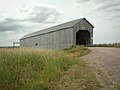
 Sawmill Creek Covered Bridge (40419785691).jpg 2,048 × 967; 1,006 KB


.jpg)
.jpg)
.jpg)
.jpg)


.jpg)


.jpg)