Category:Cox Green, Berkshire
Jump to navigation
Jump to search
English: Cox Green is a civil parish in the Royal Borough of Windsor and Maidenhead in Berkshire, England. It is now a suburb of Maidenhead.
village and civil parish in Berkshire, England, UK  | |||||
| Upload media | |||||
| Instance of | |||||
|---|---|---|---|---|---|
| Location | Windsor and Maidenhead, Berkshire, South East England, England | ||||
 | |||||
Subcategories
This category has only the following subcategory.
O
- Ockwells Manor House, Cox Green (19 F)
Media in category "Cox Green, Berkshire"
The following 115 files are in this category, out of 115 total.
-
 A4 overbridges, A404(M) - geograph.org.uk - 4754942.jpg 640 × 412; 37 KB
-
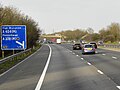
 A404 (M) - junction 9a (1-2 mile) - geograph.org.uk - 2377156.jpg 640 × 458; 77 KB
-
 A404(M) - geograph.org.uk - 3885179.jpg 640 × 440; 32 KB
-
 A404(M) - geograph.org.uk - 3885182.jpg 640 × 446; 37 KB
-
 A404(M) - geograph.org.uk - 5219442.jpg 640 × 426; 45 KB
-
 A404(M) approaches junction 9a - geograph.org.uk - 2619509.jpg 3,087 × 1,955; 1.05 MB
-
 A404(M) approaching J8 - geograph.org.uk - 4754950.jpg 640 × 426; 38 KB
-
 A404(M) approaching J9a - geograph.org.uk - 3649383.jpg 640 × 430; 46 KB
-
 A404(M) at Cox Green - geograph.org.uk - 3719341.jpg 3,463 × 2,169; 1.33 MB
-
 A404(M) Footbridge - geograph.org.uk - 4911908.jpg 3,264 × 1,840; 2.88 MB
-
 A404(M) northbound - geograph.org.uk - 3885172.jpg 640 × 480; 26 KB
-
 A404(M) south of Vanwall Business Park - geograph.org.uk - 3418689.jpg 3,545 × 2,601; 769 KB
-
 A404(M) westbound - geograph.org.uk - 3885198.jpg 640 × 462; 30 KB
-
 A404(M) westbound - geograph.org.uk - 3885204.jpg 640 × 422; 36 KB
-
 A404(M) westbound - geograph.org.uk - 3885208.jpg 640 × 505; 41 KB
-
 A404(M) westbound - geograph.org.uk - 3885212.jpg 640 × 477; 38 KB
-
 A404(M), Maidenhead Bypass - geograph.org.uk - 4462602.jpg 640 × 480; 266 KB
-
 Bath Road at the junction of the A404 - geograph.org.uk - 4608123.jpg 2,304 × 1,728; 837 KB
-
 Beginning of A404(M) - geograph.org.uk - 3529665.jpg 640 × 430; 56 KB
-
 Bridge over the stream - geograph.org.uk - 2253618.jpg 2,272 × 1,704; 2.54 MB
-
 Cannon Lane passes under A404 (M) - geograph.org.uk - 3017115.jpg 3,648 × 2,396; 1.56 MB
-
 Cannon Lane passes under Reading to Maidenhead main line - geograph.org.uk - 3017113.jpg 3,413 × 2,432; 1.33 MB
-
 Lillibrooke Manor - geograph.org.uk - 1899392.jpg 640 × 426; 95 KB
-
 Cox Green , Bath Road A4 - geograph.org.uk - 6267976.jpg 4,608 × 3,456; 4.48 MB
-
 Cox Green , The A404(M) - geograph.org.uk - 6267980.jpg 4,608 × 3,456; 5.35 MB
-
 Cox Green , The A404(M) - geograph.org.uk - 6267981.jpg 4,608 × 3,456; 4.96 MB
-
 Cox Green , The A404(M) - geograph.org.uk - 6267982.jpg 4,608 × 3,456; 3.65 MB
-
 Cox Green , The A404(M) - geograph.org.uk - 6267984.jpg 4,608 × 3,456; 3.71 MB
-
 Cox Green , The A404(M) - geograph.org.uk - 6267985.jpg 4,608 × 3,456; 3.9 MB
-
 Eastbound M4 approaching Junctions 8-9 - geograph.org.uk - 4481333.jpg 640 × 480; 231 KB
-
 Eastbound M4 at Paddock Wood - geograph.org.uk - 4481327.jpg 640 × 427; 232 KB
-
 Eastbound M4 Junction 8-9 - geograph.org.uk - 4481339.jpg 640 × 427; 221 KB
-
 End of Ockwells Road - Cox Green - geograph.org.uk - 4911917.jpg 3,264 × 1,840; 2.33 MB
-
 Entrance to Lillibrooke Manor - geograph.org.uk - 1899473.jpg 640 × 430; 100 KB
-
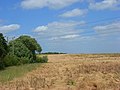 Fallow farmland, Cox Green - geograph.org.uk - 875489.jpg 640 × 480; 118 KB
-
 Farmland, Cox Green - geograph.org.uk - 875483.jpg 640 × 480; 133 KB
-
 Farmland, Maidenhead - geograph.org.uk - 875357.jpg 640 × 480; 115 KB
-
 Farmland, Maidenhead - geograph.org.uk - 875384.jpg 640 × 480; 121 KB
-
 Farmland, Maidenhead - geograph.org.uk - 875388.jpg 640 × 480; 128 KB
-
 Firs Lane, Maidenhead - geograph.org.uk - 875421.jpg 640 × 480; 138 KB
-
 Footbridge over A404(M) - geograph.org.uk - 2377224.jpg 640 × 488; 54 KB
-
 Footbridge over the A404(M) - geograph.org.uk - 3649386.jpg 640 × 430; 38 KB
-
 Footbridge over the A404(M) - geograph.org.uk - 3719329.jpg 4,497 × 2,197; 2.11 MB
-
 Footbridge over the A404(M) - geograph.org.uk - 3885173.jpg 640 × 463; 44 KB
-

-
 Footpath near Cox Green - geograph.org.uk - 1899862.jpg 640 × 426; 90 KB
-
 Footpath signs - geograph.org.uk - 1899881.jpg 640 × 426; 131 KB
-
 The Good Shepherd, Cox Green - geograph.org.uk - 1536648.jpg 640 × 458; 72 KB
-
 Great Thrift Wood - geograph.org.uk - 6073794.jpg 1,981 × 1,032; 354 KB
-

-
 Hidden path - geograph.org.uk - 2253624.jpg 2,272 × 1,704; 2.53 MB
-
 Holyport Junction - geograph.org.uk - 4485174.jpg 640 × 427; 240 KB
-
 Houses by the main Line - geograph.org.uk - 3961482.jpg 640 × 356; 56 KB
-
 Houses, Barn St - geograph.org.uk - 5374630.jpg 640 × 426; 62 KB
-
 J9a, A404(M) - geograph.org.uk - 4754946.jpg 640 × 426; 46 KB
-
 J9a, A404(M) - geograph.org.uk - 4754947.jpg 640 × 426; 55 KB
-
 Kimber's Lane footbridge over A404(M) - geograph.org.uk - 2672548.jpg 800 × 600; 370 KB
-
 Kimbers Lane Footbridge over the A404(M) - geograph.org.uk - 4462610.jpg 640 × 427; 247 KB
-
 Lillibrooke Manor Court Yard - geograph.org.uk - 4893934.jpg 5,504 × 2,944; 4.69 MB
-
 Lowbrook Drive, Woodlands Park - geograph.org.uk - 4120375.jpg 3,852 × 2,492; 1.78 MB
-
 M4 approaching junction 8-9 - geograph.org.uk - 2576761.jpg 640 × 375; 39 KB
-
 M4 east bound - geograph.org.uk - 3883842.jpg 640 × 497; 40 KB
-
 M4 eastbound - geograph.org.uk - 3883834.jpg 640 × 392; 27 KB
-
 M4 eastbound - geograph.org.uk - 3883865.jpg 640 × 435; 47 KB
-
 M4 eastbound - geograph.org.uk - 5609076.jpg 640 × 428; 80 KB
-
 M4 eastbound - geograph.org.uk - 5609079.jpg 640 × 428; 90 KB
-
 M4 footbridge - geograph.org.uk - 3617545.jpg 2,385 × 1,497; 1.7 MB
-
 M4 footbridge - geograph.org.uk - 4812077.jpg 640 × 398; 41 KB
-
 M4 junction 8-9 with A404(M) and A308(M) - geograph.org.uk - 6320365.jpg 3,648 × 2,736; 1.7 MB
-
 M4 Motorway near Stud Green - geograph.org.uk - 1909374.jpg 640 × 480; 68 KB
-
 M4, eastbound - geograph.org.uk - 5219422.jpg 640 × 426; 43 KB
-
 M4, half mile to J8-9 - geograph.org.uk - 3358290.jpg 640 × 562; 109 KB
-
 M4, slip road, J8-9 - geograph.org.uk - 3358297.jpg 640 × 451; 73 KB
-
 Maidenhead - Bissley Drive - geograph.org.uk - 5331050.jpg 4,608 × 3,456; 6.72 MB
-
 Maidenhead Bypass A404(M) - geograph.org.uk - 4462604.jpg 640 × 427; 245 KB
-
 Maidenhead Bypass, Southbound A404(M) - geograph.org.uk - 4462599.jpg 640 × 427; 233 KB
-
 Maidenhead from the air - geograph.org.uk - 3989794.jpg 640 × 480; 219 KB
-
 Maidenhead from the air - geograph.org.uk - 3989802.jpg 640 × 480; 187 KB
-
 Maidenhead Thicket on the A4 - geograph.org.uk - 4609607.jpg 2,304 × 1,728; 813 KB
-
 New Housing, Woodlands Park - geograph.org.uk - 6024960.jpg 4,838 × 3,161; 2.02 MB
-
 New Residential Development - geograph.org.uk - 4536988.jpg 1,280 × 720; 452 KB
-
 Northbound A404M approaching Junction 9B - geograph.org.uk - 4485181.jpg 640 × 427; 247 KB
-
 Northbound A404M, Maidenhead Bypass - geograph.org.uk - 4485178.jpg 640 × 427; 198 KB
-
 Ockwells Manor, Cox Green - geograph.org.uk - 6034098.jpg 4,657 × 2,885; 3.48 MB
-
 Ockwells Park Fields - geograph.org.uk - 4911901.jpg 3,264 × 1,840; 2.36 MB
-
 Ockwells Road - geograph.org.uk - 4912349.jpg 3,264 × 1,840; 1.63 MB
-
 Old Farm Workers Cottages - geograph.org.uk - 4422485.jpg 1,280 × 720; 333 KB
-
 Paddock Wood - geograph.org.uk - 6073771.jpg 3,589 × 1,491; 371 KB
-
 Pylon by the M4 - geograph.org.uk - 3358301.jpg 640 × 430; 51 KB
-
 Recently Ploughed Field opposite Lillibrooke Manor - geograph.org.uk - 4912185.jpg 3,264 × 1,840; 1.48 MB
-
 Road to Heywood Farm - geograph.org.uk - 6024950.jpg 5,059 × 3,518; 3.04 MB
-
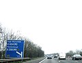
 Roundabout at A4 - A404(M)-A404 junction - geograph.org.uk - 6423677.jpg 1,024 × 684; 257 KB
-
 Roundabout on Bath Road, Maidenhead - geograph.org.uk - 4609605.jpg 2,268 × 1,680; 1.11 MB
-
 Rugged Bus Stop - geograph.org.uk - 1448043.jpg 640 × 480; 151 KB
-
 Shoppenhangers Road bridge over A404(M) - geograph.org.uk - 2672554.jpg 800 × 600; 349 KB
-
 Shoppenhangers Road Bridge, A404(M) - geograph.org.uk - 5219437.jpg 640 × 426; 47 KB
-
 Slip road at J8-9, M4 - geograph.org.uk - 5219429.jpg 640 × 426; 53 KB
-
 Slip road off M4 to junction 8-9 - geograph.org.uk - 2672537.jpg 800 × 600; 406 KB
-
 Sliproad at Junction 8-9 of the M4 - geograph.org.uk - 3719320.jpg 3,671 × 2,272; 1.54 MB
-
 Slow going on the A404 (M) - geograph.org.uk - 2377178.jpg 640 × 450; 58 KB
-
 The A404(M) - geograph.org.uk - 3719333.jpg 4,608 × 2,267; 2.2 MB
-
 The Ancient Ockwells Manor - geograph.org.uk - 4911923.jpg 3,264 × 1,840; 1.89 MB
-
 The Cut near Cox Green - geograph.org.uk - 1909449.jpg 640 × 480; 107 KB
-
 The M4 motorway from the air - geograph.org.uk - 3989787.jpg 640 × 480; 180 KB
-
 The M4 Motorway near Thimble Farm - geograph.org.uk - 3719314.jpg 4,035 × 1,902; 1.6 MB
-

-
 Through the arch - geograph.org.uk - 1899840.jpg 426 × 640; 121 KB
-
 Towards Great Thrift Wood - geograph.org.uk - 4384395.jpg 1,920 × 975; 354 KB
-
 Towards the edge of Maidenhead - geograph.org.uk - 6034108.jpg 5,184 × 3,456; 3.98 MB
-
 Wheat, Cox Green - geograph.org.uk - 875481.jpg 640 × 480; 134 KB
-
 Windsor and Maidenhead , M4 Junction 8-9 - geograph.org.uk - 5148880.jpg 4,467 × 3,351; 6.43 MB
-
 Windsor and Maidenhead , M4 Motorway - geograph.org.uk - 5726397.jpg 5,809 × 3,872; 5.79 MB
-
 Windsor and Maidenhead , M4 Motorway - geograph.org.uk - 5726398.jpg 6,000 × 4,000; 6.77 MB
-
 Windsor and Maidenhead , M4 Motorway - geograph.org.uk - 5726399.jpg 5,737 × 3,824; 7.89 MB
-
 Windsor and Maidenhead , M4 Motorway - geograph.org.uk - 5726404.jpg 6,000 × 4,000; 5.94 MB
_-_geograph.org.uk_-_4754942.jpg)
_-_junction_9a_(1-2_mile)_-_geograph.org.uk_-_2377156.jpg)
_-_geograph.org.uk_-_3885179.jpg)
_-_geograph.org.uk_-_3885182.jpg)
_-_geograph.org.uk_-_5219442.jpg)
_approaches_junction_9a_-_geograph.org.uk_-_2619509.jpg)
_approaching_J8_-_geograph.org.uk_-_4754950.jpg)
_approaching_J9a_-_geograph.org.uk_-_3649383.jpg)
_at_Cox_Green_-_geograph.org.uk_-_3719341.jpg)
_Footbridge_-_geograph.org.uk_-_4911908.jpg)
_northbound_-_geograph.org.uk_-_3885172.jpg)
_south_of_Vanwall_Business_Park_-_geograph.org.uk_-_3418689.jpg)
_westbound_-_geograph.org.uk_-_3885198.jpg)
_westbound_-_geograph.org.uk_-_3885204.jpg)
_westbound_-_geograph.org.uk_-_3885208.jpg)
_westbound_-_geograph.org.uk_-_3885212.jpg)
,_Maidenhead_Bypass_-_geograph.org.uk_-_4462602.jpg)

_-_geograph.org.uk_-_3529665.jpg)

_-_geograph.org.uk_-_3017115.jpg)


_-_geograph.org.uk_-_6267980.jpg)
_-_geograph.org.uk_-_6267981.jpg)
_-_geograph.org.uk_-_6267982.jpg)
_-_geograph.org.uk_-_6267984.jpg)
_-_geograph.org.uk_-_6267985.jpg)


_-_geograph.org.uk_-_2377224.jpg)
_-_geograph.org.uk_-_3649386.jpg)
_-_geograph.org.uk_-_3719329.jpg)
_-_geograph.org.uk_-_3885173.jpg)
_south_of_Maidenhead_-_geograph.org.uk_-_3560813.jpg)


_-_geograph.org.uk_-_5609084.jpg)


_-_geograph.org.uk_-_4754946.jpg)
_-_geograph.org.uk_-_4754947.jpg)
_-_geograph.org.uk_-_2672548.jpg)
_-_geograph.org.uk_-_4462610.jpg)


_and_A308(M)_-_geograph.org.uk_-_6320365.jpg)


_-_geograph.org.uk_-_4462604.jpg)
_-_geograph.org.uk_-_4462599.jpg)


-A404_junction_-_geograph.org.uk_-_6423677.jpg)


_-_geograph.org.uk_-_2672554.jpg)
_-_geograph.org.uk_-_5219437.jpg)


_-_geograph.org.uk_-_2377178.jpg)
_-_geograph.org.uk_-_3719333.jpg)


_and_A4_bridges_-_geograph.org.uk_-_2672560.jpg)


