Category:Crabbehof (Dordrecht)
Jump to navigation
Jump to search
| Object location | | View all coordinates using: OpenStreetMap |
|---|
neighbourhood in Dordrecht, Netherlands  | |||||
| Upload media | |||||
| Instance of | |||||
|---|---|---|---|---|---|
| Location | Dordrecht, South Holland, Netherlands | ||||
| Street address |
| ||||
| Located on street | |||||
| Heritage designation |
| ||||
 | |||||
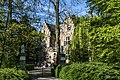
Nederlands: Kasteel de Crabbehof
Kasteel
|
This is a category about rijksmonument number 13681
|
Koetshuis
|
This is a category about rijksmonument number 522353
|
| Address |
|
Media in category "Crabbehof (Dordrecht)"
The following 22 files are in this category, out of 22 total.
-
 Castle Crabbehof, Dordrecht, Netherlands (29441674310).jpg 4,187 × 2,791; 11.9 MB
-
 Crabbehoff koetshuis.JPG 1,840 × 1,232; 1.29 MB
-
 Crabbehoff.JPG 1,840 × 1,232; 1.32 MB
-
 Exterieur OVERZICHT VOORGEVEL - Dordrecht - 20311360 - RCE.jpg 1,190 × 1,200; 504 KB
-
 Interieur, vestibule met schouw en galerij - Dubbeldam - 20065047 - RCE.jpg 894 × 1,200; 173 KB
-
 Kasteel crabbehoff (1) (16453682215).jpg 3,164 × 2,618; 3.62 MB
-
 Kasteel crabbehoff (10) (16451918311).jpg 5,184 × 3,456; 6.6 MB
-
 Kasteel crabbehoff (11) (15833589603).jpg 5,184 × 3,456; 6.37 MB
-
 Kasteel crabbehoff (12) (16267754887).jpg 5,184 × 3,456; 5.2 MB
-
 Kasteel crabbehoff (13) (16451910801).jpg 4,640 × 3,091; 6.23 MB
-
 Kasteel crabbehoff (14) (16452706912).jpg 2,899 × 3,815; 3.82 MB
-
 Kasteel crabbehoff (15) (16451906981).jpg 3,451 × 3,672; 3.82 MB
-
 Kasteel crabbehoff (2) (16427682246).jpg 3,456 × 4,610; 5.84 MB
-
 Kasteel crabbehoff (3) (16452730632).jpg 3,374 × 3,244; 4.75 MB
-
 Kasteel crabbehoff (4) (15831156874).jpg 4,910 × 3,317; 6.35 MB
-
 Kasteel crabbehoff (5) (16451927211).jpg 3,063 × 4,248; 4.52 MB
-
 Kasteel crabbehoff (6) (16265971688).jpg 3,456 × 5,184; 4.99 MB
-
 Kasteel crabbehoff (7) (15831150354).jpg 5,002 × 2,055; 3.77 MB
-
 Kasteel crabbehoff (8) (16267419689).jpg 4,586 × 2,610; 5.61 MB
-
 Kasteel crabbehoff (9) (16452717932).jpg 3,780 × 2,462; 3.75 MB
-
 Overzicht - Dubbeldam - 20065046 - RCE.jpg 894 × 1,200; 248 KB
-
 Overzicht inrijhek en hofstede - Dubbeldam - 20065045 - RCE.jpg 1,200 × 854; 326 KB
.jpg)


_(16453682215).jpg)
_(16451918311).jpg)
_(15833589603).jpg)
_(16267754887).jpg)
_(16451910801).jpg)
_(16452706912).jpg)
_(16451906981).jpg)
_(16427682246).jpg)
_(16452730632).jpg)
_(15831156874).jpg)
_(16451927211).jpg)
_(16265971688).jpg)
_(16267419689).jpg)
_(16452717932).jpg)


_(15831150354).jpg)