Category:Cranbrook, Kent
Jump to navigation
Jump to search
town in Kent, England, UK  | |||||
| Upload media | |||||
| Instance of | |||||
|---|---|---|---|---|---|
| Location | Cranbrook & Sissinghurst, Tunbridge Wells, Kent, South East England, England | ||||
| official website | |||||
 | |||||
Subcategories
This category has the following 23 subcategories, out of 23 total.
A
C
- Co-op, Cranbrook, Kent (3 F)
- Cranbrook Museum, Kent (3 F)
- Cranbrook School, Kent (11 F)
- Cranbrook war memorial (32 F)
D
G
- The George Hotel, Cranbrook (3 F)
H
- Hill House, Cranbrook (4 F)
L
- Lloyds Bank, Cranbrook (3 F)
- Lloyds Pharmacy, Cranbrook (2 F)
O
P
- Plaques in Cranbrook, Kent (23 F)
- Providence Chapel, Cranbrook (2 F)
S
T
- The Tanyard, Cranbrook (4 F)
U
- Union Mill, Cranbrook (45 F)
W
- Waterloo Road, Cranbrook (7 F)
- White Horse, Cranbrook (7 F)
Media in category "Cranbrook, Kent"
The following 200 files are in this category, out of 301 total.
(previous page) (next page)-
 1 and 2 Bakers Cross, Cranbrook - geograph.org.uk - 1309370.jpg 640 × 480; 109 KB
-
 1880 – Coffee Tavern, Cranbrook, Kent.jpg 590 × 487; 125 KB
-
 51-55 Oatfield Drive - geograph.org.uk - 2295437.jpg 640 × 480; 74 KB
-

-
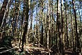
 A stand of conifers, Angley Wood - geograph.org.uk - 1807767.jpg 640 × 430; 173 KB
-
 AA Hotel light box - geograph.org.uk - 2048998.jpg 480 × 640; 77 KB
-
 Access road to Trenley Farm - geograph.org.uk - 1820365.jpg 3,072 × 2,304; 2.78 MB
-
 Allotment off Oatfield Drive - geograph.org.uk - 2295441.jpg 640 × 320; 78 KB
-
 Angelo's ^ Quirky Giftz - geograph.org.uk - 2295662.jpg 640 × 480; 84 KB
-
 Angley Wood - geograph.org.uk - 1807759.jpg 640 × 430; 219 KB
-
 Angley Wood - geograph.org.uk - 1807766.jpg 640 × 430; 207 KB
-
 Angley Wood - geograph.org.uk - 1807779.jpg 640 × 430; 204 KB
-
 Angley Wood - geograph.org.uk - 1807798.jpg 640 × 430; 199 KB
-
 Angley Wood, Cranbrook, Kent - geograph.org.uk - 917820.jpg 480 × 640; 146 KB
-
 Approach to the former Cranbrook station - geograph.org.uk - 4051401.jpg 4,000 × 3,000; 4.23 MB
-
 Baby Badger on Colliers Green Road - geograph.org.uk - 1952748.jpg 1,024 × 768; 470 KB
-
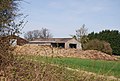 Barn and Manure, Glassenbury Hill Farm - geograph.org.uk - 1807890.jpg 640 × 430; 161 KB
-
 Bell House Interiors - geograph.org.uk - 2221098.jpg 640 × 480; 85 KB
-
 Birch Wood - geograph.org.uk - 1808113.jpg 640 × 430; 126 KB
-
 Boardwalk in Hillywood, near Friezley - geograph.org.uk - 1311963.jpg 640 × 480; 129 KB
-
 Bramley Drive - geograph.org.uk - 1893504.jpg 1,024 × 768; 185 KB
-
 Bramley Drive - geograph.org.uk - 1893524.jpg 1,024 × 768; 138 KB
-
 Buildings and Sissinghurst Castle , Kent - geograph.org.uk - 2262680.jpg 800 × 512; 299 KB
-
 Bus Stop on Angley Rd - geograph.org.uk - 1807596.jpg 640 × 430; 132 KB
-
 Carriers Road - geograph.org.uk - 2242392.jpg 640 × 480; 87 KB
-
 Carriers Road - geograph.org.uk - 2295665.jpg 640 × 480; 77 KB
-
 Catholic Church, High St, Cranbrook - geograph.org.uk - 1807569.jpg 640 × 430; 168 KB
-
 Causton Rd, Cranbrook - geograph.org.uk - 1805599.jpg 640 × 430; 158 KB
-
 Causton Road Garage Blocks Cranbrook - geograph.org.uk - 4283784.jpg 1,024 × 683; 335 KB
-
 Chapel, Cranbrook Cemetery - geograph.org.uk - 2469360.jpg 640 × 430; 90 KB
-
 Cherry Cottage, Hartridge - geograph.org.uk - 2001396.jpg 640 × 427; 118 KB
-
 Cleared area, Angley Wood - geograph.org.uk - 1807616.jpg 640 × 397; 136 KB
-
 Cleared area, Angley Wood - geograph.org.uk - 1807735.jpg 640 × 400; 129 KB
-
 Cleared area, Angley Wood - geograph.org.uk - 1807741.jpg 640 × 430; 158 KB
-

-
 Conifers, Angley Wood - geograph.org.uk - 1807732.jpg 640 × 430; 203 KB
-
 Coppicing, Angley Wood - geograph.org.uk - 1807723.jpg 640 × 430; 219 KB
-
 Coppicing, Angley Wood - geograph.org.uk - 1807816.jpg 640 × 430; 229 KB
-

-
 Cottage off Golford Road, Cranbrook, Kent - geograph.org.uk - 891453.jpg 640 × 427; 104 KB
-
 Cows in the Wood - geograph.org.uk - 1893495.jpg 768 × 1,024; 372 KB
-
 Cows near Attwater Farm - geograph.org.uk - 1893421.jpg 1,024 × 683; 283 KB
-
 Cramp Institute Club High Street Cranbrook - geograph.org.uk - 4283788.jpg 1,024 × 683; 276 KB
-
 Cramp Institute Club, Cranbrook - geograph.org.uk - 3045767.jpg 1,600 × 1,146; 408 KB
-
 Cran Brook Causton Road Cranbrook - geograph.org.uk - 4283787.jpg 1,024 × 683; 429 KB
-
 Cranbrook - geograph.org.uk - 2209846.jpg 1,107 × 757; 432 KB
-
 Cranbrook 3324.JPG 4,608 × 3,456; 3.26 MB
-
 Cranbrook 3349.JPG 4,608 × 3,456; 3.52 MB
-
 Cranbrook 3350.JPG 4,608 × 3,456; 3.5 MB
-
 Cranbrook 3351.JPG 4,608 × 3,456; 3.27 MB
-
 Cranbrook bypass, A229 - geograph.org.uk - 293764.jpg 640 × 427; 71 KB
-
 Cranbrook Car Park - geograph.org.uk - 1592184.jpg 640 × 427; 67 KB
-

-
 Cranbrook Drill Hall Causton Road Cranbrook (geograph 4283768).jpg 1,024 × 731; 412 KB
-

-

-

-

-

-

-

-
 Cranbrook Fire Station - geograph.org.uk - 1807560.jpg 640 × 430; 160 KB
-
 Cranbrook Fire Station - geograph.org.uk - 2200219.jpg 640 × 480; 74 KB
-
 Cranbrook fire station - geograph.org.uk - 588043.jpg 640 × 427; 249 KB
-
 Cranbrook Library - geograph.org.uk - 1501004.jpg 640 × 427; 101 KB
-
 Cranbrook Library - geograph.org.uk - 2242395.jpg 640 × 480; 109 KB
-
 Cranbrook library - geograph.org.uk - 2295453.jpg 640 × 480; 138 KB
-
 Cranbrook old fire station - geograph.org.uk - 588045.jpg 427 × 640; 257 KB
-
 Cranbrook painting by Niemann.jpg 500 × 338; 48 KB
-
 Cranbrook Strict Baptist Chapel - geograph.org.uk - 2474130.jpg 640 × 430; 61 KB
-
 Cranbrook Town Sign - geograph.org.uk - 1500912.jpg 640 × 427; 79 KB
-
 Cranbrook town sign - geograph.org.uk - 878244 (cropped).jpg 204 × 544; 63 KB
-
 Cranbrook town sign - geograph.org.uk - 878244.jpg 480 × 640; 191 KB
-
 Cranbrook Townscape - geograph.org.uk - 1481946.jpg 640 × 480; 88 KB
-
 Cranbrook village sign - geograph.org.uk - 2471780.jpg 640 × 430; 101 KB
-
 Cranbrook Windmill - geograph.org.uk - 2474156.jpg 640 × 430; 70 KB
-
 Cranbrook Woods - geograph.org.uk - 1808132.jpg 640 × 430; 136 KB
-
 Cranbrook, Kent.jpg 1,600 × 1,200; 238 KB
-
 Cranbrook, Sissinghurst Road - geograph.org.uk - 2740352.jpg 3,648 × 2,736; 3.6 MB
-
 Cranbrook, Sissinghurst Road - geograph.org.uk - 2740353.jpg 3,648 × 2,736; 3.2 MB
-
 Cranbrook, Sissinghurst Road - geograph.org.uk - 2740356.jpg 3,648 × 2,736; 3.42 MB
-
 Dene House - geograph.org.uk - 1309307.jpg 640 × 480; 114 KB
-
-
 Drop Gate Stile - geograph.org.uk - 1898820.jpg 2,288 × 1,712; 778 KB
-
 Entering Angley Wood - geograph.org.uk - 1807613.jpg 640 × 430; 188 KB
-
 Entering Cranbrook, Golford Rd - geograph.org.uk - 2471676.jpg 640 × 430; 116 KB
-
 Entrance to Hemsted Forest - geograph.org.uk - 1852130.jpg 3,072 × 2,304; 3.21 MB
-
 Farm track from Glassenbury Hill Farm - geograph.org.uk - 1807970.jpg 640 × 430; 134 KB
-
 Farm track to Glassenbury Hill Farm - geograph.org.uk - 1807977.jpg 640 × 430; 126 KB
-
 Field by High Weald Landscape Trail - geograph.org.uk - 1808116.jpg 640 × 403; 85 KB
-

-
 Fire Engine on High Street - geograph.org.uk - 2200218.jpg 640 × 480; 92 KB
-
 Footbridge in Hillywood - geograph.org.uk - 1311955.jpg 640 × 480; 146 KB
-

-
 Footpath crosses the A229 Angley Road - geograph.org.uk - 1592220.jpg 640 × 427; 134 KB
-
 Footpath from Friezley Lane - geograph.org.uk - 1311965.jpg 640 × 480; 74 KB
-
 Footpath signpost, Angley Wood - geograph.org.uk - 1807812.jpg 640 × 430; 208 KB
-
 Footpath through Oilseed Rape - geograph.org.uk - 1893399.jpg 1,024 × 768; 308 KB
-
 Footpath to Cranbrook High Street - geograph.org.uk - 1596216.jpg 640 × 427; 47 KB
-
 Forest Track in Bedgebury Forest - geograph.org.uk - 1820396.jpg 3,072 × 2,304; 2.86 MB
-
 Former Council Offices - geograph.org.uk - 2201278.jpg 640 × 480; 93 KB
-
 Former Stable Block at Swattenden Centre - geograph.org.uk - 1893412.jpg 1,024 × 768; 186 KB
-
 Friezley Oast, Friezley Lane - geograph.org.uk - 2721346.jpg 4,000 × 3,000; 3.09 MB
-
 Friezley Oast, Friezley Lane, Cranbrook Kent - geograph.org.uk - 4338584.jpg 1,024 × 731; 317 KB
-
-

-
 Gift shop at Sissinghurst Castle - geograph.org.uk - 1815973.jpg 640 × 480; 126 KB
-
 Glassenbury Hill Farm - geograph.org.uk - 1807900.jpg 640 × 430; 179 KB
-
 Glassenbury Hill Oast - geograph.org.uk - 1807885.jpg 640 × 430; 143 KB
-
 Glassenbury House - geograph.org.uk - 1808027.jpg 640 × 391; 159 KB
-
 Glassenbury Rd (B2085) - geograph.org.uk - 1807974.jpg 640 × 430; 171 KB
-

-
 Hartridge - geograph.org.uk - 2001339.jpg 640 × 427; 106 KB
-
 Hendley Drive - geograph.org.uk - 2295434.jpg 640 × 480; 78 KB
-
 High St, Cranbrook - geograph.org.uk - 1807565.jpg 640 × 430; 138 KB
-
 High Street - geograph.org.uk - 2221147.jpg 640 × 480; 94 KB
-
 High Street - geograph.org.uk - 2221156.jpg 640 × 640; 95 KB
-
 High Street - geograph.org.uk - 2221165.jpg 640 × 480; 99 KB
-
 High Street - geograph.org.uk - 2221223.jpg 480 × 640; 88 KB
-
 High Street - geograph.org.uk - 2230754.jpg 480 × 640; 79 KB
-
 High Street - geograph.org.uk - 2233809.jpg 640 × 427; 87 KB
-
 High Street in snow - geograph.org.uk - 2200213.jpg 640 × 480; 88 KB
-
 High Street, Cranbrook - geograph.org.uk - 2242397.jpg 640 × 480; 75 KB
-
 High Street, Cranbrook - geograph.org.uk - 3010167.jpg 1,000 × 704; 796 KB
-
 High Street, Cranbrook - geograph.org.uk - 3010171.jpg 1,000 × 658; 372 KB
-
 High Street, Cranbrook - geograph.org.uk - 3061945.jpg 1,600 × 1,165; 371 KB
-
 High Street, Cranbrook - geograph.org.uk - 4051152.jpg 4,000 × 3,000; 3.86 MB
-

-
 High Weald Landscape Trail - geograph.org.uk - 1807854.jpg 640 × 430; 174 KB
-
 High Weald Landscape Trail - geograph.org.uk - 1808119.jpg 640 × 430; 156 KB
-

-

-

-

-

-

-
-

-

-
 High Weald Landscape Trail sign, New Rd - geograph.org.uk - 1807579.jpg 640 × 430; 166 KB
-

-

-

-

-

-

-

-

-

-

-

-
 High Weald Landscape Trail, Angley Wood - geograph.org.uk - 1807617.jpg 640 × 430; 205 KB
-
 High Weald Landscape Trail, Angley Wood - geograph.org.uk - 1807765.jpg 640 × 430; 206 KB
-
 High Weald Landscape Trail, Angley Wood, Cranbrook - geograph.org.uk - 4210473.jpg 4,608 × 3,456; 5.97 MB
-
 High Weald Landscape Trail, Angley Wood, Cranbrook - geograph.org.uk - 4211027.jpg 4,608 × 3,456; 6.28 MB
-
-

-
 Hocker Edge Friezley Lane, Cranbrook Kent - geograph.org.uk - 4338592.jpg 1,024 × 730; 317 KB
-
 Hocker Edge Oast, Friezley Lane, Cranbrook - geograph.org.uk - 4527729.jpg 1,024 × 768; 344 KB
-
 Hocker Edge Oast, Friezley Lane, Cranbrook - geograph.org.uk - 4527734.jpg 1,024 × 768; 332 KB
-
 Hocker Stream from Friezley Lane, Cranbrook Kent - geograph.org.uk - 4338603.jpg 1,024 × 576; 418 KB
-

-

-
 House at Bakers Cross - geograph.org.uk - 2295667.jpg 640 × 480; 92 KB
-

-
 Houses on Hendley Drive - geograph.org.uk - 2293143.jpg 640 × 427; 76 KB
-
 Houses, High St, Cranbrook - geograph.org.uk - 1807574.jpg 640 × 430; 131 KB
-
 Huggin's Hall - geograph.org.uk - 2221606.jpg 3,072 × 2,304; 2.92 MB
-
 Invicta on the White Horse - geograph.org.uk - 2049381.jpg 480 × 640; 99 KB
-
 Little Glassenbury - geograph.org.uk - 1808033.jpg 640 × 430; 191 KB
-
 Little Glassenbury Barn - geograph.org.uk - 1808123.jpg 640 × 400; 79 KB
-
 Log piles, Angley Wood - geograph.org.uk - 1807615.jpg 640 × 430; 209 KB
-
 Logs by the track, Angley Wood - geograph.org.uk - 1807733.jpg 640 × 430; 183 KB
-
 Logs by the track, Angley Wood - geograph.org.uk - 1807754.jpg 640 × 430; 208 KB
-
 Logs by the track, Angley Wood - geograph.org.uk - 1807769.jpg 640 × 430; 186 KB
-
 Logs by the track, Little Glassenbury - geograph.org.uk - 1808039.jpg 640 × 430; 149 KB
-
 Logs under cover, Angley Wood - geograph.org.uk - 1807821.jpg 640 × 430; 201 KB
-
 Lorry Sign - geograph.org.uk - 1806323.jpg 1,024 × 768; 160 KB
-
 Loui's Barber Shop - geograph.org.uk - 1840618.jpg 1,024 × 768; 257 KB
-

-

-
 New Rd, Cranbrook (2) - geograph.org.uk - 1807590.jpg 640 × 430; 180 KB
-
 New Rd, Cranbrook - geograph.org.uk - 1807582.jpg 640 × 430; 145 KB
-
 New Rd, Cranbrook - geograph.org.uk - 1807588.jpg 640 × 336; 109 KB
-
 Oak Tree in Oilseed Rape Field - geograph.org.uk - 1893377.jpg 1,024 × 768; 340 KB
-
 Oak Tree in Oilseed Rape Field - geograph.org.uk - 1893393.jpg 1,024 × 768; 304 KB
-

-
 Oatfield Drive - geograph.org.uk - 2295435.jpg 640 × 480; 82 KB
-
 Oatfield Drive - geograph.org.uk - 2295663.jpg 640 × 427; 79 KB
-
 Oatfield Drive - geograph.org.uk - 2295668.jpg 640 × 213; 46 KB
-
 Old Cloth Hall - geograph.org.uk - 1499225.jpg 640 × 427; 47 KB
-
 Old open barn, Hartridge Manor Farm - geograph.org.uk - 2001417.jpg 640 × 427; 123 KB
-
 On the edge of Cranbrook - geograph.org.uk - 4051441.jpg 4,000 × 3,000; 3.98 MB
-
 On the way to Cranbrook - geograph.org.uk - 3835532.jpg 4,000 × 3,000; 4.31 MB
-
 Orchard Lodge - geograph.org.uk - 892427.jpg 640 × 640; 96 KB
-
 Ordnance Survey One-Inch Sheet 126 Weald of Kent, Published 1927.jpg 11,876 × 8,922; 10.88 MB
-

-

-

-


.jpg)
.jpg)
.jpg)


_-_geograph.org.uk_-_1807974.jpg)


_-_geograph.org.uk_-_1807867.jpg)


_-_geograph.org.uk_-_1807724.jpg)
_-_geograph.org.uk_-_1807776.jpg)
_-_geograph.org.uk_-_1807725.jpg)
_-_geograph.org.uk_-_1807789.jpg)
_-_geograph.org.uk_-_1807736.jpg)
_-_geograph.org.uk_-_1807794.jpg)
_-_geograph.org.uk_-_1807739.jpg)
_-_geograph.org.uk_-_1807743.jpg)
_-_geograph.org.uk_-_1807758.jpg)


_-_geograph.org.uk_-_1807590.jpg)


.jpg)