Category:Cross dykes
Jump to navigation
Jump to search
type of linear earthwork believed to be a prehistoric land boundary | |||||
| Upload media | |||||
| Subclass of |
| ||||
|---|---|---|---|---|---|
| |||||
Subcategories
This category has the following 5 subcategories, out of 5 total.
Media in category "Cross dykes"
The following 53 files are in this category, out of 53 total.
-
 Braided hollow-ways on The Street - geograph.org.uk - 1374210.jpg 640 × 480; 73 KB
-
 Bridleway, White Sheet Hill - geograph.org.uk - 1334489.jpg 480 × 640; 193 KB
-
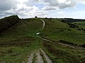
 Chanctonbury Hill, Cross Dyke - geograph.org.uk - 440533.jpg 640 × 480; 60 KB
-
 Chantry and Kithurst Hills - geograph.org.uk - 246485.jpg 640 × 479; 143 KB
-
 Cross Dyke - geograph.org.uk - 1462187.jpg 640 × 480; 123 KB
-
 Cross Dyke - geograph.org.uk - 292403.jpg 640 × 384; 97 KB
-
 Cross Dyke - geograph.org.uk - 30828.jpg 442 × 301; 33 KB
-
 Cross Dyke - geograph.org.uk - 401335.jpg 640 × 480; 89 KB
-
 Cross Dyke - geograph.org.uk - 839782.jpg 640 × 480; 83 KB
-
 Cross Dyke - geograph.org.uk - 849475.jpg 640 × 480; 131 KB
-
 Cross Dyke by Old Shaftsbury Drove - geograph.org.uk - 336034.jpg 640 × 430; 136 KB
-
 Cross Dyke close-up - geograph.org.uk - 401339.jpg 640 × 480; 102 KB
-
 Cross Dyke on Compton Down - geograph.org.uk - 352667.jpg 640 × 430; 123 KB
-
 Cross Dyke Pincombe Down - geograph.org.uk - 304570.jpg 640 × 427; 83 KB
-
 Cross dyke southeast of Wolstonbury Camp 03.jpg 4,000 × 3,000; 3.15 MB
-
 Cross dyke southeast of Wolstonbury Camp 04.jpg 4,000 × 3,000; 2.62 MB
-
 Cross dyke southeast of Wolstonbury Camp 05.jpg 3,615 × 3,000; 8.04 MB
-
 Cross Dyke, Barpham Hill - geograph.org.uk - 1329405.jpg 640 × 480; 74 KB
-
 Cross Dyke, Barpham Hill - geograph.org.uk - 1329531.jpg 640 × 480; 84 KB
-
 Cross Dyke, Chanctonbury Hill - geograph.org.uk - 991395.jpg 640 × 479; 96 KB
-
 Cross Dyke, Standish Wood - geograph.org.uk - 1125561.jpg 640 × 426; 118 KB
-
 Cross Dyke, Steyning Round Hill - geograph.org.uk - 1195456.jpg 445 × 640; 79 KB
-
 Cross dykes on Pen Hill - geograph.org.uk - 684174.jpg 640 × 480; 122 KB
-
 Cross-dyke between Cochrane Pike and Wether Hill - geograph.org.uk - 1804865.jpg 1,024 × 768; 239 KB
-

-
 Crossdyke on Newtimber Hill - geograph.org.uk - 388338.jpg 640 × 480; 92 KB
-
 Downland, Kingston Deverill - geograph.org.uk - 539217.jpg 640 × 480; 163 KB
-
 DSCN1513 Pen Hill cross dykes.JPG 2,816 × 2,112; 1.47 MB
-
 Earthwork at Deepdale Plantation (geograph 5715591).jpg 1,024 × 768; 358 KB
-

-
 Horseshoe Woods cross dyke 01.jpg 4,000 × 3,000; 5.82 MB
-
 Horseshoe Woods cross dyke 02.jpg 4,000 × 3,000; 5.45 MB
-
-
 Part of the Standish Wood Cross Dyke.jpg 4,896 × 3,264; 10.44 MB
-
 Pen Hill cross dykes 01.jpg 3,264 × 2,448; 2.19 MB
-
 Pen Hill cross dykes 02.jpg 3,264 × 2,448; 2.38 MB
-
 Pen Hill cross dykes 03.jpg 5,152 × 3,864; 4.35 MB
-
 Pen Hill Cross Dykes.jpg 6,409 × 2,110; 8.07 MB
-
 Section through cross dyke, Chanctonbury Ring.gif 1,050 × 290; 30 KB
-
 Sompting cross dyke - geograph.org.uk - 1114296.jpg 640 × 480; 104 KB
-
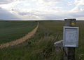
 South Downs Way - geograph.org.uk - 213670.jpg 640 × 479; 138 KB
-
 Stile and gate, Hambledon Hill - geograph.org.uk - 646204.jpg 640 × 480; 105 KB
-
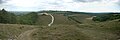
 Chantry Hill - geograph.org.uk - 1003093.jpg 640 × 479; 79 KB
-
 Telscombe Cross Dyke - geograph.org.uk - 465627.jpg 640 × 480; 84 KB
-
 The Bank of the Standish Wood Cross Dyke.jpg 4,896 × 3,264; 11.59 MB
-
-
 The Street between Craik Moor and Calroust Common - geograph.org.uk - 1424139.jpg 7,216 × 2,707; 2.19 MB
-

-
 Track next to Cross Dyke - geograph.org.uk - 337985.jpg 640 × 430; 136 KB
-
 Trackway, Cefn-y-grug - geograph.org.uk - 837999.jpg 640 × 359; 54 KB
-
 View of Landscape from the Standish Wood Cross Dyke.jpg 4,729 × 3,158; 11.47 MB
-

-
 View west across arable land - geograph.org.uk - 1804489.jpg 1,600 × 1,200; 407 KB


.jpg)


