Category:Cserépvár
Jump to navigation
Jump to search
| Object location | | View all coordinates using: OpenStreetMap |
|---|
Hungarian castle | |||||
| Upload media | |||||
| Location |
| ||||
|---|---|---|---|---|---|
 | |||||
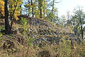
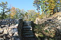
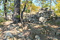
Magyar: Cserépvár vára. Várrom 14. sz.-i eredetű. Elpusztult a 16 sz.-ban.
|
This is a category about a monument in Hungary. Identifier: 2716 |
Media in category "Cserépvár"
The following 18 files are in this category, out of 18 total.
-
 Barlanglakás - Cserépváralja, 2014.06.20 (7).JPG 4,320 × 3,240; 5.32 MB
-
 Cserepvaralja castle.jpg 600 × 402; 102 KB
-
 Cserépvár - 2014.06.20 (1).JPG 4,320 × 3,240; 5.53 MB
-
 Cserépvár - 2014.06.20 (2).JPG 4,320 × 3,240; 5.66 MB
-
 Cserépvár - 2014.06.20 (3).JPG 4,320 × 3,240; 5.68 MB
-
 Cserépvár - 2014.06.20 (4).JPG 4,320 × 3,240; 5.46 MB
-
 Cserépvár - 2014.06.20 (5).JPG 4,320 × 3,240; 5.59 MB
-
 Cserépvár 1.JPG 4,272 × 2,848; 10.28 MB
-
 Cserépvár 2.JPG 4,272 × 2,848; 10.68 MB
-
 Cserépvár 3.JPG 4,272 × 2,848; 9.97 MB
-
 Cserépvár 4.JPG 4,272 × 2,848; 7.71 MB
-
 Cserépvár 5.JPG 4,272 × 2,848; 8.69 MB
-
 Cserépvár 6.JPG 4,272 × 2,848; 8.75 MB
-
 Cserépvár 7.JPG 4,272 × 2,848; 10.19 MB
-
 Cserépvár 8.JPG 4,272 × 2,848; 9.89 MB
-
 Cserépvár légi felvételen.jpg 900 × 675; 815 KB
-
 Cserépvár légi fotó.jpg 600 × 411; 108 KB
-
 Cserépvár, légi fotó.jpg 900 × 675; 781 KB
.JPG)

.JPG)
.JPG)
.JPG)
.JPG)
.JPG)


