Category:Cumnock
Jump to navigation
Jump to search

English: Cumnock (Cumnag in Gaelic) is a town in East Ayrshire, Scotland. The town sits at the confluence of the Glaisnock Water and the Lugar Water. There are three neighbouring housing projects which lie just outside the town boundaries, Netherthird, Craigens and Logan, with the former ironworks settlement of Lugar also just outside the town, contributing to a population of around 13,000 in the immediate locale.
Gàidhlig: 'S e baile beag ann an Siorrachd Inbhir Àir an ear, ann an àird an iar-dheas Alba a tha ann an Cumnag (Beurla: Cumnock). Ann an 2001 's e 13,000an àireamh-shluaigh a tha aige. Tha am baile ainmeil airson toll-guail.
Hrvatski: Cumnock je grad u East Ayrshire, Škotska. Indsutrijski grad koji je rodno mjesto Keira Hardiea. S populacijom od 10,000 ljudi u prošlosti je bilo rudarsko i tekstilno središte, no skoro ništa od te industrije nije ostalo. U blizini grada nalazi se Glaisnock Water i River Lugar.
Norsk bokmål: Cumnock ( Skotsk gælisk: Cumnag) er en by (town) i regionen East Ayrshire i Skottland. Cumnock ligger øst for Ayr og sørøst for Kilmarnock. Like nordvest for byen ligger Auchinleck.
town in East Ayrshire, Scotland, UK  | |||||
| Upload media | |||||
| Instance of | |||||
|---|---|---|---|---|---|
| Location |
| ||||
| Population |
| ||||
 | |||||
Subcategories
This category has the following 17 subcategories, out of 17 total.
A
- St Andrew's church, Cumnock (2 F)
B
- Benston, Cumnock (7 F)
C
- Cumnock mercat cross (2 F)
- Cumnock Picture House (2 F)
- Cumnock Town Hall (3 F)
D
G
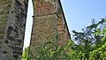
- Glaisnock Viaduct (4 F)
M
- Mote Hill (9 F)
N
- Netherton, Cumnock (9 F)
O
- Old Cumnock Old Church (37 F)
S
- Skares Viaduct (1 F)
T
- Terringzean Castle (11 F)
W
- Woodroad viaduct (4 F)
Media in category "Cumnock"
The following 54 files are in this category, out of 54 total.
-
 A70 - geograph.org.uk - 421232.jpg 640 × 480; 144 KB
-
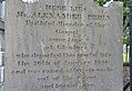 Alexander Peden's gravestone, Cumnock, East Ayrshire, Scotland.jpg 4,584 × 3,149; 6.46 MB
-
 Ayr, Carrick and Cumnock UK Chart.png 464 × 341; 15 KB
-
 Bank Viaduct, Cumnock, East Ayrshire.jpg 1,920 × 1,080; 774 KB
-
 Bridge over the Rose Burn - geograph.org.uk - 330264.jpg 640 × 480; 128 KB
-
 Broomfield Track and Pavilion - geograph.org.uk - 620648.jpg 640 × 480; 83 KB
-
 By The Lugar Water - geograph.org.uk - 937324.jpg 640 × 465; 82 KB
-
 Carrick Cumnock and Doon Valley C Ward Map 2011.svg 1,021 × 966; 369 KB
-
 Changue Farm roadend - geograph.org.uk - 330259.jpg 471 × 640; 59 KB
-
 Church of St John the Evangelist, Cumnock.jpg 5,184 × 3,456; 7.73 MB
-
 Cumnock - geograph.org.uk - 205229.jpg 640 × 480; 145 KB
-
 Cumnock and Doon Valley.svg 1,023 × 1,345; 2.82 MB
-
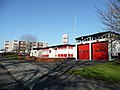 Cumnock Fire Station - geograph.org.uk - 699853.jpg 640 × 480; 73 KB
-
 Cumnock Old Cemetery - geograph.org.uk - 992780.jpg 640 × 427; 118 KB
-
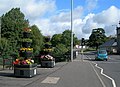
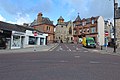 Cumnock town centre, Scotland.jpg 1,920 × 1,280; 1.35 MB
-
 Cumnock.jpg 640 × 480; 132 KB
-
 East Ayrshire Community Hospital - geograph.org.uk - 207254.jpg 640 × 376; 63 KB
-
 Equisetum sylvaticum (Wood Horsetail), Mote Hill, Cumnock, East Ayrshire.jpg 1,522 × 904; 586 KB
-
 From Stepend Bing Cumnock Scotland.jpg 1,062 × 835; 163 KB
-
 From Stepend Bing, Cumnock, Scotland-LCCN2001705961.jpg 3,646 × 2,738; 3.13 MB
-
 From Stepend Bing, Cumnock, Scotland-LCCN2001705961.tif 3,646 × 2,738; 28.56 MB
-
 Green Fields - geograph.org.uk - 433082.jpg 640 × 480; 107 KB
-

-
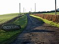 Knockterra farm roadend - geograph.org.uk - 330272.jpg 640 × 480; 79 KB
-
 Leaving Cumnock in East Ayrshire - geograph.org.uk - 1159224.jpg 640 × 480; 78 KB
-
 Leifnorris Castle site, Dumfries House, Ayrshire.jpg 1,920 × 1,080; 1.25 MB
-
 Line painting in Glaisnock Street.jpg 640 × 427; 112 KB
-
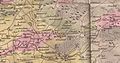 Map of Auchinleck and Cumnock, Circa 1811.jpg 1,683 × 877; 1.06 MB
-
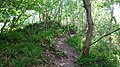
 Mote Hill and path site, Cumnock, East Ayrshire, Scotland.jpg 1,920 × 1,080; 1.17 MB
-
 Mote Hill and seat, Cumnock, East Ayrshire, Scotland.jpg 1,920 × 1,080; 1.08 MB
-
 Mote Hill and steps, Cumnock, East Ayrshire, Scotland.jpg 1,920 × 1,080; 1.14 MB
-
 Mote Hill mound and path, Cumnock, East Ayrshire, Scotland.jpg 1,920 × 1,080; 1.02 MB
-
 Mote Hill pond site and path, Cumnock, East Ayrshire, Scotland.jpg 1,920 × 1,080; 1,006 KB
-
 Mote Hill site, Cumnock, East Ayrshire, Scotland.jpg 1,637 × 1,080; 1.19 MB
-
 Mote Hill, Cumnock, East Ayrshire.jpg 1,920 × 1,080; 1.06 MB
-
 Old Leifnorris Castle site, Dumfries House, Ayrshire.jpg 1,920 × 1,080; 1.12 MB
-
 Ordnance Survey One-Inch Sheet 67 Ayr, Published 1964 2.jpg 8,940 × 10,712; 20.03 MB
-
 Ordnance Survey One-Inch Sheet 67 Ayr, Published 1964.jpg 8,489 × 9,865; 11.31 MB
-
 Ordnance Survey One-Inch Sheet 78 Kilmarnock & Ayr, Published 1925.jpg 12,243 × 9,307; 21.46 MB
-
 Private road to Woodhead Cottage - geograph.org.uk - 330269.jpg 640 × 480; 126 KB
-
 Rent a flat above a shop - geograph.org.uk - 699851.jpg 640 × 480; 74 KB
-
 River Lugar, Mote Hill wood, Cumnock, East Ayrshire - view east.jpg 1,920 × 1,080; 1.04 MB
-
 River Lugar, Mote Hill, Cumnock, East Ayrshire - view north.jpg 1,920 × 1,080; 1.15 MB
-
 River Lugar, Mote Hill, Cumnock, East Ayrshire.jpg 1,496 × 939; 566 KB
-
 Road over the A76 - geograph.org.uk - 331247.jpg 640 × 499; 114 KB
-
 Robert Burns Academy.jpg 750 × 529; 367 KB
-
 Roseburn - house in a hollow - geograph.org.uk - 330337.jpg 640 × 480; 95 KB
-
 Scruffy pasture, scrubby woodland - geograph.org.uk - 330323.jpg 640 × 480; 83 KB
-
 Templand Bridge, Cumnock, Scotland LOC 3450350986.jpg 1,024 × 775; 268 KB
-
 The concrete heart of Cumnock - geograph.org.uk - 699849.jpg 640 × 480; 83 KB
-
 The Corporate Colours - geograph.org.uk - 937321.jpg 640 × 480; 76 KB
-
 The Mote Hill, Cumnock, East Ayrshire.jpg 1,920 × 1,080; 1.05 MB
-
 William Simson's gravestone at Cumnock - geograph.org.uk - 992792.jpg 427 × 640; 137 KB
-
 Window shopping in Cumnock - geograph.org.uk - 992767.jpg 640 × 416; 133 KB


,_Mote_Hill,_Cumnock,_East_Ayrshire.jpg)


