Category:Dún an Óir
Jump to navigation
Jump to search

|
This object is indexed in the Archaeological Survey of Ireland under SMR No. KE042-002001
Geographic information system of the National Monuments Service: Historic Environment Viewer – Database record. |
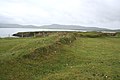
English: Dún an Óir (Fort del Oro or Smerwick Castle) ruins of a promontory fort and rest of the walls of the fortification Smerwick castle (see the Siege of Smerwick) on a rock spur in the Ard na Caithne, in the Gaeltacht (Irish-speaking) region of the Dingle Peninsula (County Kerry), Ireland.
Deutsch: Dún an Óir (auch: Fort del Oro oder Smerwick Castle) Reste einer eisenzeitlichen Befestigungsanlage (promontory fort) mit Fortifikationsresten der spätmittelalterlichen Smerwick Festung aus der zweiten Desmond Rebellion und dem Smerwick Massaker von 1580 an etwa 600 spanischen Söldnern und irischen Aufständischen im westlichen Teil der Smerwick-Bucht auf der Dingle-Halbinsel (Corca Dhuibhne) in der Gälischen Region (Irisch sprechend) des County Kerry in Irland.
Promontory Fort in Co. Kerry  | |||||
| Upload media | |||||
| Instance of |
| ||||
|---|---|---|---|---|---|
| Part of |
| ||||
| Location | County Kerry, Munster, Ireland | ||||
| Heritage designation |
| ||||
 | |||||
Media in category "Dún an Óir"
The following 36 files are in this category, out of 36 total.
-
 Dún an Óir0.JPG 1,280 × 1,920; 1.4 MB
-
 Dún an Óir1.JPG 1,280 × 1,920; 1.17 MB
-
 Dún an Óir10.JPG 1,280 × 1,920; 1.18 MB
-
 Dún an Óir11.JPG 1,280 × 1,920; 1.2 MB
-
 Dún an Óir12.JPG 1,280 × 1,920; 2.11 MB
-
 Dún an Óir2.JPG 1,920 × 1,280; 1.17 MB
-
 Dún an Óir3.JPG 1,920 × 1,280; 1.31 MB
-
 Dún an Óir4.JPG 1,920 × 1,280; 1.09 MB
-
 Dún an Óir5.JPG 1,920 × 1,280; 1.33 MB
-
 Dún an Óir6.JPG 1,920 × 1,280; 1.4 MB
-
 Dún an Óir7.JPG 1,920 × 1,280; 1.61 MB
-
 Dún an Óir8.JPG 1,920 × 1,280; 1.71 MB
-
 Dún an Óir81.JPG 1,280 × 1,920; 1.49 MB
-
 Dún an Óir9.JPG 1,920 × 1,280; 863 KB
-
 Dúnan Óir1.JPG 1,920 × 1,280; 1.03 MB
-
 Dúnan Óir2.JPG 1,920 × 1,280; 1.14 MB
-
 DúnanÓir1.JPG 1,920 × 1,280; 1.43 MB
-
 DúnanÓir10.JPG 1,920 × 1,280; 1.05 MB
-
 DúnanÓir2.JPG 1,920 × 1,280; 1.12 MB
-
 DúnanÓir3.JPG 1,920 × 1,280; 1.26 MB
-
 DúnanÓir30.JPG 1,920 × 1,280; 1.07 MB
-
 DúnanÓir4.JPG 1,920 × 1,280; 1.24 MB
-
 DúnanÓir5.JPG 1,920 × 1,280; 1.22 MB
-
 Marshland near Dun an Oir - geograph.org.uk - 16996.jpg 640 × 480; 497 KB
-
 Signpost, Ard na Caithne.JPG 1,920 × 1,280; 1.28 MB
-
 The fort at Dun an Oir (Fort del Oro) - geograph.org.uk - 219399.jpg 600 × 450; 57 KB
-
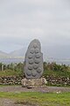
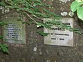 Two memorial stones at Dùn an Oir - geograph.org.uk - 1750761.jpg 640 × 481; 95 KB
-
 Cattle pasture near Dun an Oir - geograph.org.uk - 459606.jpg 640 × 398; 99 KB
-
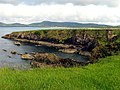 Cliff and cove at Dun an Oir - geograph.org.uk - 16969.jpg 640 × 480; 449 KB
-
 Cliffs near Dun an Oir - geograph.org.uk - 459705.jpg 640 × 427; 156 KB
-
 Cove at Dun an Oir - geograph.org.uk - 17017.jpg 640 × 480; 430 KB
-
 Dun an Oir - geograph.org.uk - 17015.jpg 640 × 480; 444 KB
-
 Earthworks at Dun an Oir - geograph.org.uk - 459736.jpg 640 × 427; 125 KB
-
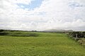
 Farming Country at Dun an Oir - geograph.org.uk - 17016.jpg 640 × 480; 458 KB
-
 Rock strata at Dun an Oir - geograph.org.uk - 219400.jpg 600 × 450; 88 KB
-
 Sheep Pasture near Dun an Oir - geograph.org.uk - 16997.jpg 640 × 480; 415 KB


_-_geograph.org.uk_-_219399.jpg)


