Category:Dallowgill
Jump to navigation
Jump to search
village in United Kingdom  | |||||
| Upload media | |||||
| Instance of | |||||
|---|---|---|---|---|---|
| Location | Laverton, Harrogate, North Yorkshire, Yorkshire and the Humber, England | ||||
 | |||||
Media in category "Dallowgill"
The following 30 files are in this category, out of 30 total.
-
 Abandoned Farm Buildings, Dallowgill - geograph.org.uk - 88264.jpg 640 × 480; 108 KB
-
 Approach to Greygarth Monument - geograph.org.uk - 87997.jpg 640 × 480; 89 KB
-
 Approaching Bents House - geograph.org.uk - 88005.jpg 640 × 480; 65 KB
-
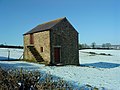 Barn on Hogerston Hill - geograph.org.uk - 1717148.jpg 2,048 × 1,536; 1.07 MB
-
 Boundary Stone, Dallowgill Moor - geograph.org.uk - 287691.jpg 640 × 480; 77 KB
-
 Bridleway to Dallowgill - geograph.org.uk - 266180.jpg 640 × 480; 89 KB
-
 Access Track, Dallowgill Moor - geograph.org.uk - 287696.jpg 640 × 480; 57 KB
-
 Dallowgill oakwoods - geograph.org.uk - 634806.jpg 480 × 640; 144 KB
-
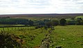
 Farm on edge of Dallowgill Moor - geograph.org.uk - 88017.jpg 640 × 480; 79 KB
-
 Footbridge in the woods - geograph.org.uk - 634798.jpg 480 × 640; 105 KB
-
 Footbridge near Dallow - geograph.org.uk - 635510.jpg 640 × 480; 118 KB
-
 Footpath to Potter Lane Farm - geograph.org.uk - 1523289.jpg 640 × 372; 53 KB
-
 Ford through Stock Beck - geograph.org.uk - 669275.jpg 480 × 640; 154 KB
-

-
 Greygarth Monument - geograph.org.uk - 87990.jpg 640 × 480; 88 KB
-
 Hambleton Hill from the South - geograph.org.uk - 243461.jpg 640 × 480; 70 KB
-
 Highland Cattle pose - geograph.org.uk - 669242.jpg 640 × 239; 31 KB
-
 Kettlestang Shooting House - geograph.org.uk - 286612.jpg 640 × 480; 64 KB
-
 Moorland at Coal Hill - geograph.org.uk - 1580132.jpg 640 × 376; 48 KB
-
 North Gill Beck, Dallowgill - geograph.org.uk - 2441350.jpg 2,304 × 3,456; 4.11 MB
-
 Pond at Greygarth - geograph.org.uk - 669231.jpg 640 × 571; 126 KB
-
 Road at Madge Hill Farm - geograph.org.uk - 88011.jpg 640 × 480; 82 KB
-
 Rocks and Sheep - geograph.org.uk - 669251.jpg 640 × 480; 95 KB
-
 Rudimentary Shelter, Dallowgill Moor - geograph.org.uk - 286619.jpg 640 × 480; 67 KB
-
 Saint Peter's Church - geograph.org.uk - 271383.jpg 640 × 480; 115 KB
-
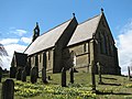 Saint Peter's Church, Dallowgill. - geograph.org.uk - 154462.jpg 640 × 480; 134 KB
-
 South Gill Beck - geograph.org.uk - 287702.jpg 640 × 480; 94 KB
-
 Stope Bridge over North Gill Beck - geograph.org.uk - 245425.jpg 640 × 480; 80 KB
-
 Stream and Woods in Woods near Dallow - geograph.org.uk - 506340.jpg 640 × 480; 175 KB
-
 Woods in Dallowgill - geograph.org.uk - 88267.jpg 640 × 480; 134 KB


