Category:De Bonte Hen
Jump to navigation
Jump to search
| Object location | | View all coordinates using: OpenStreetMap |
|---|
windmill in Zaandam, Netherlands  | |||||
| Upload media | |||||
| Instance of | |||||
|---|---|---|---|---|---|
| Location | Zaandijk, Zaanstad, North Holland, Netherlands | ||||
| Street address |
| ||||
| Has use | |||||
| Heritage designation |
| ||||
| Inception |
| ||||
| Source of energy | |||||
 | |||||
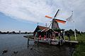
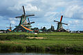
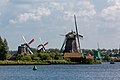
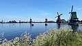
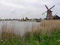
English: De Bonte Hen is the name of an oil mill, located in the Zaanse Schans, in the municipality of Zaanstad. De Bonte Hen is the northernmost of the mill Schans.
Nederlands: De Bonte Hen is een oliemolen aan de Zaanse Schans in de gemeente Zaanstad. De Bonte Hen is de noordelijkste molen aan de Schans.
|
This is a category about rijksmonument number 506221
|
| Address |
|
Media in category "De Bonte Hen"
The following 102 files are in this category, out of 102 total.
-
 1-Vollendam (11) 21557163449 o.jpg 1,000 × 663; 138 KB
-
 1509 Zaanse Schans, Netherlands - panoramio (58).jpg 4,896 × 3,264; 1.82 MB
-
 De Bonte Hen 1.JPG 3,648 × 2,736; 1.97 MB
-
 De Bonte Hen Windmill 2018.jpg 2,937 × 1,958; 2.19 MB
-
 De Bonte Hen.JPG 1,024 × 768; 203 KB
-
 Detail exterieur molen - Zaandam - 20219011 - RCE.jpg 1,200 × 1,200; 418 KB
-
 Edam to Haarlem 4-22 (17398893879).jpg 5,472 × 3,648; 3.78 MB
-
 Exterieur - Zaandam - 20219013 - RCE.jpg 1,197 × 1,200; 447 KB
-
 Exterieur gedeelte met schuren - Zaandam - 20219012 - RCE.jpg 1,188 × 1,200; 441 KB
-
 Fundering molen - Zaandam - 20219014 - RCE.jpg 1,200 × 1,195; 395 KB
-

-
 Interieur - Zaandam - 20219015 - RCE.jpg 1,190 × 1,200; 353 KB
-
 Interieur - Zaandam - 20219016 - RCE.jpg 1,195 × 1,200; 362 KB
-
 Interieur - Zaandam - 20219017 - RCE.jpg 1,190 × 1,200; 324 KB
-
 Interieur - Zaandam - 20219018 - RCE.jpg 1,190 × 1,200; 313 KB
-
 Interieur - Zaandam - 20219019 - RCE.jpg 1,200 × 1,195; 307 KB
-
 Interieur - Zaandam - 20219020 - RCE.jpg 1,197 × 1,200; 285 KB
-
 Kogerveld, Zaandam - panoramio.jpg 3,100 × 2,150; 5.92 MB
-
 Lumber Mill (14572260238).jpg 5,658 × 3,776; 9.78 MB
-
 Molen de bonte hen vanaf molen de huisman.jpg 3,072 × 2,048; 1.85 MB
-
 Molen de bonte hen vanaf molen het jonge schaap.jpg 3,072 × 2,048; 1.36 MB
-
 Molen de bonte hen vanuit het oosten.jpg 1,952 × 2,608; 2.31 MB
-
 Molen Het Jonge Schaap en De Zoeker.jpg 3,214 × 2,387; 1.04 MB
-
 Molen in herstel - Zaandam - 20219021 - RCE.jpg 1,200 × 1,177; 250 KB
-
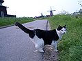
 NL-zaanse-schans-de-kat.jpg 4,928 × 3,264; 4.15 MB
-
 Oliemolen, exterieur - Zaandam - 20219008 - RCE.jpg 1,200 × 1,197; 380 KB
-
 Oliemolen, exterieur - Zaandam - 20219009 - RCE.jpg 1,197 × 1,200; 493 KB
-
 Oliemolen, exterieur - Zaandam - 20219010 - RCE.jpg 1,195 × 1,200; 477 KB
-
 Overbrengingen in molen de bonte hen 1.jpg 5,184 × 3,456; 4.82 MB
-
 Overzicht van de molen - Zaandam - 20420994 - RCE.jpg 800 × 1,200; 205 KB
-
 Overzicht van de molen - Zaandam - 20420999 - RCE.jpg 800 × 1,200; 186 KB
-
 Overzicht van de molen - Zaandam - 20421000 - RCE.jpg 800 × 1,200; 152 KB
-
 Overzicht vanuit Zaanse schans - Zaandam - 20219022 - RCE.jpg 1,200 × 1,165; 248 KB
-
 Potroede nummer 963 in molen De Bonte Hen.tif 3,456 × 5,184; 51.29 MB
-
 Potroede nummer 964 in molen De Bonte Hen.tif 3,456 × 5,184; 51.29 MB
-
 Schelrad in molen De Bonte Hen.tif 5,184 × 3,456; 51.29 MB
-
 Twee oliemolens aan de Zaanse Schans - AMR Molenfoto - 20539382 - RCE.jpg 1,200 × 900; 115 KB
-
 Verfmolen "De Kat", overzicht - Zaandam - 20219133 - RCE.jpg 1,200 × 1,186; 178 KB
-
 Windmill at the Zaanse Schans (Zaandijk, Netherlands 2016) (27919171133).jpg 3,264 × 2,448; 1.86 MB
-
 Windmill-netherlands.jpg 1,733 × 1,300; 131 KB
-
 Windmills (14753999995).jpg 5,519 × 3,701; 6.54 MB
-
 Windmills at the Zaanse Schans (Zaandijk, Netherlands 2016) (28534881675).jpg 3,264 × 2,448; 1.89 MB
-
 Windmills in Zaanstad, Netherlands, Jul 6 2018.jpg 3,264 × 2,448; 1.96 MB
-
 Windmolens aan de Zaanse Schans - AMR Molenfoto - 20539381 - RCE.jpg 1,200 × 900; 150 KB
-
 WLM - Lumperjack - Windmill "De Bonte Hen", Zaanse Schans.jpg 721 × 1,024; 432 KB
-
 Zaandijk - Zaanse Schans - Kalverringdijk - ICE Photocompilation Viewing from WSW to NNE.jpg 7,236 × 2,112; 14.71 MB
-

-
 Zaandijk - Zaanse Schans - Kalverringdijk - View NNW on 'De Os' 1693.jpg 3,024 × 2,016; 2.43 MB
-

-

-

-

-

-

-

-

-

-

-

-

-

-
 Zaandijk - Zaanse Schans - Kalverringdijk - View SW on Oil Mill 'De Bonte Hen' 1693 I.jpg 3,024 × 2,016; 1.99 MB
-
 Zaandijk - Zaanse Schans - Kalverringdijk - View SW on Oil Mill 'De Bonte Hen' 1693 II.jpg 3,024 × 2,016; 2.23 MB
-
 Zaandijk - Zaanse Schans - Kalverringdijk - View SW on Oil Mill 'De Bonte Hen' 1693 III.jpg 3,024 × 2,016; 2.79 MB
-
 Zaandijk - Zaanse Schans - Kalverringdijk - View WNW II.jpg 800 × 1,200; 171 KB
-
 Zaandijk - Zaanse Schans - Kalverringdijk - View WNW on Oil Mill 'De Bonte Hen' 1693.jpg 3,024 × 2,016; 2.15 MB
-

-

-
 Zaanse Schans (5525279578).jpg 1,400 × 477; 222 KB
-
 Zaanse Schans - Kalverringdijk 7.jpg 10,240 × 2,597; 6.29 MB
-
 Zaanse Schans - Kalverringdijk 9.jpg 9,728 × 2,344; 6.1 MB
-
 Zaanse Schans - Windmill Interior 2.jpg 4,000 × 3,000; 4.5 MB
-
 Zaanse Schans - Windmills 1.jpg 2,268 × 1,257; 456 KB
-
 Zaanse Schans 11 - De Bonte Hen.jpg 1,704 × 2,272; 1.42 MB
-
 Zaanse Schans 2017 7.jpg 5,472 × 3,648; 10.71 MB
-
 Zaanse Schans green (Holland).jpg 600 × 450; 72 KB
-
 Zaanse Schans LCD Alt2.jpg 4,923 × 2,447; 2.5 MB
-
 Zaanse Schans LCD.jpg 5,616 × 3,744; 5.25 MB
-
 Zaanse Schans mills spring.jpg 2,048 × 1,380; 3.54 MB
-
 Zaanse Schans molen De Bonte Hen.jpg 2,100 × 1,400; 1.43 MB
-
 Zaanse Schans Summer 2015 (130687065).jpeg 1,600 × 1,067; 369 KB
-
 Zaanse Schans Windmills 2.JPG 5,184 × 3,456; 4.05 MB
-
 Zaanse Schans windmills.jpg 4,032 × 3,024; 2.91 MB
-
 Zaanse Schans, October 2014 03.JPG 4,000 × 3,000; 5.19 MB
-
 Zaanse Schans, October 2014 06.JPG 4,000 × 3,000; 5.22 MB
-
 Zaanse Schans, October 2014 13.JPG 4,000 × 3,000; 6.12 MB
-
 Zaanse Schans, October 2014 19.JPG 4,000 × 3,000; 6.69 MB
-
 Zaanse Schans, the Netherlands. Windmills and canals.jpg 1,600 × 1,200; 284 KB
-

-
 Zaanse Schans, Windmühlen -- 2015 -- 7270.jpg 5,397 × 2,267; 6.41 MB
-
 Zaanse Schans, Windmühlen -- 2015 -- 7271.jpg 5,472 × 3,648; 9.56 MB
-
 Zaanse-Schans-2020.jpg 4,000 × 2,250; 2.71 MB
-
 Zaanse-Schans-cat-and-windmills-0273.jpg 2,560 × 1,920; 1.64 MB
-
 Zaanse-Schans-dike-road-0270.jpg 2,560 × 1,920; 1.55 MB
-
 Zaanse-Schans-windmill-0275.jpg 2,560 × 1,920; 1.56 MB
-
 Zaanse-Schans-windmills-0295.jpg 2,560 × 1,920; 1.58 MB
-
 Zaanseschands - panoramio (1).jpg 2,592 × 1,936; 1.48 MB
-
 Zaanseschands - panoramio.jpg 2,592 × 1,936; 2.33 MB
-
 Zaanseschans, janeiro de 2010 - panoramio - Kell Kell.jpg 756 × 567; 128 KB
-
 ZaanseWindmill.jpg 1,280 × 960; 342 KB
-
 Zaanstad Zaanse Schans 33.jpg 4,488 × 2,718; 3.41 MB
-
 荷蘭古蹟7 Dutch monuments.jpg 2,560 × 1,920; 2.04 MB
_21557163449_o.jpg)
.jpg)


.jpg)


.jpg)


_(27919171133).jpg)

.jpg)
_(28534881675).jpg)


_IMG_9853_2019-06-17_12.05.jpg)


.jpg)


.jpeg)


_met_op_de_achteregrond_houtzaagmolen_Het_Jonge_Schaap,_voormalige_oliemolen_De_Os_en_oliemolen_De_Bonte_Hen_(RM506221)_IMG_9857_2019-06-17_12.22.jpg)


.jpg)


.jpg)