Category:De Maasduinen
Jump to navigation
Jump to search
| Object location | | View all coordinates using: OpenStreetMap |
|---|
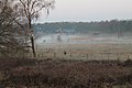
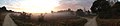
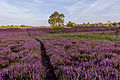
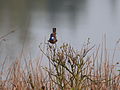
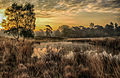
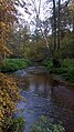
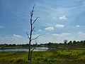
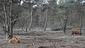
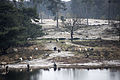
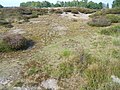
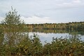
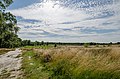
Nederlands: Afbeeldingen van het nationaal park De Maasduinen in de provincie Limburg in het zuiden van Nederland. Het wordt beheerd door Staatsbosbeheer en het Limburgs Landschap. De Maasduinen is gelegen nabij Bergen, Venray, Arcen en Venlo. Niet ver van Duitsland. Sinds mei 2012 ligt in het sluizencomplex in Well, tussen het Reindersmeer en het Leukermeer het Bezoekerscentrum De Maasduinen met de Bosbrasserie In de Sluis, Bosserheide 3e, 5855 AE Well
protected area in Kingdom of the Netherlands  | |||||
| Upload media | |||||
| Instance of |
| ||||
|---|---|---|---|---|---|
| Location | Limburg, Netherlands | ||||
| IUCN protected areas category | |||||
| Inception |
| ||||
| Area |
| ||||
| official website | |||||
 | |||||
Subcategories
This category has the following 6 subcategories, out of 6 total.
Media in category "De Maasduinen"
The following 55 files are in this category, out of 55 total.
-
 5854 Bergen, Netherlands - panoramio (1).jpg 4,272 × 2,848; 3.37 MB
-
 5854 Bergen, Netherlands - panoramio (10).jpg 4,272 × 2,848; 2.87 MB
-
 5854 Bergen, Netherlands - panoramio (11).jpg 4,272 × 2,848; 1.95 MB
-
 5854 Bergen, Netherlands - panoramio (12).jpg 4,272 × 2,848; 1.55 MB
-
 5854 Bergen, Netherlands - panoramio (13).jpg 4,272 × 2,848; 1.36 MB
-
 5854 Bergen, Netherlands - panoramio (14).jpg 4,272 × 2,848; 2.78 MB
-
 5854 Bergen, Netherlands - panoramio (3).jpg 2,592 × 1,944; 2.07 MB
-
 5854 Bergen, Netherlands - panoramio (4).jpg 2,592 × 1,944; 1.88 MB
-
 5854 Bergen, Netherlands - panoramio (5).jpg 10,800 × 2,332; 6.92 MB
-
 5854 Bergen, Netherlands - panoramio (6).jpg 10,800 × 2,354; 6.45 MB
-
 5854 Bergen, Netherlands - panoramio (7).jpg 10,800 × 2,332; 7.23 MB
-
 5854 Bergen, Netherlands - panoramio (9).jpg 4,272 × 2,848; 1.26 MB
-
 Bij het Eendemeer Bergen Lb.jpg 5,184 × 3,456; 2.91 MB
-
 Blauwborst bekje open staart omhoog.jpg 2,341 × 1,756; 1.39 MB
-
 Blauwborst.jpg 2,053 × 1,540; 1.13 MB
-
 Bord Uitkijktoren Afferden.JPG 4,320 × 3,240; 5.82 MB
-
 De Es in Afferden Lb.jpg 5,184 × 3,456; 5.12 MB
-
 De Maasduinen - panoramio (1).jpg 1,568 × 1,168; 935 KB
-
 De Maasduinen - panoramio (2).jpg 1,568 × 1,168; 901 KB
-
 De Maasduinen - panoramio (4).jpg 2,592 × 1,944; 2.47 MB
-
 De Maasduinen - panoramio (5).jpg 2,592 × 1,944; 2 MB
-
 De Maasduinen - panoramio.jpg 960 × 720; 356 KB
-
De Maasduinen 113001.webm 36 s, 3,840 × 2,160; 35.46 MB
-
 Duvelskuul Afferden Lb.jpg 5,184 × 3,456; 1.43 MB
-
 Duvelskuul.jpg 4,549 × 2,945; 3.31 MB
-
 Eendenmeer Bergen LB.jpg 5,184 × 3,232; 2.27 MB
-
Entrance de Maasduinen 103642.webm 38 s, 1,920 × 1,080; 10.58 MB
-
 Herfstfoto van Geldersch Nierskanaal.jpg 1,728 × 3,072; 2.52 MB
-
 Het Quin, Maasduinen.JPG 3,104 × 787; 636 KB
-
 Het Quin.JPG 4,000 × 3,000; 2.66 MB
-
 Maasduinen - het Quin bij Afferden.jpg 3,264 × 1,836; 1.11 MB
-
 Maasduinen 1.jpg 6,016 × 4,016; 18.72 MB
-
 Maasduinen.jpg 3,648 × 2,736; 3.06 MB
-
 Mistige zonsopkomst gezien vanaf de uitzichttoren Afferden Lb.jpg 4,992 × 2,474; 935 KB
-
Monument der Gevallenen Maasduinen 0038.webm 24 s, 3,840 × 2,160; 10.95 MB
-
 Nationaal Park De Maasduinen (29).JPG 4,320 × 3,240; 3.12 MB
-
 Nationaal Park De Maasduinen 1.jpg 5,472 × 3,648; 11.86 MB
-
 Nationaal Park De Maasduinen 2.jpg 5,472 × 3,648; 13.07 MB
-
 Nationaal Park De Maasduinen 3.jpg 5,472 × 3,648; 3.52 MB
-
 Nationaal Park De Maasduinen.jpg 5,472 × 3,648; 3.23 MB
-
 Nationalpark-Maasduinen-2012.jpg 4,819 × 3,191; 11.67 MB
-
 Op de uitkijk.JPG 4,608 × 2,592; 4.89 MB
-
 Open vlakte Maasduinen.JPG 4,000 × 3,000; 3.35 MB
-
River Maas 0036.webm 21 s, 3,840 × 2,160; 12.07 MB
-
River Maas 112527.webm 33 s, 3,840 × 2,160; 14.27 MB
-
 Sluis Maasduinen 2.jpg 5,472 × 3,648; 3.04 MB
-
 Sluis Maasduinen.jpg 3,648 × 5,472; 2.12 MB
-
 Stuifzandrug.JPG 4,000 × 3,000; 3.11 MB
-
 Tussen Wellerlooi en Twisteden, meer in Maasduinen 2009-08-16 18.30.JPG 2,592 × 1,944; 751 KB
-
 Wanderung 01 April 2017 Duesseldorf (V-1008-2017).jpg 2,222 × 1,667; 2.22 MB
-
 Wanderung 01 April 2017 Duesseldorf (V-1009-2017).jpg 2,222 × 1,667; 2.41 MB
-
 Wanderung 01 April 2017 Duesseldorf (V-1010-2017).jpg 2,000 × 1,500; 1.53 MB
-
 Wanderung 01 April 2017 Duesseldorf (V-1011-2017).jpg 2,222 × 1,667; 1.11 MB
-
 Wooden bird sculpture by Roel van Wijlick in De Maasduinen National Park, NL (DSCF7763).jpg 4,571 × 3,253; 14.53 MB
-
 Zonsopkomst.jpg 4,935 × 3,002; 3.44 MB
.jpg)
.jpg)
.jpg)
.jpg)
.jpg)
.jpg)
.jpg)
.jpg)
.jpg)


.jpg)
.jpg)
.jpg)
.jpg)


.JPG)


.jpg)
.jpg)
.jpg)
.jpg)
.jpg)

.jpg)
.jpg)
.jpg)