Category:De Matanze
Jump to navigation
Jump to search
| Object location | | View all coordinates using: OpenStreetMap |
|---|
| Upload media | |||||
| Instance of | |||||
|---|---|---|---|---|---|
| Part of | |||||
| Location | Terwolde, Voorst, Gelderland, Netherlands | ||||
| Street address |
| ||||
| Heritage designation |
| ||||
 | |||||
|
This is a category about rijksmonumentcomplex number 511826
|
Landhuis:
|
This is a category about rijksmonument number 511825
|
Historische tuin- en parkaanleg:
|
This is a category about rijksmonument number 511827
|
Koetshuis met dienstwoning:
|
This is a category about rijksmonument number 511828
|
Prieeltje:
|
This is a category about rijksmonument number 511829
|
Jachtopzienerswoning:
|
This is a category about rijksmonument number 511830
|
Boerderij:
|
This is a category about rijksmonument number 511831
|
Moestuinmuur, twee kassen en tweede koude bakken:
|
This is a category about rijksmonument number 511832
|
| Address |
|
Subcategories
This category has the following 3 subcategories, out of 3 total.
K
- Kassen, de Matanze (13 F)
- Koetshuis, de Matanze (5 F)
W
- Wintertuin De Matanze (7 F)
Media in category "De Matanze"
The following 73 files are in this category, out of 73 total.
-
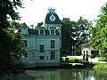 De Matanze Terwolde 2012-08-12.jpg 1,600 × 1,200; 441 KB
-
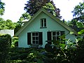 Deventerweg 8 Terwolde.jpg 1,600 × 1,200; 453 KB
-
 Exterieur OVERZICHT - Terwolde - 20288414 - RCE.jpg 1,200 × 1,195; 290 KB
-
 Exterieur OVERZICHT - Terwolde - 20288415 - RCE.jpg 1,200 × 1,195; 391 KB
-
 Exterieur OVERZICHT, ACHTERGEVEL - Terwolde - 20288420 - RCE.jpg 1,200 × 1,195; 351 KB
-
 Exterieur OVERZICHT, LINKER ZIJGEVEL - Terwolde - 20288418 - RCE.jpg 1,200 × 1,200; 353 KB
-
 Exterieur OVERZICHT, LINKER ZIJGEVEL - Terwolde - 20288419 - RCE.jpg 1,195 × 1,200; 289 KB
-
 Exterieur OVERZICHT, VOORGEVEL - Terwolde - 20288416 - RCE.jpg 1,200 × 1,195; 346 KB
-
 Exterieur VOORGEVEL, GEDEELTE - Terwolde - 20288417 - RCE.jpg 1,197 × 1,200; 211 KB
-

-

-

-
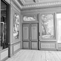 INTERIEUR, EERSTE VERDIEPING, DEURBESCHILDERING - Terwolde - 20288443 - RCE.jpg 1,200 × 1,197; 280 KB
-
 INTERIEUR, EERSTE VERDIEPING, KAMER - Terwolde - 20288439 - RCE.jpg 1,200 × 1,200; 313 KB
-
 INTERIEUR, EERSTE VERDIEPING, KAMER - Terwolde - 20288440 - RCE.jpg 1,190 × 1,200; 276 KB
-

-

-

-

-

-

-

-

-
-

-

-

-

-

-

-

-

-

-

-
 INTERIEUR, EERSTE VERDIEPING, KAMER, DEURBESCHILDERING - Terwolde - 20288442 - RCE.jpg 1,188 × 1,200; 308 KB
-

-

-

-

-

-

-
 INTERIEUR, EERSTE VERDIEPING, KAMER, SCHOUW - Terwolde - 20288444 - RCE.jpg 1,197 × 1,200; 263 KB
-
 INTERIEUR, EERSTE VERDIEPING, KAMER, SCHOUW - Terwolde - 20288445 - RCE.jpg 1,195 × 1,200; 252 KB
-

-

-
-
 INTERIEUR, EERSTE VERDIEPING, KAMER. SCHOUW - Terwolde - 20265169 - RCE.jpg 775 × 1,200; 160 KB
-

-
 INTERIEUR, EERSTE VERDIEPING, OVERZICHT KAMER - Terwolde - 20265151 - RCE.jpg 1,200 × 775; 134 KB
-
 INTERIEUR, EERSTE VERDIEPING, OVERZICHT KAMER - Terwolde - 20288425 - RCE.jpg 1,200 × 1,185; 288 KB
-
 INTERIEUR, EERSTE VERDIEPING, OVERZICHT KAMER - Terwolde - 20288426 - RCE.jpg 1,195 × 1,200; 265 KB
-
 INTERIEUR, EERSTE VERDIEPING, OVERZICHT KAMER - Terwolde - 20288427 - RCE.jpg 1,195 × 1,200; 266 KB
-
 INTERIEUR, EERSTE VERDIEPING, OVERZICHT KAMER - Terwolde - 20288428 - RCE.jpg 1,200 × 1,197; 250 KB
-
 INTERIEUR, EERSTE VERDIEPING, OVERZICHT KAMER - Terwolde - 20288429 - RCE.jpg 1,200 × 1,192; 265 KB
-
 INTERIEUR, EERSTE VERDIEPING, OVERZICHT KAMER - Terwolde - 20288430 - RCE.jpg 1,195 × 1,200; 264 KB
-

-

-
 INTERIEUR, EERSTE VERDIEPING, PLAFONDSCHILDERING - Terwolde - 20288431 - RCE.jpg 1,200 × 1,197; 309 KB
-
 INTERIEUR, EERSTE VERDIEPING, PLAFONDSCHILDERING - Terwolde - 20288432 - RCE.jpg 1,200 × 1,200; 306 KB
-
 INTERIEUR, EERSTE VERDIEPING, PLAFONDSCHILDERING - Terwolde - 20288433 - RCE.jpg 1,200 × 1,197; 310 KB
-
 INTERIEUR, EERSTE VERDIEPING, PLAFONDSCHILDERING - Terwolde - 20288434 - RCE.jpg 1,197 × 1,200; 294 KB
-
 INTERIEUR, EERSTE VERDIEPING, PLAFONDSCHILDERING - Terwolde - 20288435 - RCE.jpg 1,200 × 1,200; 232 KB
-
 INTERIEUR, EERSTE VERDIEPING, PLAFONDSCHILDERING - Terwolde - 20288436 - RCE.jpg 1,185 × 1,200; 335 KB
-
 INTERIEUR, EERSTE VERDIEPING, PLAFONDSCHILDERING, DETAIL - Terwolde - 20288437 - RCE.jpg 1,200 × 1,195; 262 KB
-
 INTERIEUR, EERSTE VERDIEPING, WANDBESCHILDERING - Terwolde - 20288438 - RCE.jpg 1,200 × 1,200; 314 KB
-
 INTERIEUR, GLAS IN LOODRAAM - Terwolde - 20265177 - RCE.jpg 775 × 1,200; 72 KB
-
 Old Manor near Deventer in the wintersunshine - panoramio.jpg 4,288 × 2,848; 5.91 MB
-
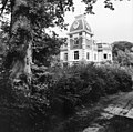
 Overzicht hoofdgebouw - Terwolde - 20331820 - RCE.jpg 1,191 × 1,200; 364 KB
-
 Overzicht hoofdgebouw - Terwolde - 20331838 - RCE.jpg 1,186 × 1,200; 304 KB
-
 Overzicht hoofdgebouw, achteruitgang via brug - Terwolde - 20331839 - RCE.jpg 1,191 × 1,200; 404 KB
-
 Overzicht hoofdgebouw, links hoofdentree via brug - Terwolde - 20331837 - RCE.jpg 1,189 × 1,200; 309 KB
-
 Overzicht prieel aan tuinzijde - Terwolde - 20331849 - RCE.jpg 1,187 × 1,200; 465 KB
-
 Overzicht prieel aan tuinzijde - Terwolde - 20331850 - RCE.jpg 1,185 × 1,200; 469 KB


_VAN_BESCHILDERD_PLAFOND_-_Terwolde_-_20265185_-_RCE.jpg)


_-_Terwolde_-_20265153_-_RCE.jpg)


