Category:De Olle Kerk
Jump to navigation
Jump to search
| Object location | | View all coordinates using: OpenStreetMap |
|---|
church building in Groningen, Netherlands  | |||||
| Upload media | |||||
| Instance of | |||||
|---|---|---|---|---|---|
| Location | Hoogkerk, Groningen, Netherlands | ||||
| Street address |
| ||||
| Located on street |
| ||||
| Heritage designation |
| ||||
| Inception |
| ||||
| Significant event |
| ||||
 | |||||
Nederlands: De kerk van Hoogkerk (rm 18750), gemeente Groningen
|
This is a category about rijksmonument number 18750
|
| Address |
|
Media in category "De Olle Kerk"
The following 78 files are in this category, out of 78 total.
-
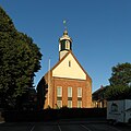 20130801 Hervormde kerk Hoogkerk Groningen NL.jpg 3,600 × 3,600; 3.22 MB
-
 Aanzet kolonnet deuromlijsting noord-zijde - Hoogkerk - 20115206 - RCE.jpg 1,200 × 788; 230 KB
-
 Aanzet zuid-oost hoeklesene schip - Hoogkerk - 20115184 - RCE.jpg 788 × 1,200; 262 KB
-

-
 Bekapping schip zuid zijde - Hoogkerk - 20115192 - RCE.jpg 1,200 × 788; 228 KB
-
 Console boven zuidelijke zijaltaar - Hoogkerk - 20115180 - RCE.jpg 1,200 × 788; 215 KB
-
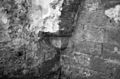
 Detail van muur met restant van schildering - Hoogkerk - 20381532 - RCE.jpg 1,200 × 1,196; 364 KB
-
 Detail van muur met restant van schildering - Hoogkerk - 20381533 - RCE.jpg 1,200 × 1,194; 340 KB
-
 Deur in koor zuid-zijde - Hoogkerk - 20115205 - RCE.jpg 1,200 × 788; 175 KB
-
 Deur in koor zuidzijde - Hoogkerk - 20403409 - RCE.jpg 1,200 × 792; 189 KB
-
 Documentatieblad RDMZ 12-01 Hervormde Kerk - Hoogkerk - 20356963 - RCE.jpg 848 × 1,200; 152 KB
-
 Exterieur naar het noord-westen - Hoogkerk - 20115160 - RCE.jpg 950 × 1,200; 280 KB
-

-
 Fragmenten inwijdingssteen - Hoogkerk - 20115187 - RCE.jpg 1,200 × 788; 226 KB
-

-
 Fundering zuid zijaltaar - Hoogkerk - 20115179 - RCE.jpg 1,200 × 788; 233 KB
-
 Grafzerken - Hoogkerk - 20115167 - RCE.jpg 835 × 1,200; 227 KB
-
 Hoek koor schip zuid-zijde - Hoogkerk - 20115202 - RCE.jpg 1,200 × 788; 231 KB
-

-
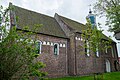
 Hoogkerk - kerk - 01.jpg 3,790 × 5,306; 7.91 MB
-
 Hoogkerk - kerk - interieur (1).jpg 6,000 × 4,000; 8.36 MB
-
 Hoogkerk - kerk - interieur (2).jpg 6,000 × 4,000; 9.72 MB
-
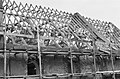
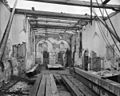
 Hoogkerk - kerk - metalen draagconstructie.jpg 5,000 × 4,000; 9.35 MB
-
 Hoogkerk - kerk - nis met boogversiering.jpg 3,701 × 4,626; 5.61 MB
-
 Hoogkerk - kerk - nis.jpg 3,647 × 3,647; 6.26 MB
-
 Hoogkerk - kerk - noordingang.jpg 2,810 × 3,512; 6.02 MB
-
 Hoogkerk - kerk - noordoosten.jpg 4,896 × 3,264; 12.01 MB
-
 Hoogkerk - kerk - preekstoel.jpg 4,000 × 6,000; 9.56 MB
-
 Hoogkerk - kerk - rune-tekens.jpg 3,584 × 2,867; 6.78 MB
-
 Hoogkerk - kerk - sacramentsnis.jpg 3,103 × 4,655; 8.31 MB
-
 Hoogkerk - kerk - zoldering en orgel.jpg 4,000 × 6,000; 7.51 MB
-
 Hoogkerk - kerk - zuidzijde.jpg 3,264 × 4,896; 9.82 MB
-
 Ingang noord-zijde - Hoogkerk - 20115183 - RCE.jpg 1,200 × 791; 188 KB
-
 Ingang noord-zijde - Hoogkerk - 20115207 - RCE.jpg 1,200 × 788; 240 KB
-

-
 Ingang noordzijde - Hoogkerk - 20403410 - RCE.jpg 1,200 × 780; 234 KB
-
 Ingang schip zuid zijde kolonnet deuromlijsting - Hoogkerk - 20115181 - RCE.jpg 1,200 × 789; 217 KB
-
 Interieur naar het oosten - Hoogkerk - 20115165 - RCE.jpg 1,200 × 950; 167 KB
-
 Interieur naar het westen - Hoogkerk - 20115164 - RCE.jpg 1,200 × 957; 217 KB
-
 Interieur noord-gevel - Hoogkerk - 20115170 - RCE.jpg 958 × 1,200; 270 KB
-
 Interieur oost-zijde - Hoogkerk - 20115171 - RCE.jpg 960 × 1,200; 275 KB
-
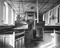
 Interieur tijdens restauratie - Hoogkerk - 20115169 - RCE.jpg 1,200 × 955; 246 KB
-
 Interieur, aanzicht orgel, orgelnummer 714 - Hoogkerk - 20368890 - RCE.jpg 837 × 1,200; 155 KB
-
 Koor inwendig naar het zuid-oosten - Hoogkerk - 20115194 - RCE.jpg 1,200 × 788; 233 KB
-
 Koor naar het oosten - Hoogkerk - 20115204 - RCE.jpg 1,200 × 788; 182 KB
-
 Kraagsteen boogfries zuid-zijde koor - Hoogkerk - 20115185 - RCE.jpg 1,200 × 788; 228 KB
-
 Kraagsteen boogfries zuid-zijde koor - Hoogkerk - 20115211 - RCE.jpg 788 × 1,200; 251 KB
-
 Meest oost deel van de zuid-gevel - Hoogkerk - 20115162 - RCE.jpg 1,200 × 947; 321 KB
-
 N.H.Kerk - Hoogkerk - 20115203 - RCE.jpg 1,200 × 788; 275 KB
-
 Noord ingang inwendig - Hoogkerk - 20115182 - RCE.jpg 788 × 1,200; 195 KB
-
 Noord muur koor en schip - Hoogkerk - 20115199 - RCE.jpg 1,200 × 788; 206 KB
-
 Noord schip muur (losgevroren oppervlak) - Hoogkerk - 20115189 - RCE.jpg 788 × 1,200; 195 KB
-
 Noord-zijde schip - Hoogkerk - 20115197 - RCE.jpg 1,200 × 788; 318 KB
-
 Oost gevel - Hoogkerk - 20115163 - RCE.jpg 946 × 1,200; 299 KB
-

-
 Opgraving - Hoogkerk - 20115172 - RCE.jpg 1,200 × 960; 354 KB
-
 Opgraving - Hoogkerk - 20115173 - RCE.jpg 1,200 × 962; 366 KB
-
 Opgraving - Hoogkerk - 20115174 - RCE.jpg 953 × 1,200; 342 KB
-
 Opgraving - Hoogkerk - 20115175 - RCE.jpg 1,200 × 965; 332 KB
-
 Opgraving west-zijde - Hoogkerk - 20115176 - RCE.jpg 1,200 × 960; 304 KB
-
 Overzicht noord-gevel naar het zuid-westen - Hoogkerk - 20115161 - RCE.jpg 1,200 × 953; 374 KB
-
 Overzicht van trekbalken in constructietorentje - Hoogkerk - 20115168 - RCE.jpg 999 × 1,200; 170 KB
-
 Sacramentshuisje - Hoogkerk - 20115198 - RCE.jpg 780 × 1,200; 197 KB
-
 Schip noord-zijde naar het westen - Hoogkerk - 20115208 - RCE.jpg 1,200 × 790; 223 KB
-

-
 Toren naar het noorden - Hoogkerk - 20115213 - RCE.jpg 788 × 1,200; 202 KB
-
 Toren vanuit het noord-westen - Hoogkerk - 20115215 - RCE.jpg 788 × 1,200; 190 KB
-
 Toren vanuit het noord-westen - Hoogkerk - 20115216 - RCE.jpg 788 × 1,200; 194 KB
-
 Toren vanuit het westen - Hoogkerk - 20115214 - RCE.jpg 791 × 1,200; 193 KB
-

-
 West-gevel met fundering oorspronkelijke toren - Hoogkerk - 20115212 - RCE.jpg 1,200 × 790; 279 KB
-
 Wijdingsteken - Hoogkerk - 20115190 - RCE.jpg 1,200 × 788; 218 KB
-
 Zuid ingang schip - Hoogkerk - 20115201 - RCE.jpg 1,200 × 793; 264 KB
-
 Zuid muur koor - Hoogkerk - 20115186 - RCE.jpg 1,200 × 788; 218 KB
-

-
 Zuid muur schip venstertje boven zijaltaar - Hoogkerk - 20115188 - RCE.jpg 788 × 1,200; 254 KB
-
 Zuid wand koor en schip met fundering zijaltaar - Hoogkerk - 20115178 - RCE.jpg 1,200 × 788; 195 KB
-


penan_van_de_noord_ingang_-_Hoogkerk_-_20115209_-_RCE.jpg)


.jpg)
.jpg)


_-_Hoogkerk_-_20115189_-_RCE.jpg)


