Category:De Ruyterstraat 46, Oudeschild
Jump to navigation
Jump to search
| Object location | | View all coordinates using: OpenStreetMap |
|---|
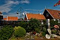
building in Texel, Netherlands  | |||||
| Upload media | |||||
| Instance of | |||||
|---|---|---|---|---|---|
| Location | Oudeschild, Texel, North Holland, Netherlands | ||||
| Street address |
| ||||
| Located on street |
| ||||
| Heritage designation |
| ||||
 | |||||
|
This is a category about rijksmonument number 35167
|
| Address |
|
Media in category "De Ruyterstraat 46, Oudeschild"
The following 6 files are in this category, out of 6 total.
-
 De Ruyterstraat 46, voorgevel - Oudeschild - 20179423 - RCE.jpg 1,200 × 1,183; 275 KB
-
 De Ruyterstraat 46, voorgevel - Oudeschild - 20179424 - RCE.jpg 963 × 1,200; 252 KB
-
 Oudeschild-De Ruyterstraat 46.jpg 1,765 × 2,440; 551 KB
-
 Texel - Oudeschild - De Ruyterstraat - View ENE.jpg 3,024 × 2,016; 5.04 MB
-
 Texel - Oudeschild - De Ruyterstraat - View ESE.jpg 2,951 × 1,967; 4.5 MB
-
 Texel - Oudeschild - De Ruyterstraat - View NNE.jpg 3,020 × 2,013; 4.31 MB


