Category:De Utrecht (Amsterdam)
Jump to navigation
Jump to search
| Object location | | View all coordinates using: OpenStreetMap |
|---|
building in Amsterdam  | |||||
| Upload media | |||||
| Instance of | |||||
|---|---|---|---|---|---|
| Part of | |||||
| Location | Amsterdam, North Holland, Netherlands | ||||
| Street address |
| ||||
| Located on street | |||||
| Architect | |||||
| Heritage designation |
| ||||
| Inception |
| ||||
| Date of official opening |
| ||||
 | |||||
|
This is a category about rijksmonumentcomplex number 518298
|
Verzekeringskantoor (Damrak 28)
|
This is a category about rijksmonument number 518299
|
Magazijn (Damrak 26)
|
This is a category about rijksmonument number 518300
|
| Address |
|
Media in category "De Utrecht (Amsterdam)"
The following 47 files are in this category, out of 47 total.
-
 Amsterdam (4095362704).jpg 2,640 × 1,760; 3.89 MB
-
 Amsterdam (4095363814).jpg 2,599 × 1,732; 3.98 MB
-
 Amsterdam - Damrak - panoramio.jpg 1,546 × 2,113; 508 KB
-

-

-
 Amsterdam - Prins Hendrikkade - Nieuwebrugsteeg - View SW along Damrak.jpg 5,946 × 3,964; 16.62 MB
-
 Amsterdam Zentrum 20091106 001.JPG 2,848 × 4,272; 4 MB
-
 Amsterdam Zentrum 20091106 007.JPG 2,848 × 4,272; 4.32 MB
-
 Beeldhouwwerk Gebouw De Utrecht - Sculpture De Utrecht Building (4750943687).jpg 585 × 1,280; 102 KB
-
 Brulapen en Mandrils Uilen Joseph Mendes da Costa Damrak Amsterdam.jpg 3,455 × 2,049; 2.61 MB
-
 Damrak (3).jpg 4,000 × 3,000; 4.81 MB
-
 Damrak - Amsterdam - 2013 - panoramio (2).jpg 3,072 × 4,608; 5.8 MB
-
 Damrak 1 tm 18 (vrnl) Jacob Olie (max res).jpg 4,961 × 3,763; 5.17 MB
-
 Damrak26.jpg 470 × 740; 71 KB
-
 Damrak28.jpg 470 × 740; 195 KB
-
 De Dingen des Levens 1.jpg 480 × 640; 90 KB
-
 De Dingen des Levens 2.jpg 480 × 640; 93 KB
-
 De Dingen des Levens 3.jpg 480 × 640; 92 KB
-
 De Dingen des Levens 4.jpg 480 × 640; 94 KB
-
 Dierfiguren Joseph Mendes da Costa in trappenhuis Damrak 30 Amsterdam2.JPG 3,264 × 2,448; 1.75 MB
-
 Dierfiguren Joseph Mendes da Costa in trappenhuis Damrak 30 Amsterdam3.JPG 3,264 × 2,448; 2.22 MB
-
 En hoger, overzicht - Amsterdam - 20016402 - RCE.jpg 1,200 × 950; 234 KB
-
 En hoger, overzicht - Amsterdam - 20016404 - RCE.jpg 953 × 1,200; 294 KB
-
-

-

-
 Overzicht - Amsterdam - 20016390 - RCE.jpg 1,200 × 946; 236 KB
-
 Overzicht - Amsterdam - 20016391 - RCE.jpg 1,200 × 953; 234 KB
-
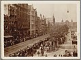
 Panorama Damrak , Amsterdam (ansichtkaart).jpg 995 × 653; 419 KB
-
 Stadsarchief Amsterdam, Afb ANWG00010000001.jpg 4,580 × 3,454; 1.85 MB
-
 Stadsarchief Amsterdam, Afb ANWG00011000001.jpg 4,604 × 3,455; 1.95 MB
-
 Stadsarchief Amsterdam, Afb ANWG00012000001.jpg 4,599 × 3,455; 1.88 MB
-
 Stadsarchief Amsterdam, Afb ANWG00013000001.jpg 4,595 × 3,455; 1.61 MB
-
 Stadsarchief Amsterdam, Afb ANWG00014000001.jpg 3,455 × 4,580; 1.76 MB
-
 Stadsarchief Amsterdam, Afb ANWG00015000001.jpg 4,585 × 3,455; 1.92 MB
-
 Stadsarchief Amsterdam, Afb ANWG00016000001.jpg 4,570 × 3,464; 1.91 MB
-
 Stadsarchief Amsterdam, Afb ANWG00017000001.jpg 4,599 × 3,455; 2.04 MB
-
 Stadsarchief Amsterdam, Afb ANWG00018000001.jpg 4,580 × 3,445; 1.68 MB
-
 Stadsarchief Amsterdam, Afb ANWG00019000001.jpg 3,469 × 4,575; 2.23 MB
-
 Stadsarchief Amsterdam, Afb ANWG00027000001.jpg 4,575 × 3,455; 2 MB
-
 Stadsarchief Amsterdam, Afb OSIM00001000084.jpg 1,427 × 1,052; 193 KB
-

-
 Sunrise , Amsterdam , Netherlands - panoramio (96).jpg 4,272 × 2,848; 7.78 MB
-
 Voorgevel - Amsterdam - 20016405 - RCE.jpg 963 × 1,200; 254 KB
-
 Voorgevels - Amsterdam - 20016403 - RCE.jpg 1,200 × 1,194; 348 KB
-
 Weenenk & Snel, Afb PBKD00312000033.jpg 1,758 × 1,173; 238 KB
-
 Weenenk & Snel, Afb PBKD00312000036.jpg 1,754 × 1,157; 267 KB
.jpg)
.jpg)


.jpg)

.jpg)
.jpg)
_Jacob_Olie_(max_res).jpg)


.jpg)
.jpg)


.jpg)


.jpg)


