Category:De Vrijheid, Beesd
Jump to navigation
Jump to search
| Object location | | View all coordinates using: OpenStreetMap |
|---|
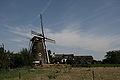
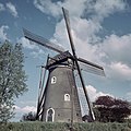
windmill in Beesd, Netherlands  | |||||
| Upload media | |||||
| Instance of |
| ||||
|---|---|---|---|---|---|
| Location |
| ||||
| Street address |
| ||||
| Located on street |
| ||||
| Has use | |||||
| Heritage designation |
| ||||
| Source of energy | |||||
 | |||||
|
This is a category about rijksmonument number 16467
|
| Address |
|
Media in category "De Vrijheid, Beesd"
The following 13 files are in this category, out of 13 total.
-
 Beesd - molen De Vrijheid foto 2.jpg 1,950 × 1,300; 1.45 MB
-
 Beesd - molen De Vrijheid.jpg 1,300 × 1,950; 1.59 MB
-
 Beesd De Vrijheid.jpg 2,624 × 3,671; 3.14 MB
-
 Beesd molen - panoramio.jpg 1,536 × 2,048; 471 KB
-
 Beesd. Bij de Molen "De Vrijheid".jpg 4,592 × 3,044; 4.67 MB
-
 Beesd. Molen "De Vrijheid"..jpg 4,770 × 3,177; 4.85 MB
-
 Bloeiende Betuwe bij Beest, molen, Bestanddeelnr 907-1261.jpg 2,586 × 3,304; 1.75 MB
-

-
 Korenmolen, Molendijk 12, aanzicht - Beesd - 20029828 - RCE.jpg 777 × 1,200; 255 KB
-
 Molen - Beesd - 20029827 - RCE.jpg 866 × 1,200; 219 KB
-
 Molen-de-Vrijheid-Beesd-bloesemtocht-01.jpg 1,234 × 799; 213 KB
-
 Overzicht - Beesel - 20364537 - RCE.jpg 1,199 × 1,200; 294 KB
-
 Windmill in a Dutch meadow landscape at Beesd - panoramio.jpg 4,288 × 2,848; 3.6 MB


