Category:December 2006 in County Londonderry
Jump to navigation
Jump to search
English: Images taken in County Londonderry, Northern Ireland in this month of 2006 (not the date of the upload).
| Jan | Feb | Mar | Apr | May | Jun | Jul | Aug | Sep | Oct | Nov | Dec | ||
| ← | 18 | 1 | 11 | 5 | 30 | 10 | 26 | 62 | 4 | 39 | 4 | 18 | → |
|---|
Media in category "December 2006 in County Londonderry"
The following 18 files are in this category, out of 18 total.
-
 Ballyriff Townland - geograph.org.uk - 300777.jpg 640 × 479; 48 KB
-
 Ballyriff Townland - geograph.org.uk - 300785.jpg 640 × 479; 51 KB
-
 Ballyriff Townland - geograph.org.uk - 300789.jpg 640 × 280; 29 KB
-
 Bin collection, Ballyriff - geograph.org.uk - 300783.jpg 640 × 479; 76 KB
-
 Drumenagh Townland - geograph.org.uk - 300762.jpg 640 × 479; 49 KB
-
 Farm Buildings at Ballyriff - geograph.org.uk - 300776.jpg 640 × 479; 57 KB
-
 Fish pass, River Bann at Portna - geograph.org.uk - 287998.jpg 640 × 426; 131 KB
-
 Floodgates, River Bann at Portna (1) - geograph.org.uk - 288005.jpg 640 × 426; 142 KB
-
 Floodgates, River Bann at Portna (2) - geograph.org.uk - 288012.jpg 640 × 426; 127 KB
-
 Lough Neagh - geograph.org.uk - 300765.jpg 640 × 479; 62 KB
-
 Mulderg Road - geograph.org.uk - 300781.jpg 640 × 479; 67 KB
-
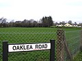 Oaklea Road - geograph.org.uk - 300773.jpg 640 × 479; 63 KB
-
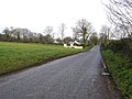 Road at Ballyriff - geograph.org.uk - 300772.jpg 640 × 479; 62 KB
-
 Somerset forest near Coleraine - geograph.org.uk - 287943.jpg 640 × 426; 163 KB
-
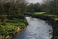 The Agivey River at Cullycapple - geograph.org.uk - 287990.jpg 640 × 426; 159 KB
-
 The Bishop's Road at Burren Beg - geograph.org.uk - 301327.jpg 640 × 426; 143 KB
-
 The bla hole at Portstewart - geograph.org.uk - 290711.jpg 640 × 426; 160 KB
-
 Woods Primary School - geograph.org.uk - 300770.jpg 640 × 261; 24 KB


_-_geograph.org.uk_-_288005.jpg)
_-_geograph.org.uk_-_288012.jpg)


