Category:Deganwy
Vai alla navigazione
Vai alla ricerca
Български: 300px|мини|Панорамен изглед от Дегануи
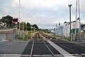
Cymraeg: Tref fechan ym mwrdeistref sirol Conwy yw Degannwy (sillafiad amgen: Deganwy; llurguniad: Deganway). Gorwedd i'r de o Landudno, ac i'r dwyrain o dref Conwy, sydd gyferbyn iddi ar ochr arall Afon Conwy. Mae yno orsaf ar y rheilffordd sy'n rhedeg rhwng Llandudno a Chyffordd Llandudno, tua milltir i'r de.
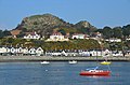
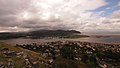
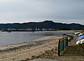
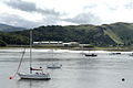
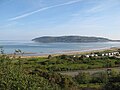
English: Deganwy (Middle Welsh Degannwy, Brythonic *Decantouion) is a small town in Conwy County Borough, Wales. Population 3,700, Welsh speakers 23%. It is south of Llandudno and east of Conwy, which is on the opposite side of the River Conwy, and with which it forms the Conwy community. Deganwy is in the Church in Wales parish of Llanrhos, and has a Victorian era Gothic Revival parish church dedicated to All Saints.
town in Conwy County Borough, Wales  | |||||
| Carica un file multimediale | |||||
| Istanza di | |||||
|---|---|---|---|---|---|
| Luogo | Conwy County Borough, Galles | ||||
 | |||||
Sottocategorie
Questa categoria contiene le 5 sottocategorie indicate di seguito, su un totale di 5.
B
D
- Deganwy Castle (98 F)
- Deganwy railway station (35 F)
M
- Deganwy Marina (23 F)
S
- Station Road, Deganwy (12 F)
File nella categoria "Deganwy"
Questa categoria contiene 200 file, indicati di seguito, su un totale di 343.
(pagina precedente) (pagina successiva)-
 'The end of the world is nigh' - geograph.org.uk - 658086.jpg 640 × 480; 82 KB
-
 'The Great Train Shrubbery'^ - geograph.org.uk - 658066.jpg 640 × 480; 111 KB
-
 A jetty near, but apart from, the marina - geograph.org.uk - 1917201.jpg 4 599 × 3 067; 2,52 MB
-
 A navigation light in Conwy Estuary - geograph.org.uk - 5153553.jpg 1 500 × 986; 200 KB
-
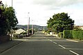
 A546 Deganwy Road looking north - geograph.org.uk - 4385562.jpg 640 × 480; 37 KB
-
 A546 south-east of Deganwy station - geograph.org.uk - 4385543.jpg 640 × 480; 45 KB
-
 A546 Station Road, Deganwy - geograph.org.uk - 6126725.jpg 800 × 600; 93 KB
-
 Above Deganwy - geograph.org.uk - 290143.jpg 640 × 480; 169 KB
-

-
 Albert Drive - geograph.org.uk - 1483393.jpg 640 × 430; 149 KB
-
 Another Deganwy sunset - geograph.org.uk - 4610550.jpg 2 448 × 3 264; 163 KB
-
 Another fine Deganwy sunset - geograph.org.uk - 5375856.jpg 1 024 × 768; 128 KB
-

-
 Approaching Conwy Marina - geograph.org.uk - 3352503.jpg 800 × 504; 69 KB
-
 At Conwy, Wales 2019 095.jpg 5 184 × 3 456; 10,85 MB
-
 At Conwy, Wales 2019 220.jpg 5 184 × 3 456; 13,82 MB
-
 Bait collecting - geograph.org.uk - 5484276.jpg 640 × 480; 60 KB
-
 Beach at Deganwy - geograph.org.uk - 6127836.jpg 800 × 472; 77 KB
-
 Beach at Marine Crescent Deganwy - geograph.org.uk - 3833450.jpg 640 × 456; 68 KB
-
 Beached hay bale at Deganwy - geograph.org.uk - 1770140.jpg 2 472 × 3 296; 1,74 MB
-

-
 Boats at anchor on the River Conwy - geograph.org.uk - 1480462.jpg 640 × 430; 111 KB
-
 Boats in Conwy estuary (8024).jpg 4 288 × 2 848; 5,68 MB
-
 Boats in Conwy estuary (8051).jpg 4 288 × 2 848; 5,7 MB
-
-
 Boats on the Afon Conwy - geograph.org.uk - 1482593.jpg 640 × 430; 122 KB
-
 Bridleway below Bodlondeb Woods - geograph.org.uk - 1340507.jpg 640 × 480; 90 KB
-
 Bron-Y-Gaer - geograph.org.uk - 1483510.jpg 640 × 430; 130 KB
-
 Bryn Gosol Road from Deganwy Road - geograph.org.uk - 591448.jpg 640 × 480; 72 KB
-

-
 Bungalows in Arfryn - geograph.org.uk - 941701.jpg 640 × 480; 49 KB
-
 Bungalows in Rockfield Drive - geograph.org.uk - 941708.jpg 640 × 480; 52 KB
-
 Buoy C10 on the port side - geograph.org.uk - 6246304.jpg 800 × 600; 64 KB
-
 Bwlch Farm - geograph.org.uk - 1017041.jpg 640 × 480; 98 KB
-
 Castell Degannwy 01.JPG 1 280 × 854; 147 KB
-
 Castell Degannwy Deganwy Castle Sir Ddinbych Wales 59.JPG 4 272 × 2 848; 3,91 MB
-
 Castle Hotel vs. The Moorings 1 - geograph.org.uk - 3118739.jpg 640 × 480; 101 KB
-
 Castle Hotel vs. The Moorings 2 - geograph.org.uk - 3118748.jpg 640 × 480; 100 KB
-
 Central sandbank - geograph.org.uk - 2496008.jpg 640 × 480; 97 KB
-
 Channel marker - geograph.org.uk - 1917185.jpg 4 599 × 3 067; 3,25 MB
-

-
 Cliff and path below Bodlondeb Woods - geograph.org.uk - 1466457.jpg 640 × 480; 270 KB
-
 Cliff below Bodlondeb Woods with Pathway - geograph.org.uk - 1466449.jpg 640 × 480; 263 KB
-
 Conway bottle - geograph.org.uk - 5119519.jpg 480 × 640; 92 KB
-
 Conwy (Caernarvonshire) Golf Course - geograph.org.uk - 3100778.jpg 640 × 427; 72 KB
-
 Conwy (Caernarvonshire) Golf Course - geograph.org.uk - 3100796.jpg 640 × 426; 64 KB
-
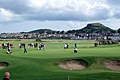 Conwy (Caernarvonshire) Golf Course - geograph.org.uk - 3100804.jpg 640 × 427; 60 KB
-
 Conwy (Caernarvonshire) Golf Course - geograph.org.uk - 3100811.jpg 640 × 427; 54 KB
-
 Conwy estuary - geograph.org.uk - 154915.jpg 640 × 480; 55 KB
-
 Conwy Estuary - geograph.org.uk - 4389643.jpg 640 × 480; 60 KB
-
 Conwy Estuary - geograph.org.uk - 864409.jpg 640 × 480; 167 KB
-
 Conwy estuary and Deganwy - geograph.org.uk - 343191.jpg 640 × 480; 111 KB
-
 Conwy Marina - geograph.org.uk - 3675475.jpg 1 024 × 683; 134 KB
-
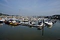 Conwy Marina - geograph.org.uk - 4185768.jpg 1 600 × 1 064; 416 KB
-
 Conwy Marina - geograph.org.uk - 5076719.jpg 5 184 × 3 456; 4,79 MB
-
 Conwy Marina - geograph.org.uk - 5076723.jpg 5 184 × 3 456; 5,78 MB
-
 Conwy Marina - geograph.org.uk - 5135173.jpg 1 500 × 1 000; 197 KB
-
 Conwy Marina - geograph.org.uk - 5135179.jpg 1 500 × 1 000; 193 KB
-
 Conwy marina from Deganwy - geograph.org.uk - 4607510.jpg 1 024 × 768; 170 KB
-

-
 Conwy Sands - geograph.org.uk - 456103.jpg 640 × 480; 104 KB
-
 Conwy sands - geograph.org.uk - 5119465.jpg 640 × 480; 76 KB
-
 Conwy Sands - geograph.org.uk - 5333780.jpg 1 600 × 1 200; 223 KB
-

-
 Cychod yn Neganwy - Boats in Deganwy - geograph.org.uk - 5761305.jpg 640 × 596; 102 KB
-
 Cycleway along the River Conwy - geograph.org.uk - 1479855.jpg 640 × 409; 78 KB
-
 Cycleway along the River Conwy - geograph.org.uk - 1479857.jpg 640 × 430; 118 KB
-
 Cycleway along the River Conwy - geograph.org.uk - 1479944.jpg 640 × 430; 131 KB
-
 Cycleway and Rip rap, Deganwy - geograph.org.uk - 1479926.jpg 640 × 430; 82 KB
-

-
 Cycleway near Deganwy - geograph.org.uk - 1479863.jpg 640 × 430; 139 KB
-
 Damage to the shelter - geograph.org.uk - 3796100.jpg 480 × 640; 90 KB
-
 Deganwy - geograph.org.uk - 1722746.jpg 2 816 × 2 112; 958 KB
-
 Deganwy - geograph.org.uk - 1722751.jpg 2 816 × 2 112; 1,1 MB
-
 Deganwy - panoramio.jpg 3 936 × 2 624; 4,78 MB
-
 Deganwy and The Vardre (hill) - geograph.org.uk - 4185685.jpg 1 600 × 1 064; 487 KB
-

-
 Deganwy Beach - geograph.org.uk - 1117117.jpg 640 × 480; 157 KB
-
 Deganwy Beach - geograph.org.uk - 19159.jpg 640 × 480; 54 KB
-
 Deganwy Castle Apartments - geograph.org.uk - 4278468.jpg 640 × 476; 53 KB
-
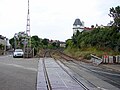
 Deganwy Crossing renewal - geograph.org.uk - 4724258.jpg 640 × 480; 78 KB
-
 Deganwy Crossing renewal 2 - geograph.org.uk - 4724286.jpg 640 × 480; 77 KB
-
 Deganwy dawn - geograph.org.uk - 2766605.jpg 640 × 480; 96 KB
-
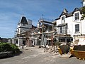
 Deganwy Development - geograph.org.uk - 864537.jpg 640 × 480; 198 KB
-
 Deganwy Dock Crossing - geograph.org.uk - 294966.jpg 600 × 450; 80 KB
-
 Deganwy from across the Conwy estuary - geograph.org.uk - 2388586.jpg 1 600 × 846; 81 KB
-
 Deganwy from Conwy Castle - geograph.org.uk - 1480431.jpg 640 × 339; 73 KB
-
 Deganwy from the across Afon Conwy - geograph.org.uk - 4185746.jpg 1 600 × 1 064; 716 KB
-
 Deganwy from the other side of the river - geograph.org.uk - 5319662.jpg 6 000 × 4 000; 3,91 MB
-
 Deganwy level crossing - geograph.org.uk - 1722733.jpg 2 816 × 2 112; 1,08 MB
-
 Deganwy level crossing and signalbox - geograph.org.uk - 3560453.jpg 2 048 × 1 536; 1,32 MB
-
 Deganwy Little Shore - geograph.org.uk - 6246270.jpg 800 × 600; 89 KB
-
 Deganwy Marina - geograph.org.uk - 1479942.jpg 640 × 430; 85 KB
-
 Deganwy Marina Lift - geograph.org.uk - 1922705.jpg 3 296 × 2 472; 1,93 MB
-
 Deganwy Marina office - geograph.org.uk - 1925716.jpg 3 296 × 2 472; 1,91 MB
-
 Deganwy Marine Crescent Level Crossing - geograph.org.uk - 864497.jpg 640 × 480; 192 KB
-
 Deganwy Mountain, Conwy - geograph.org.uk - 2250919.jpg 2 592 × 1 728; 3,59 MB
-
 Deganwy Post Office - geograph.org.uk - 5302255.jpg 6 000 × 4 000; 6,56 MB
-

-
 Deganwy Quay - geograph.org.uk - 1480457.jpg 640 × 298; 70 KB
-
 Deganwy Quay - geograph.org.uk - 2923550.jpg 640 × 427; 54 KB
-
 Deganwy Quay Hotel - geograph.org.uk - 3711753.jpg 640 × 480; 66 KB
-
 Deganwy Quay Level Crossing (open).jpg 1 366 × 768; 143 KB
-
 Deganwy Quay Marina - geograph.org.uk - 2142365.jpg 1 500 × 1 000; 249 KB
-
 Deganwy Quay Marina - geograph.org.uk - 2142366.jpg 1 500 × 988; 232 KB
-
 Deganwy Quay old dock crane - geograph.org.uk - 4218741.jpg 1 024 × 768; 111 KB
-
 Deganwy railway station MMB 07 175113.jpg 2 400 × 1 458; 1,9 MB
-
 Deganwy Road to Llandudno - geograph.org.uk - 5195114.jpg 1 500 × 999; 165 KB
-
 Deganwy Road, Deganwy - geograph.org.uk - 3815397.jpg 640 × 480; 43 KB
-

-
 Deganwy seen from Conwy Morfa - geograph.org.uk - 5076679.jpg 5 184 × 3 456; 5,13 MB
-
 Deganwy signal box - geograph.org.uk - 2911369.jpg 3 296 × 2 472; 1,97 MB
-
 Deganwy Signal Box and Level Crossing - geograph.org.uk - 1866971.jpg 2 048 × 1 536; 1,41 MB
-
 Deganwy signal box and level crossing - geograph.org.uk - 864445.jpg 640 × 480; 186 KB
-
 Deganwy signalbox - geograph.org.uk - 3560455.jpg 2 048 × 1 536; 1,54 MB
-
 Deganwy Signalbox, Deganwy Train Station - geograph.org.uk - 3833352.jpg 1 200 × 798; 339 KB
-
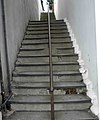 Deganwy steps - geograph.org.uk - 3044184.jpg 856 × 1 024; 145 KB
-
 Deganwy sunset - geograph.org.uk - 2117265.jpg 1 600 × 1 200; 351 KB
-
 Deganwy sunset - geograph.org.uk - 4607964.jpg 2 560 × 1 920; 253 KB
-
 Deganwy sunset - geograph.org.uk - 4610552.jpg 2 826 × 2 114; 134 KB
-
 Deganwy sunset ^2 - geograph.org.uk - 4607968.jpg 1 024 × 768; 108 KB
-
 Deganwy town and castle.jpg 640 × 579; 81 KB
-
 Deganwy viewpoint - geograph.org.uk - 4096419.jpg 1 000 × 750; 170 KB
-
 Deganwy Waterfront from Deganwy Quay - geograph.org.uk - 1480250.jpg 640 × 430; 119 KB
-
 Deganwy, Conwy Estuary - geograph.org.uk - 3352519.jpg 800 × 530; 113 KB
-
 Deganwy, UK - panoramio (1).jpg 4 032 × 2 272; 3,47 MB
-
 Deganwy, UK - panoramio (2).jpg 4 032 × 2 272; 3,35 MB
-
 Deganwy, UK - panoramio (3).jpg 4 032 × 2 272; 3,53 MB
-
 Deganwy, UK - panoramio (4).jpg 4 032 × 2 272; 3,37 MB
-
 Deganwy, UK - panoramio (5).jpg 4 032 × 2 272; 3,92 MB
-
 Deganwy, UK - panoramio.jpg 4 032 × 2 272; 3,77 MB
-
 Deganwy4102773X.JPG 1 989 × 1 311; 1,44 MB
-
 DeganwyLB01.JPG 2 048 × 1 536; 587 KB
-
 Designated public place - geograph.org.uk - 864379.jpg 640 × 480; 133 KB
-
 Dinghies at Deganwy - geograph.org.uk - 864442.jpg 640 × 480; 226 KB
-
 Disused building on Deganwy Prom - geograph.org.uk - 864384.jpg 640 × 480; 153 KB
-
 Entrance to the quay at Deganwy - geograph.org.uk - 3711781.jpg 640 × 480; 96 KB
-

-
 Exposed trunk and roots, Morfa Beach, Conwy - geograph.org.uk - 5025806.jpg 4 608 × 3 456; 3,69 MB
-
 Fatw, Ruin near Deganwy - geograph.org.uk - 238132.jpg 600 × 450; 126 KB
-
 Footbridge over the railway - geograph.org.uk - 864368.jpg 640 × 480; 169 KB
-

-
 Golf links at Deganwy - geograph.org.uk - 864354.jpg 640 × 480; 175 KB
-
 Gone fishing (well musselling anyway) - geograph.org.uk - 588497.jpg 640 × 557; 75 KB
-
 Great Orme - geograph.org.uk - 93645.jpg 640 × 480; 114 KB
-
 Hawes Drive, Deganwy - geograph.org.uk - 590584.jpg 640 × 480; 59 KB
-
 Hilary's Drive - geograph.org.uk - 1483397.jpg 640 × 430; 151 KB
-
 Houses at Deganwy Quays Marina - geograph.org.uk - 3833324.jpg 1 200 × 798; 322 KB
-

-
 Houses by Deganwy Castle Ruins - geograph.org.uk - 1587463.jpg 640 × 428; 60 KB
-

-
 Large house, Deganwy Quay - geograph.org.uk - 1480242.jpg 640 × 430; 100 KB
-
 Level Crossing near Deganwy - geograph.org.uk - 1479936.jpg 640 × 418; 107 KB
-
 Level Crossing to Station Road - geograph.org.uk - 2142369.jpg 1 500 × 862; 137 KB
-
 Level Crossing, Deganwy Quay - geograph.org.uk - 1479964.jpg 640 × 399; 82 KB
-
 Llandudno and Deganwy from the Great Orme - geograph.org.uk - 116331.jpg 640 × 480; 105 KB
-
 Llandudno and Peninsula, aerial 2015 - geograph.org.uk - 4691799.jpg 1 024 × 683; 115 KB
-
 Looking across Conwy sands to The Great Orme - geograph.org.uk - 2388581.jpg 1 024 × 768; 176 KB
-
-

-
-

-

-

-

-
 Looking west across the River Conwy - geograph.org.uk - 1479845.jpg 640 × 430; 75 KB
-
 Low tide channel - geograph.org.uk - 2495935.jpg 640 × 480; 89 KB
-
 Low tide channel - geograph.org.uk - 2495957.jpg 640 × 480; 97 KB
-
 Low Tide on the Afon Conwy estuary, North Wales - geograph.org.uk - 5001350.jpg 4 128 × 2 322; 2,82 MB
-
 Manchester train at Deganwy - geograph.org.uk - 864360.jpg 640 × 480; 216 KB
-
 Marine Crescent Level Crossing, Deganwy - geograph.org.uk - 5051644.jpg 5 184 × 3 456; 5,25 MB
-
 Marine Crescent, Deganwy - geograph.org.uk - 3833372.jpg 1 200 × 798; 335 KB
-
 Marine Crescent, Deganwy - geograph.org.uk - 3833444.jpg 1 200 × 798; 255 KB
-
 Marine Crescent, Deganwy - geograph.org.uk - 864401.jpg 640 × 480; 136 KB
-
 Moodle 1.jpg 800 × 532; 287 KB
-
 Moored in the estuary - geograph.org.uk - 1424367.jpg 640 × 426; 321 KB
-

-
 Morfa Conwy Marina - geograph.org.uk - 5333756.jpg 1 600 × 1 200; 433 KB
-
 Morfa Conwy.JPG 1 280 × 960; 181 KB
-
 Morfa shore - geograph.org.uk - 6152790.jpg 800 × 600; 86 KB
-

-
 New crossing furniture - geograph.org.uk - 2873638.jpg 640 × 480; 96 KB
-
 New houses, Deganwy Quay - geograph.org.uk - 1479952.jpg 640 × 438; 76 KB
-
 New houses, Deganwy Quay - geograph.org.uk - 1479962.jpg 640 × 430; 128 KB
-
 New housing development, Deganwy Quay - geograph.org.uk - 1479947.jpg 640 × 430; 105 KB
-
 North Wales Path - geograph.org.uk - 575626.jpg 640 × 480; 89 KB
-
 On the beach, Conwy Sands - geograph.org.uk - 3353028.jpg 800 × 480; 44 KB
-
 Path closed due to storm damage - geograph.org.uk - 3833470.jpg 1 200 × 798; 386 KB
-
 Path closed due to storm damage - geograph.org.uk - 3833472.jpg 1 200 × 798; 502 KB
-
 Path closed due to storm damage - geograph.org.uk - 3833476.jpg 1 200 × 798; 485 KB
-
 Path closed due to storm damage - geograph.org.uk - 3833532.jpg 1 200 × 798; 347 KB
-
 Path closed due to storm damage - geograph.org.uk - 3833537.jpg 1 200 × 798; 271 KB
-
 Path closed due to storm damage - geograph.org.uk - 3833592.jpg 1 200 × 798; 505 KB
-
 Path closed due to storm damage - geograph.org.uk - 3833603.jpg 1 200 × 798; 376 KB
-
 Path closed due to storm damage - geograph.org.uk - 3833617.jpg 1 200 × 798; 452 KB
-
 Peniel Chapel, information board - geograph.org.uk - 658057.jpg 640 × 480; 102 KB
-
 Peniel, Deganwy - geograph.org.uk - 3711811.jpg 640 × 480; 77 KB
-
 Pontoons in Conwy Marina - geograph.org.uk - 5135167.jpg 1 500 × 1 000; 185 KB
-
 Postbox on Albert Drive - geograph.org.uk - 1483382.jpg 640 × 430; 149 KB
-
 Private Samuel Llewellyn Frank Williams (6641541699).jpg 496 × 800; 40 KB


.jpg)
.jpg)


_Golf_Course_-_geograph.org.uk_-_3100778.jpg)
_Golf_Course_-_geograph.org.uk_-_3100796.jpg)
_Golf_Course_-_geograph.org.uk_-_3100804.jpg)
_Golf_Course_-_geograph.org.uk_-_3100811.jpg)


_-_geograph.org.uk_-_4185685.jpg)


.jpg)


.jpg)
.jpg)
.jpg)
.jpg)
.jpg)


_-_geograph.org.uk_-_588497.jpg)


.jpg)