Category:Denby Dale Road, Wakefield, West Yorkshire
Jump to navigation
Jump to search
Subcategories
This category has the following 6 subcategories, out of 6 total.
Media in category "Denby Dale Road, Wakefield, West Yorkshire"
The following 59 files are in this category, out of 59 total.
-
 A636 Road Bridge - geograph.org.uk - 2539871.jpg 800 × 473; 99 KB
-

-

-
 Base to Thornes Pump - geograph.org.uk - 5828275.jpg 1,600 × 1,200; 562 KB
-
 Beck - Denby Dale Road - geograph.org.uk - 848595.jpg 521 × 640; 88 KB
-
 Blue Plaque - geograph.org.uk - 1098855.jpg 640 × 480; 128 KB
-

-
 Bridge MVN2-230 - Denby Dale Road - geograph.org.uk - 848567.jpg 640 × 452; 44 KB
-

-
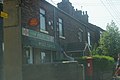 Calder Grove Post Office - geograph.org.uk - 625182.jpg 640 × 426; 59 KB
-
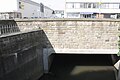
 Canal Bridge 44 - Denby dale Road - geograph.org.uk - 3039270.jpg 2,048 × 1,536; 581 KB
-
 Canal Bridge on Denby Dale Rd - geograph.org.uk - 824061.jpg 640 × 480; 79 KB
-
 Denby Dale Road - Thornes Lane roundabout - geograph.org.uk - 287778.jpg 640 × 480; 103 KB
-

-

-
 Denby Dale Road Bridge - geograph.org.uk - 3168147.jpg 1,024 × 683; 139 KB
-
 Denby Dale Road, Calder Grove - geograph.org.uk - 193169.jpg 640 × 480; 103 KB
-
 Denby Dale Road, Crigglestone CP - geograph.org.uk - 280901.jpg 640 × 480; 64 KB
-
 Denby Dale Road, Wakefield (geograph 5747619).jpg 1,600 × 1,065; 490 KB
-
 Denby Dale Road, Wakefield (geograph 5747628).jpg 1,600 × 1,065; 526 KB
-
 Denby Dale Road, Wakefield (geograph 5747636).jpg 1,600 × 1,065; 539 KB
-
 Denby Dale Road, Wakefield (geograph 5747642).jpg 1,600 × 1,065; 563 KB
-
 Denby Dale Road, Wakefield (geograph 5747655).jpg 1,600 × 1,065; 696 KB
-
 Denby Dale Road, Wakefield - geograph.org.uk - 942772.jpg 640 × 480; 94 KB
-
 Edge of Bullcliff Wood, West Bretton - geograph.org.uk - 280625.jpg 640 × 480; 138 KB
-

-
 Former Cooperative store, Denby Dale Road, Wakefield (geograph 5747753).jpg 1,065 × 1,600; 722 KB
-

-
 Funeral Service - geograph.org.uk - 969043.jpg 640 × 480; 80 KB
-
 Gala Bingo Hall - geograph.org.uk - 1098884.jpg 640 × 413; 209 KB
-
 Holmefield House - geograph.org.uk - 969062.jpg 640 × 480; 108 KB
-
 Holmfield House - geograph.org.uk - 867273.jpg 624 × 480; 74 KB
-
 Holmfield House - geograph.org.uk - 969068.jpg 640 × 480; 103 KB
-

-
 Ings Beck bridge, Denby Dale Road (1) - geograph.org.uk - 1525129.jpg 640 × 480; 122 KB
-
 Ings Beck bridge, Denby Dale Road (2) - geograph.org.uk - 1525131.jpg 640 × 419; 139 KB
-
 Ings Beck bridge, Denby Dale Road (3) - geograph.org.uk - 1525132.jpg 640 × 610; 152 KB
-

-

-
 Milestone- In Place (geograph 6126397).jpg 716 × 521; 69 KB
-

-
 Park on Denby Dale Road, Wakefield (geograph 5747645).jpg 1,600 × 1,065; 835 KB
-
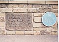
 Plaque on Denby Dale Road Bridge - geograph.org.uk - 3167986.jpg 1,024 × 683; 197 KB
-
 Queens Arms - Denby Dale Road - geograph.org.uk - 848564.jpg 640 × 468; 86 KB
-
 Rail bridge on Denby Dale Road, Wakefield (geograph 5747614).jpg 1,600 × 1,065; 505 KB
-
 Rail bridge on Denby Dale Road, Wakefield (geograph 5747747).jpg 1,600 × 1,065; 526 KB
-
 Railway bridge over Denby Dale Road at Thornes - geograph.org.uk - 3039266.jpg 2,048 × 1,536; 585 KB
-
 Railway line, Calder Grove - geograph.org.uk - 194695.jpg 480 × 640; 108 KB
-
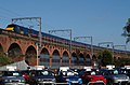 Railway Viaduct - geograph.org.uk - 362217.jpg 640 × 421; 106 KB
-
 Raines House, Denby Dale Road - geograph.org.uk - 1098917.jpg 640 × 480; 76 KB
-

-
 Royal Mail building on Denby Dale Road, Wakefield (geograph 5747604).jpg 1,600 × 1,065; 404 KB
-

-
 Royal Mail sorting office - geograph.org.uk - 1098868.jpg 640 × 460; 67 KB
-

-
 Thornes Office Park - geograph.org.uk - 5826417.jpg 1,600 × 1,200; 432 KB
-
 Thornes Pump - geograph.org.uk - 969075.jpg 640 × 480; 104 KB
-
 Thornes Trough - geograph.org.uk - 2132124.jpg 640 × 480; 64 KB
-


.jpg)
.jpg)
.jpg)
.jpg)
.jpg)


.jpg)


_-_geograph.org.uk_-_1525129.jpg)
_-_geograph.org.uk_-_1525131.jpg)
_-_geograph.org.uk_-_1525132.jpg)
_-_geograph.org.uk_-_1525134.jpg)

.jpg)
.jpg)
.jpg)


.jpg)
.jpg)


.jpg)


