Category:Denkmalzone Langgasse (Haßloch)
Jump to navigation
Jump to search
| Object location | | View all coordinates using: OpenStreetMap |
|---|

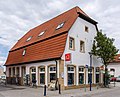
Monument zone Langgasse
- Ensemble of house courtyards, mostly from the 18th century.
Subcategories
This category has the following 17 subcategories, out of 17 total.
L
- Langgasse 20 (Haßloch) (2 F)
- Langgasse 25 (Haßloch) (2 F)
- Langgasse 45 (Haßloch) (4 F)
- Langgasse 49 (Haßloch) (2 F)
- Langgasse 61 (Haßloch) (3 F)
- (zu) Langgasse 66 (Haßloch) (14 F)
- Langgasse 72 (Haßloch) (2 F)
- Langgasse 87 (Haßloch) (3 F)
- Langgasse 89 (Haßloch) (3 F)
- Langgasse 109 (Haßloch) (2 F)
- Langgasse 119 (Haßloch) (2 F)
- Langgasse 126 (Haßloch) (2 F)
- Langgasse 134/136 (Haßloch) (2 F)
- Langgasse 138 (Haßloch) (3 F)
- Langgasse 147 (Haßloch) (2 F)
- Langgasse 149 (Haßloch) (2 F)
- Langgasse 167 (Haßloch) (2 F)
Media in category "Denkmalzone Langgasse (Haßloch)"
The following 9 files are in this category, out of 9 total.
-
 015 2015 08 27 Kulturdenkmaeler Hassloch.jpg 2,812 × 1,777; 3.31 MB
-
 016 2015 07 09 Kulturdenkmaeler Hassloch.jpg 2,481 × 2,015; 3.07 MB
-
 026 2015 08 27 Kulturdenkmaeler Hassloch.jpg 1,969 × 2,540; 2.68 MB
-
 027 2015 08 27 Kulturdenkmaeler Hassloch.jpg 2,246 × 2,225; 3.08 MB
-
 Hassloch langgasse-139 20120915 630e.jpg 3,753 × 2,515; 2.89 MB
-
 Hassloch langgasse-156-158 20120912 363e.jpg 3,470 × 2,775; 2.72 MB
-
 Hassloch langgasse-47 20120916 689e.jpg 3,781 × 2,835; 3.06 MB
-
 Hassloch langgasse-62 20120914 528e.jpg 3,475 × 2,606; 2.45 MB
-
 Hassloch langgasse-ost 20120912 374e.jpg 4,000 × 3,000; 3.53 MB


