Category:Derelict buildings in Wiltshire
Jump to navigation
Jump to search
Ceremonial counties of England: Bedfordshire · Berkshire · Buckinghamshire · Cambridgeshire · Cheshire · Cornwall · Cumbria · Derbyshire · Devon · Dorset · Durham · East Riding of Yorkshire · East Sussex · Essex · Gloucestershire · Greater London · Greater Manchester · Hampshire · Herefordshire · Hertfordshire · Kent · Lancashire · Leicestershire · Lincolnshire · Merseyside · Norfolk · North Yorkshire · Northamptonshire · Northumberland · Nottinghamshire · Oxfordshire · Rutland · Shropshire · Somerset · South Yorkshire · Staffordshire · Suffolk · Surrey · Tyne and Wear · Warwickshire · West Midlands · West Sussex · West Yorkshire · Wiltshire · Worcestershire
City-counties: Bristol · City of London
Former historic counties:
Other former counties:
City-counties: Bristol · City of London
Former historic counties:
Other former counties:
Media in category "Derelict buildings in Wiltshire"
The following 48 files are in this category, out of 48 total.
-
 Amesbury - Derelict Cottage - geograph.org.uk - 1459741.jpg 640 × 480; 81 KB
-
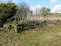
 At the entrance to Hobb's Bottom Farm - geograph.org.uk - 868222.jpg 640 × 460; 65 KB
-
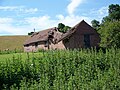
 Barns at Throope Manor - geograph.org.uk - 885928.jpg 640 × 480; 149 KB
-
 Cow Byre - panoramio.jpg 4,608 × 3,456; 5.47 MB
-
 Coxhill Farm, near Purton Stoke - geograph.org.uk - 1237510.jpg 640 × 480; 116 KB
-
 Coxhill Farm, near Purton Stoke - geograph.org.uk - 1238523.jpg 640 × 480; 170 KB
-
 Coxhill Farmhouse, near Purton Stoke - geograph.org.uk - 1240157.jpg 640 × 480; 241 KB
-
 Cusse's Gorse - geograph.org.uk - 448087.jpg 640 × 480; 90 KB
-

-
 Derelict building near Common Wood - geograph.org.uk - 1560112.jpg 640 × 480; 146 KB
-

-
 Derelict Church, Trafalgar Park - geograph.org.uk - 871219.jpg 640 × 480; 117 KB
-
 Derelict Farm Buildings - geograph.org.uk - 296792.jpg 640 × 480; 127 KB
-
 Derelict hangar, Yatesbury - geograph.org.uk - 339553.jpg 640 × 480; 96 KB
-
 Derelict mill at Avoncliff weir - geograph.org.uk - 872727.jpg 640 × 480; 119 KB
-
 Disused barn on Dursley Road - geograph.org.uk - 802602.jpg 640 × 485; 79 KB
-

-
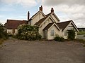
 East Winterslow - Pheasant Hotel - geograph.org.uk - 782590.jpg 640 × 480; 97 KB
-
 Farm buildings, near Coped Hall - geograph.org.uk - 1213213.jpg 640 × 452; 141 KB
-

-
 Greenlands Camp - geograph.org.uk - 1152176.jpg 640 × 512; 131 KB
-
 Greenlands Camp - geograph.org.uk - 1152199.jpg 640 × 512; 64 KB
-
 Hinks Mill - geograph.org.uk - 414516.jpg 640 × 480; 133 KB
-
 Marten - Windmill Restaurant - geograph.org.uk - 1447192.jpg 640 × 480; 64 KB
-
 Marten - Windmill Restaurant - geograph.org.uk - 1447205.jpg 640 × 480; 86 KB
-
 Marten - Windmill Restaurant - geograph.org.uk - 1447219.jpg 640 × 480; 64 KB
-

-
 Oh dear, the roof fell in - geograph.org.uk - 885976.jpg 640 × 480; 112 KB
-
 Old Barn - geograph.org.uk - 295988.jpg 640 × 480; 167 KB
-

-
 Part of Coxhill Farm, near Purton Stoke - geograph.org.uk - 1238520.jpg 640 × 480; 198 KB
-
 Rag boiler at Rag Mill - geograph.org.uk - 1529085.jpg 2,448 × 3,264; 2.68 MB
-
 Rag Mill water wheel - geograph.org.uk - 1529051.jpg 3,264 × 2,448; 2.32 MB
-
 Rag Mill water wheel among trees - geograph.org.uk - 1529067.jpg 3,264 × 2,448; 1.76 MB
-

-
-

-
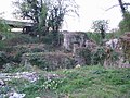
 Ruin near the Avon - geograph.org.uk - 1012695.jpg 640 × 480; 162 KB
-
 Ruined farm building - geograph.org.uk - 1652844.jpg 640 × 425; 62 KB
-
 Ruined House at Imber - Military Custodianship - panoramio.jpg 3,648 × 2,736; 5.62 MB
-
 Rusty old barn on the road to Charlcutt - geograph.org.uk - 1520860.jpg 640 × 522; 154 KB
-
 The former Windmill Restaurant. Marten - geograph.org.uk - 1248240.jpg 640 × 479; 120 KB
-

-

-

-
 Abandoned house - geograph.org.uk - 212421.jpg 600 × 450; 104 KB
-

-


.jpg)


