Category:Deuxhill
Jump to navigation
Jump to search
village in the United Kingdom  | |||||
| Upload media | |||||
| Instance of | |||||
|---|---|---|---|---|---|
| Location | Shropshire, West Midlands, England | ||||
 | |||||
English: Deuxhill (pronounced "Dukeshill") is a hamlet and very small civil parish in Shropshire, England.
Polski: Deuxhill – osada w Anglii, w hrabstwie Shropshire. Leży 33 km na południowy wschód od miasta Shrewsbury i 193 km na północny zachód od Londynu.
Media in category "Deuxhill"
The following 22 files are in this category, out of 22 total.
-
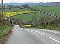 A view down the B4363 in Shropshire - geograph.org.uk - 396861.jpg 640 × 469; 95 KB
-
 Approaching the Deuxhill lane - geograph.org.uk - 4482374.jpg 1,142 × 857; 423 KB
-

-
 B4363 at Deuxhill - geograph.org.uk - 2527526.jpg 640 × 480; 170 KB
-
 B4363 at Deuxhill, heading north - geograph.org.uk - 2527530.jpg 640 × 480; 191 KB
-
 B4363 at Horsford Bridge - geograph.org.uk - 2865119.jpg 640 × 480; 67 KB
-
 B4363 at Horsford Farm - geograph.org.uk - 2865115.jpg 640 × 480; 58 KB
-
 B4363 at Horsford milestone - geograph.org.uk - 2865120.jpg 640 × 480; 71 KB
-
 B4363 north of Deuxhill - geograph.org.uk - 2865129.jpg 640 × 480; 38 KB
-
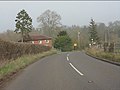
 B4363, Horsford - geograph.org.uk - 5852002.jpg 1,024 × 576; 317 KB
-
 Deuxhill lane junction - geograph.org.uk - 2865126.jpg 640 × 480; 75 KB
-
 Dutch barns by the road junction - geograph.org.uk - 4482377.jpg 1,142 × 857; 306 KB
-
 Field boundary at Hall Farm - geograph.org.uk - 602303.jpg 640 × 480; 222 KB
-
 Field, Horsford - geograph.org.uk - 5852000.jpg 1,024 × 576; 295 KB
-
 Hall Farm in Deuxhill, Shropshire - geograph.org.uk - 396853.jpg 640 × 485; 160 KB
-
 Novel windbreak - geograph.org.uk - 2280760.jpg 640 × 480; 95 KB
-

-
 Path to Deuxhill - geograph.org.uk - 602313.jpg 640 × 480; 224 KB
-
 Room between hedgerow and crop - geograph.org.uk - 777959.jpg 640 × 480; 70 KB
-
 Sharp bend at Deuxhill - geograph.org.uk - 867872.jpg 640 × 480; 333 KB
-

-
 Shropshire Cropfields near Deuxhill - geograph.org.uk - 615859.jpg 640 × 411; 122 KB


