Category:Diswellstown (townland, Castleknock)
Diswellstown is a townland in the civil parish of Castleknock, in the ancient barony of Castleknock. At the northern tip, a thin strip of land parallel to Sheepmoor crosses the Royal Canal. To the north-east it is bounded by the townland of Carpenterstown; to the east by the townland of Castleknock; a thin strip of land to the south - the townland of Astagob - separates it from the River Liffey. To the south-west are two townlands from the parish of Clonsilla: Astagob in Clonsilla and Porterstown. The land occupied by the "Carpenter" pub and by Castleknock Community College is actually in the Diswellstown, not in Carpenterstown. The M50 motorway cuts the south-eastern part of Diswellstown.
| NO WIKIDATA ID FOUND! Search for Diswellstown (townland, Castleknock) on Wikidata | |
| Upload media |
Subcategories
This category has only the following subcategory.
C
Media in category "Diswellstown (townland, Castleknock)"
The following 13 files are in this category, out of 13 total.
-

-
 Carpenter pub and shops.jpg 3,264 × 1,089; 652 KB
-
 Castleknock Community College.jpg 3,264 × 1,836; 2.08 MB
-
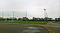
 Castleknock GAA, Somerton Park (2018).jpg 2,592 × 1,454; 915 KB
-
 Castleknock Golf Club, Dublin 15 - geograph.org.uk - 1741952.jpg 3,648 × 2,736; 1.83 MB
-
 Castleknock Hotel - geograph.org.uk - 546231.jpg 640 × 481; 62 KB
-
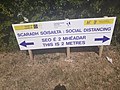 COVID-19 Social Distancing Bilingual Sign Tír na nÓg Park Carpenterstown (2020).jpg 4,128 × 3,096; 4.75 MB
-
 Diswellstown stream 2020.jpg 1,836 × 3,264; 2.37 MB
-
 Lake at Castleknock Golf Club, Dublin 15 - geograph.org.uk - 1741946.jpg 3,648 × 2,736; 2.08 MB
-
 Ragwell at Diswellstown 2020.jpg 3,264 × 1,836; 2 MB
-
 Riverwood, Coill na hAbhann, Castleknock, Caisleán Cnucha (2020).jpg 960 × 540; 54 KB
-
 Somerton Park, Castleknock GAA (2018).jpg 2,590 × 1,456; 1.02 MB
-
 Tír na nÓg Park, Diswellstown Road, Castleknock, Dublin 15.jpg 1,024 × 576; 177 KB
.jpg)

.jpg)


.jpg)


.jpg)
.jpg)
