Category:Dormansland
Jump to navigation
Jump to search
English: Dormansland is a village and civil parish approximately one mile south of Lingfield in Surrey, southern England. It is bordered on the east by the county of Kent and on the south by West Sussex.
village and civil parish in Tandridge, Surrey, England, UK  | |||||
| Upload media | |||||
| Instance of | |||||
|---|---|---|---|---|---|
| Location | Tandridge, Surrey, South East England, England | ||||
| Area |
| ||||
 | |||||
Subcategories
This category has the following 10 subcategories, out of 10 total.
C
- Claridge House, Dormansland (4 F)
D
- Dormans Park (1 F)
- Dormans railway station (21 F)
- Dormansland Baptist Church (10 F)
- Dormansland Memorial Hall (3 F)
- Dormansland War Memorial (2 F)
H
P
- Puttenden Manor (1 F)
S
- Starborough Castle (1 F)
Media in category "Dormansland"
The following 200 files are in this category, out of 643 total.
(previous page) (next page)-
 A line of Poplars, Dry Hill Farm - geograph.org.uk - 1710497.jpg 640 × 427; 61 KB
-
 A small ditch - geograph.org.uk - 4034332.jpg 640 × 430; 75 KB
-
 A small pond - geograph.org.uk - 4009589.jpg 640 × 430; 100 KB
-
 A very young crop - geograph.org.uk - 3989011.jpg 640 × 430; 81 KB
-
 Abandoned House - geograph.org.uk - 1860992.jpg 1,024 × 768; 338 KB
-
 Abandoned House near Hooper's Farm - geograph.org.uk - 1860995.jpg 1,024 × 683; 267 KB
-
 Abandoned House near Hooper's Farm - geograph.org.uk - 1861018.jpg 1,024 × 768; 324 KB
-
 Access lane towards Park Farm - geograph.org.uk - 2506697.jpg 3,072 × 2,304; 1.45 MB
-
 Access road to Old Surrey Hall - geograph.org.uk - 2509587.jpg 3,072 × 2,304; 1.65 MB
-
 Access road to Starborough Castle - geograph.org.uk - 2509844.jpg 3,072 × 2,304; 3.28 MB
-
 An old Oak tree, Jules Wood - geograph.org.uk - 1711294.jpg 427 × 640; 112 KB
-
 B2028 - geograph.org.uk - 4481054.jpg 640 × 572; 130 KB
-
 B2028, Dormansland - geograph.org.uk - 4480742.jpg 640 × 426; 85 KB
-
 B2028, Dormansland - geograph.org.uk - 4480745.jpg 640 × 426; 83 KB
-
 Bankside Cottage - geograph.org.uk - 5268964.jpg 640 × 426; 128 KB
-
 Barberry - geograph.org.uk - 5160071.jpg 1,000 × 662; 836 KB
-
 Barley Field near Greathed Manor - geograph.org.uk - 1947132.jpg 1,024 × 683; 221 KB
-
 Barn at Starborough Castle - geograph.org.uk - 4026801.jpg 640 × 430; 75 KB
-
 Barn by Tandridge Border Path - geograph.org.uk - 5268968.jpg 640 × 425; 86 KB
-
 Barn, Beeches Farm - geograph.org.uk - 1711205.jpg 640 × 427; 68 KB
-
 Barn, Dry Hill Farm - geograph.org.uk - 1710493.jpg 640 × 427; 58 KB
-
 Barn, Dwelly Farm - geograph.org.uk - 4040806.jpg 640 × 430; 73 KB
-
 Barn, Haxted House - geograph.org.uk - 4001334.jpg 640 × 430; 50 KB
-
 Barn, Haxted House - geograph.org.uk - 4001379.jpg 640 × 430; 77 KB
-
 Barn, Wilderwick Farm - geograph.org.uk - 5258245.jpg 640 × 426; 76 KB
-
 Beeches Farm - geograph.org.uk - 1711201.jpg 640 × 427; 104 KB
-
 Beeches Farmhouse - geograph.org.uk - 1952492.jpg 3,072 × 2,304; 1.46 MB
-
 Beeches Mead on Hollow Lane - geograph.org.uk - 4667632.jpg 2,304 × 1,728; 838 KB
-
 Beeches Mead on Hollow Lane - geograph.org.uk - 4667676.jpg 2,304 × 1,728; 822 KB
-
 Bend, Hollow Lane - geograph.org.uk - 4480789.jpg 640 × 426; 102 KB
-
 Blackberry Lane - geograph.org.uk - 5268963.jpg 640 × 426; 104 KB
-
 Blackberry Lane - geograph.org.uk - 5268970.jpg 640 × 426; 100 KB
-
 Blackberry Lane - geograph.org.uk - 5268971.jpg 640 × 426; 98 KB
-
 Blackberry Lane, Dormansland - geograph.org.uk - 4672586.jpg 2,170 × 1,532; 1.61 MB
-
 Border Paths beside Blackhatch Wood - geograph.org.uk - 2509544.jpg 3,072 × 2,304; 1.57 MB
-
 Boxin Wood - geograph.org.uk - 5258261.jpg 640 × 426; 131 KB
-
 Bridge on Shepherdsgrove Lane - geograph.org.uk - 1951305.jpg 3,072 × 2,304; 1.78 MB
-
 Bridge over the River Eden - geograph.org.uk - 4001421.jpg 640 × 430; 120 KB
-
 Bridge to Surrey - geograph.org.uk - 3988992.jpg 640 × 430; 134 KB
-
 Bridge Wall - geograph.org.uk - 5077896.jpg 1,200 × 1,600; 593 KB
-
 Bridge Wall, Barrier and path - geograph.org.uk - 4184159.jpg 1,200 × 1,600; 646 KB
-
 Bridge, Water Lane - geograph.org.uk - 4034368.jpg 640 × 430; 66 KB
-
 Bridleway between Woodlands Farm and Beeches Farm - geograph.org.uk - 1951348.jpg 3,072 × 2,304; 2.45 MB
-
 Bridleway in Bog Wood - geograph.org.uk - 2509606.jpg 3,072 × 2,304; 3.44 MB
-
 Bridleway junction at Beeches Farm - geograph.org.uk - 1952490.jpg 3,072 × 2,304; 1.72 MB
-
 Bridleway junction near Beeches Farm - geograph.org.uk - 1952496.jpg 3,072 × 2,304; 1.86 MB
-
 Bridleway junction near Burnpit Farm - geograph.org.uk - 2509601.jpg 3,072 × 2,304; 2.78 MB
-
 Bridleway junction on Sussex Border Path in Jules Wood - geograph.org.uk - 1952516.jpg 3,072 × 2,304; 2.33 MB
-

-
 Bridleway near Beeches Farm - geograph.org.uk - 1711266.jpg 640 × 427; 109 KB
-
 Bridleway on the edge of Jules Wood - geograph.org.uk - 1711282.jpg 640 × 427; 120 KB
-

-
 Bridleway to Beeches Farm - geograph.org.uk - 1952397.jpg 3,072 × 2,304; 2.61 MB
-
 Bridleway to Woodlands Farm - geograph.org.uk - 1951337.jpg 2,304 × 3,072; 2.44 MB
-
 Bridleway traffic, Old Lodge Farm - geograph.org.uk - 2434355.jpg 640 × 480; 120 KB
-
 Bridleway, Jules Wood - geograph.org.uk - 1711286.jpg 640 × 478; 95 KB
-
 Bridleway, Jules Wood - geograph.org.uk - 1711292.jpg 640 × 427; 100 KB
-
 Brook Cottage - geograph.org.uk - 3989016.jpg 640 × 401; 72 KB
-
 Brook Cottage - geograph.org.uk - 3989032.jpg 640 × 430; 86 KB
-
 Building on St Pier's Lane - geograph.org.uk - 1947142.jpg 1,024 × 768; 206 KB
-
 By Starborough Rd - geograph.org.uk - 4034359.jpg 640 × 430; 46 KB
-
 By the Eden Valley Walk - geograph.org.uk - 4009593.jpg 640 × 430; 78 KB
-
 By The Oxted Line - geograph.org.uk - 5263332.jpg 640 × 426; 113 KB
-
 By the Tandridge Border Path - geograph.org.uk - 5263336.jpg 640 × 426; 97 KB
-
 Cattle feeder - geograph.org.uk - 4034385.jpg 640 × 430; 54 KB
-
 Cattle grazing by Jules Wood - geograph.org.uk - 1711143.jpg 640 × 427; 46 KB
-
 Cattle grazing near Dry Hill Fort - geograph.org.uk - 1711139.jpg 640 × 427; 74 KB
-
 Cernes Farm - geograph.org.uk - 4001487.jpg 640 × 352; 55 KB
-
 Cernes Farm - geograph.org.uk - 4026949.jpg 640 × 430; 72 KB
-
 Cernes Farm - geograph.org.uk - 4026958.jpg 640 × 430; 48 KB
-
 Cernes Farmhouse - geograph.org.uk - 4001496.jpg 640 × 430; 78 KB
-
 Cernes Farmhouse - geograph.org.uk - 4009580.jpg 640 × 430; 104 KB
-
 Chapel at College of St Barnabas, Dormans Station Road, Dormansland (May 2013) (1).JPG 2,400 × 1,600; 952 KB
-
 Chapel at College of St Barnabas, Dormans Station Road, Dormansland (May 2013) (2).JPG 1,900 × 2,500; 1.06 MB
-
 Chartham Park Golf Course - geograph.org.uk - 5274878.jpg 640 × 426; 65 KB
-
 Chartham Park Golf Course - geograph.org.uk - 5274896.jpg 640 × 426; 66 KB
-
 Chartham Park Golf Course - geograph.org.uk - 5274897.jpg 640 × 426; 58 KB
-
 Chartham Park Golf Course - geograph.org.uk - 5274899.jpg 640 × 426; 102 KB
-
 Chartham Park Golf Course - geograph.org.uk - 5274900.jpg 640 × 426; 55 KB
-
 Colour in Jules Wood - geograph.org.uk - 2434402.jpg 640 × 480; 186 KB
-
 Conifer stands, Jules Wood - geograph.org.uk - 1711289.jpg 640 × 427; 104 KB
-
 Conifers, Jules Wood - geograph.org.uk - 1710335.jpg 640 × 427; 120 KB
-
 Conifers, Jules Wood - geograph.org.uk - 1710368.jpg 640 × 427; 131 KB
-
 Conifers, Jules Wood - geograph.org.uk - 1711295.jpg 640 × 427; 108 KB
-
 Cooks Pond Viaduct - geograph.org.uk - 5263248.jpg 426 × 640; 120 KB
-
 Cooks Pond Viaduct - geograph.org.uk - 5263251.jpg 426 × 640; 130 KB
-
 Cooks Pond Viaduct - geograph.org.uk - 5263252.jpg 640 × 426; 116 KB
-
 Cooks Pond Viaduct - geograph.org.uk - 5263256.jpg 640 × 426; 66 KB
-
 Cooks Pond Viaduct - geograph.org.uk - 5263259.jpg 640 × 426; 77 KB
-
 Cooks Pond Viaduct - geograph.org.uk - 5263262.jpg 640 × 426; 81 KB
-
 Cooks Pond Viaduct - geograph.org.uk - 5263268.jpg 640 × 426; 83 KB
-
 Cooks Pond Viaduct - geograph.org.uk - 5263272.jpg 640 × 426; 121 KB
-

-
 Corduroy Road at Dormans Park - geograph.org.uk - 2265179.jpg 1,944 × 2,592; 2.44 MB
-
 Countryside to the east of Dormansland - geograph.org.uk - 788294.jpg 640 × 451; 137 KB
-
 Crossroads in Dormansland - geograph.org.uk - 2506818.jpg 3,072 × 2,304; 1.67 MB
-
 Crossroads near Dormansland - geograph.org.uk - 2506844.jpg 3,072 × 2,304; 2.6 MB
-
 Crossroads on Dormans High Street - geograph.org.uk - 4667777.jpg 2,304 × 1,728; 807 KB
-
 Derelict building, Dwelly Farm - geograph.org.uk - 4040807.jpg 640 × 388; 76 KB
-
 Dormans High Street - geograph.org.uk - 4670855.jpg 2,304 × 1,728; 1,020 KB
-
 Dormans Park Entrance - geograph.org.uk - 5268972.jpg 640 × 426; 85 KB
-
 Dormans Park Telephone Exchange (1) - geograph.org.uk - 3056752.jpg 3,072 × 2,304; 1.78 MB
-
 Dormans Park Telephone Exchange (2) - geograph.org.uk - 3057058.jpg 3,072 × 2,304; 1.79 MB
-
 Dormansland Recreation Ground - geograph.org.uk - 3823420.jpg 1,024 × 768; 215 KB
-
 Dormansland Rockets F.C. - geograph.org.uk - 2434306.jpg 640 × 480; 99 KB
-
 Dormansland Rockets FC Club House - geograph.org.uk - 3787559.jpg 1,024 × 768; 137 KB
-
 Dormansland Rockets Football Club - geograph.org.uk - 2506847.jpg 3,072 × 2,304; 1.9 MB
-
 Dormansland Village Sign - geograph.org.uk - 2506826.jpg 2,304 × 3,072; 1.83 MB
-
 Dormansland, postbox No. RH7 62 - geograph.org.uk - 1778918.jpg 640 × 480; 76 KB
-

-
 Drive to Greathed Manor - geograph.org.uk - 1947121.jpg 1,024 × 768; 303 KB
-
 Dry Hill Farm - geograph.org.uk - 1860953.jpg 1,024 × 768; 137 KB
-
 Dry Hill Fort - geograph.org.uk - 1711133.jpg 640 × 427; 96 KB
-
 Dry Hill Fort - geograph.org.uk - 1711278.jpg 640 × 427; 44 KB
-
 Dry Hill Reservoir - geograph.org.uk - 1711117.jpg 640 × 427; 62 KB
-
 Dry Hill Reservoir - geograph.org.uk - 1711122.jpg 640 × 427; 55 KB
-
 Dryhill Farm - geograph.org.uk - 1952524.jpg 3,072 × 2,304; 1.6 MB
-
 Dwelly Farm - geograph.org.uk - 4040800.jpg 640 × 430; 82 KB
-
 Dwelly Farm Cottage - geograph.org.uk - 4040802.jpg 640 × 430; 89 KB
-
 Dwelly Farmhouse - geograph.org.uk - 4040804.jpg 640 × 430; 90 KB
-
 Dwelly Lane - geograph.org.uk - 1949559.jpg 3,072 × 2,304; 2.03 MB
-
 Dwelly Lane - geograph.org.uk - 4040786.jpg 640 × 430; 80 KB
-
 Dwelly Lane - geograph.org.uk - 4040787.jpg 640 × 430; 85 KB
-
 Dwelly Lane - geograph.org.uk - 4040791.jpg 640 × 430; 57 KB
-
 Dwelly Lane - geograph.org.uk - 4040793.jpg 640 × 430; 75 KB
-
 Dwelly Lane - geograph.org.uk - 4040795.jpg 640 × 410; 73 KB
-
 Dwelly Lane - geograph.org.uk - 4040810.jpg 640 × 430; 73 KB
-
 Dwelly Lane - geograph.org.uk - 4040816.jpg 640 × 430; 73 KB
-
 East Haxted Farm - geograph.org.uk - 1864516.jpg 3,072 × 2,304; 1.74 MB
-
 East Haxted Farm - geograph.org.uk - 4001424.jpg 640 × 430; 58 KB
-
 East Haxted Farm Cottage - geograph.org.uk - 4001383.jpg 640 × 430; 113 KB
-
 East Haxted Farm Grass Airstrip - geograph.org.uk - 4001415.jpg 640 × 430; 59 KB
-
 East Haxted Farm Grass Airstrip - geograph.org.uk - 4001416.jpg 640 × 430; 67 KB
-
 East Haxted Farm Grass Airstrip - geograph.org.uk - 4001418.jpg 640 × 399; 52 KB
-
 East Haxted Farm Grass Taxi Way - geograph.org.uk - 1867655.jpg 3,072 × 2,304; 1.86 MB
-
 East Haxted Farm Hangar - geograph.org.uk - 1867649.jpg 3,072 × 2,304; 1.5 MB
-
 East Haxted Farmhouse - geograph.org.uk - 1867677.jpg 3,072 × 2,304; 1.58 MB
-
 Eden Brook (3) - geograph.org.uk - 2506681.jpg 3,072 × 2,304; 2 MB
-
 Eden Brook - geograph.org.uk - 2506649.jpg 3,072 × 2,304; 1.57 MB
-
 Eden Brook - geograph.org.uk - 2509909.jpg 3,072 × 2,304; 1.58 MB
-
 Eden Brook - geograph.org.uk - 3808136.jpg 3,008 × 2,000; 1.39 MB
-
 Eden Brook - geograph.org.uk - 4001461.jpg 640 × 430; 106 KB
-
 Eden Brook - geograph.org.uk - 4001464.jpg 640 × 430; 133 KB
-
 Eden Brook - geograph.org.uk - 4034375.jpg 640 × 430; 91 KB
-
 Eden Brook - geograph.org.uk - 4034378.jpg 640 × 430; 94 KB
-
 Eden Brook - geograph.org.uk - 4253680.jpg 640 × 480; 95 KB
-
 Eden Brook 2 - geograph.org.uk - 2506674.jpg 3,072 × 2,304; 1.84 MB
-
 Eden Brook from a footbridge - geograph.org.uk - 5329950.jpg 4,000 × 3,000; 4.97 MB
-
 Eden Brook from the air - geograph.org.uk - 2337346.jpg 640 × 480; 134 KB
-
 Eden Brook seen from Water Lane - geograph.org.uk - 5338453.jpg 4,000 × 3,000; 5.16 MB
-
 Eden Brook seen from Water Lane - geograph.org.uk - 5338456.jpg 4,000 × 3,000; 5.05 MB
-
 Eden Brook towards River Eden - geograph.org.uk - 2509923.jpg 3,072 × 2,304; 2.4 MB
-
 Eden Valley Walk - geograph.org.uk - 4001506.jpg 640 × 430; 68 KB
-
 Eden Valley Walk - geograph.org.uk - 4009585.jpg 640 × 430; 98 KB
-
 Eden Valley Walk - geograph.org.uk - 4009591.jpg 640 × 430; 86 KB
-
 Eden Valley Walk - geograph.org.uk - 4009598.jpg 640 × 430; 125 KB
-
 Eden Valley Walk - geograph.org.uk - 4009622.jpg 640 × 430; 73 KB
-
 Eden Valley Walk meets Haxted Road - geograph.org.uk - 4040680.jpg 640 × 430; 87 KB
-
 Eden Valley Walk towards the River Eden - geograph.org.uk - 1867816.jpg 3,072 × 2,304; 1.71 MB
-
 Embankments and ditches, Dry Hill Fort - geograph.org.uk - 1711105.jpg 640 × 427; 121 KB
-
-
 Entering Felcourt - geograph.org.uk - 5269002.jpg 640 × 426; 117 KB
-
 Entrance on Hollow Lane, Dormansland - geograph.org.uk - 4672573.jpg 2,304 × 1,728; 1.82 MB
-
 Entrance to Chartham Park - geograph.org.uk - 2845031.jpg 800 × 600; 127 KB
-
 Entrance to Dormansland Cricket Club - geograph.org.uk - 3787556.jpg 1,024 × 768; 250 KB
-
 Entrance, Starborough Castle - geograph.org.uk - 4026909.jpg 640 × 430; 119 KB
-
 Farmhouse, Beeches Farm - geograph.org.uk - 1711209.jpg 640 × 427; 68 KB
-
 Farmland by Dwelly Lane - geograph.org.uk - 4040790.jpg 640 × 430; 37 KB
-
 Farmland by Dwelly Lane - geograph.org.uk - 4040792.jpg 640 × 430; 49 KB
-
 Farmland by Starborough Rd - geograph.org.uk - 4034356.jpg 640 × 430; 44 KB
-
 Farmland in the Eden Valley - geograph.org.uk - 4034331.jpg 640 × 430; 75 KB
-
 Farmland near Marsh Green Rd - geograph.org.uk - 4014302.jpg 640 × 430; 59 KB
-
 Farmland, Cernes Farm - geograph.org.uk - 4034317.jpg 640 × 430; 70 KB
-
 Farmland, Eden Valley - geograph.org.uk - 4034320.jpg 640 × 406; 41 KB
-
 Farmland, Starborough Castle - geograph.org.uk - 4026834.jpg 640 × 430; 70 KB
-
 Farmland, Starborough Castle - geograph.org.uk - 4026873.jpg 640 × 430; 52 KB
-
 Felcourt Rd - geograph.org.uk - 5268999.jpg 640 × 426; 107 KB
-
 Felcourt Rd - geograph.org.uk - 5269000.jpg 640 × 426; 90 KB
-
 Felcourt Rd - geograph.org.uk - 5269001.jpg 640 × 426; 88 KB
-
 Felcourt Rd - geograph.org.uk - 5269004.jpg 640 × 426; 98 KB
-
 Field by the River Eden - geograph.org.uk - 4034394.jpg 640 × 430; 41 KB
-
 Field east of Cernes Farm - geograph.org.uk - 4009578.jpg 640 × 430; 69 KB
-
 Field entrance on Hollow Lane, Dormansland - geograph.org.uk - 4672568.jpg 2,304 × 1,728; 848 KB
-
 Field in the Eden Valley - geograph.org.uk - 4001467.jpg 640 × 407; 60 KB
-
 Field near Cernes Farm - geograph.org.uk - 4001480.jpg 640 × 401; 61 KB
-
 Field of Cows - geograph.org.uk - 1947158.jpg 1,024 × 768; 186 KB
-
 Field, Cernes Farm - geograph.org.uk - 4026928.jpg 640 × 430; 38 KB
-
 Field, Haxted - geograph.org.uk - 4001340.jpg 640 × 430; 77 KB
-
 Fields off Haxted Road - geograph.org.uk - 1947161.jpg 1,024 × 768; 188 KB
-
 Fishing Lake near the River Eden - geograph.org.uk - 1867834.jpg 3,072 × 2,304; 2.31 MB
-
 Flood water Eden Brook - geograph.org.uk - 3808126.jpg 3,008 × 2,000; 2.87 MB
-
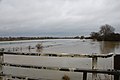 Flood Water Eden Brook - geograph.org.uk - 3840306.jpg 3,008 × 2,000; 2.09 MB
-
 Flooded woodland - geograph.org.uk - 4009600.jpg 640 × 430; 141 KB
-
 Followed by sheep - geograph.org.uk - 3518439.jpg 1,600 × 1,200; 669 KB
-
 Footbridge - geograph.org.uk - 4026756.jpg 640 × 430; 118 KB
-
 Footbridge near Nann's Common Clump - geograph.org.uk - 2509666.jpg 3,072 × 2,304; 2.06 MB
-
 Footbridge near North Lodge - geograph.org.uk - 2509646.jpg 3,072 × 2,304; 3.16 MB
-
 Footbridge near the Eden Valley Walk - geograph.org.uk - 5326085.jpg 4,000 × 3,000; 5.02 MB
-
 Footbridge on the River Eden - geograph.org.uk - 1867842.jpg 3,072 × 2,304; 2.61 MB
-
 Footbridge over River Eden - geograph.org.uk - 1867737.jpg 3,072 × 2,304; 2.65 MB


_(1).JPG)
_(2).JPG)


_-_geograph.org.uk_-_3056752.jpg)
_-_geograph.org.uk_-_3057058.jpg)


_-_geograph.org.uk_-_2506681.jpg)


