Category:Dorpskerk, Oud-Beijerland
Jump to navigation
Jump to search
| Object location | | View all coordinates using: OpenStreetMap |
|---|
church building in Oud-Beijerland, Netherlands  | |||||
| Upload media | |||||
| Instance of | |||||
|---|---|---|---|---|---|
| Location | Oud-Beijerland, Hoeksche Waard, South Holland, Netherlands | ||||
| Street address |
| ||||
| Heritage designation |
| ||||
| Inception |
| ||||
| Significant event |
| ||||
| Religion or worldview | |||||
| Maximum capacity |
| ||||
 | |||||
Nederlands: Dorpskerk Oud-Beijerland - anno 1650
Kerk:
|
This is a category about rijksmonument number 31920
|
Toren:
|
This is a category about rijksmonument number 31921
|
| Address |
|
Media in category "Dorpskerk, Oud-Beijerland"
The following 52 files are in this category, out of 52 total.
-
 Balkenkruis kapvoet - Oud-Beijerland - 20178225 - RCE.jpg 1,195 × 1,200; 300 KB
-
 Binnenzijde hoogste geleding met nieuwe galmgaten - Oud-Beijerland - 20178224 - RCE.jpg 1,192 × 1,200; 289 KB
-
 Boogfries van de vroegere kapvoet - Oud-Beijerland - 20178214 - RCE.jpg 1,195 × 1,200; 417 KB
-
 Console tegenwoordige kapvoet - Oud-Beijerland - 20178220 - RCE.jpg 1,195 × 1,200; 375 KB
-
 Detail gedenksteen - Oud-Beijerland - 20178237 - RCE.jpg 1,200 × 1,200; 308 KB
-
 Exterieur - Oud-Beijerland - 20178204 - RCE.jpg 814 × 1,200; 188 KB
-
 Exterieur naar het oosten - Oud-Beijerland - 20178207 - RCE.jpg 946 × 1,200; 279 KB
-
 Gecementeerde waterlijsten - Oud-Beijerland - 20178222 - RCE.jpg 1,200 × 1,195; 392 KB
-
 Gedenksteen - Oud-Beijerland - 20178236 - RCE.jpg 1,195 × 1,200; 275 KB
-
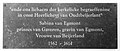 Gedenksteen Sabina van Egmont.jpg 3,885 × 1,641; 3.97 MB
-
 Gemetselde sluitsteen en boog-aanzetten - Oud-Beijerland - 20178221 - RCE.jpg 1,188 × 1,200; 464 KB
-
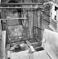
 Grafkapel - Oud-Beijerland - 20327097 - RCE.jpg 877 × 1,200; 237 KB
-
 Gravinnenhuisje met graf Sabina van Egmont.jpg 1,726 × 3,136; 2.79 MB
-
 HervormdeKerk.jpg 3,888 × 2,592; 5.03 MB
-
 HervormdeKerka.jpg 3,888 × 2,592; 7.14 MB
-
 HervormdeKerkToren.jpg 2,592 × 3,888; 7.71 MB
-
 Huwelijkswapen Sabina van Egmont.jpg 2,236 × 2,600; 980 KB
-
 Interieur naar het noord-westen - Oud-Beijerland - 20178229 - RCE.jpg 1,200 × 945; 180 KB
-
 Interieur naar het noorden - Oud-Beijerland - 20178228 - RCE.jpg 1,200 × 946; 179 KB
-
 Interieur naar het oosten - Oud-Beijerland - 20178211 - RCE.jpg 965 × 1,200; 155 KB
-
 Interieur naar het oosten - Oud-Beijerland - 20178226 - RCE.jpg 1,200 × 953; 211 KB
-
 Interieur naar het orgel - Oud-Beijerland - 20178212 - RCE.jpg 962 × 1,200; 187 KB
-
 Interieur naar het westen - Oud-Beijerland - 20178227 - RCE.jpg 1,200 × 932; 188 KB
-
 Interieur naar het zuid-oosten - Oud-Beijerland - 20178230 - RCE.jpg 1,200 × 954; 174 KB
-
 Interieur naar het zuiden met kansel - Oud-Beijerland - 20178210 - RCE.jpg 952 × 1,200; 174 KB
-
 Interieur transept - Oud-Beijerland - 20178209 - RCE.jpg 953 × 1,200; 166 KB
-
 Interieur, aanzicht orgel - Oud-Beijerland - 20349303 - RCE.jpg 956 × 1,200; 215 KB
-
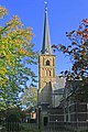
 Kerk vanuit het westen - Oud-Beijerland - 20178202 - RCE.jpg 883 × 1,200; 189 KB
-
 Kerk vanuit het zuid-oosten - Oud-Beijerland - 20178203 - RCE.jpg 886 × 1,200; 171 KB
-
 Lezenaar - Oud-Beijerland - 20178233 - RCE.jpg 1,197 × 1,200; 278 KB
-
 Lezenaar - Oud-Beijerland - 20178234 - RCE.jpg 1,200 × 1,197; 361 KB
-
 Met Nederlands Hervormde Kerk - Oud-Beijerland - 20178192 - RCE.jpg 1,200 × 965; 173 KB
-
 Nieuwe dakvoet met steigergat - Oud-Beijerland - 20178219 - RCE.jpg 1,190 × 1,200; 390 KB
-

-
 Orgel - Oud-Beijerland - 20178231 - RCE.jpg 960 × 1,200; 207 KB
-
 Orgel, tekening Akkermans Dordt - Oud-Beijerland - 20178213 - RCE.jpg 1,200 × 879; 163 KB
-
 Oud-Beijerland, de Dorpskerk en toren RM31920+31921 foto5 2014-04-14 15.54.jpg 4,416 × 3,312; 10.19 MB
-
 Oude boogfries met oude galmgat - Oud-Beijerland - 20178215 - RCE.jpg 1,195 × 1,200; 424 KB
-
 Oude boogfries met oude galmgat - Oud-Beijerland - 20178216 - RCE.jpg 1,198 × 1,200; 442 KB
-
 Oude boogfries met oude galmgat - Oud-Beijerland - 20178217 - RCE.jpg 1,192 × 1,200; 402 KB
-
 Overzicht toren hervormde kerk - Oud-Beijerland - 20377391 - RCE.jpg 936 × 1,200; 278 KB
-
 Preekstoel - Oud-Beijerland - 20178232 - RCE.jpg 940 × 1,200; 246 KB
-
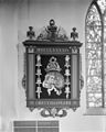 Rouwbord - Oud-Beijerland - 20178235 - RCE.jpg 960 × 1,200; 190 KB
-
 Te verwijderen betonnen kapvoet - Oud-Beijerland - 20178223 - RCE.jpg 1,200 × 1,195; 238 KB
-
 Toren - Oud-Beijerland - 20178205 - RCE.jpg 951 × 1,200; 288 KB
-
 Toren, wapensteen - Oud-Beijerland - 20178201 - RCE.jpg 843 × 1,200; 292 KB
-
 Transept - Oud-Beijerland - 20178208 - RCE.jpg 985 × 1,200; 261 KB
-
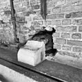
 Vlietkade, overzicht - Oud-Beijerland - 20178284 - RCE.jpg 1,200 × 808; 200 KB
-
 Vooraanzicht - Oud-Beijerland - 20178206 - RCE.jpg 1,200 × 957; 282 KB
-
 Voorgevels binnenplaats - Oud-Beijerland - 20178247 - RCE.jpg 951 × 1,200; 215 KB
-
 Westzijde toren - Oud-Beijerland - 20178238 - RCE.jpg 953 × 1,200; 240 KB
-
 Zuid-west zijde toren - Oud-Beijerland - 20178239 - RCE.jpg 948 × 1,200; 261 KB


_betonnen_vloer_-_Oud-Beijerland_-_20178218_-_RCE.jpg)


