Category:Dorpsplein 4, Riethoven
Jump to navigation
Jump to search
| Object location | | View all coordinates using: OpenStreetMap |
|---|
building in Bergeijk, Netherlands  | |||||
| Upload media | |||||
| Instance of | |||||
|---|---|---|---|---|---|
| Part of | |||||
| Location | Riethoven, Bergeyk | ||||
| Street address |
| ||||
| Located on street |
| ||||
| Heritage designation |
| ||||
 | |||||
|
This is a category about rijksmonumentcomplex number 517903
|
Café
|
This is a category about rijksmonument number 517904
|
Schuur
|
This is a category about rijksmonument number 517905
|
| Address |
|
Media in category "Dorpsplein 4, Riethoven"
The following 40 files are in this category, out of 40 total.
-
 Achtergevel - Riethoven - 20338892 - RCE.jpg 1,181 × 1,200; 366 KB
-
 Ankers linker zijgevel - Riethoven - 20338895 - RCE.jpg 1,181 × 1,200; 339 KB
-
 Café Van Deijck Dorpsplein 4 Riethoven Monument 517904.jpg 4,320 × 3,240; 6.08 MB
-
 Detail zijgevel- deur met twee muurankers - Riethoven - 20338900 - RCE.jpg 1,200 × 1,162; 332 KB
-
 Detail zijgevel- T-venster en twee muurankers - Riethoven - 20338905 - RCE.jpg 1,181 × 1,200; 319 KB
-
 Dorpsplein 4, Riethoven (2).JPG 4,320 × 3,240; 5.73 MB
-
 Dorpsplein 4, Riethoven (3).JPG 4,320 × 3,240; 5.52 MB
-
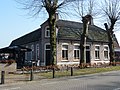 Dorpsplein 4, Riethoven.JPG 4,320 × 3,240; 5.38 MB
-

-
 Linker zijgevel van het voormalig woonhuis - Riethoven - 20403788 - RCE.jpg 1,200 × 812; 277 KB
-
 Overzicht - Riethoven - 20331786 - RCE.jpg 1,200 × 783; 261 KB
-
 Overzicht - Riethoven - 20331787 - RCE.jpg 1,200 × 783; 231 KB
-
 Overzicht achtergevel en schuur - Riethoven - 20338891 - RCE.jpg 1,179 × 1,200; 517 KB
-

-

-

-
 Overzicht met omgeving, vanaf het ANWB verkeersbord - Riethoven - 20338901 - RCE.jpg 1,181 × 1,200; 352 KB
-
 Overzicht van achter af gezien - Riethoven - 20338894 - RCE.jpg 1,181 × 1,200; 419 KB
-
 Overzicht van schuur aan de rechterzijgevel - Riethoven - 20403783 - RCE.jpg 1,200 × 798; 294 KB
-
 Overzicht van schuur aan de rechterzijgevel - Riethoven - 20403784 - RCE.jpg 1,200 × 822; 251 KB
-
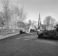
 Overzicht vanaf de oprit van de kerk - Riethoven - 20338886 - RCE.jpg 1,179 × 1,200; 387 KB
-
 Overzicht vanuit de Molenstraat - Riethoven - 20338887 - RCE.jpg 1,170 × 1,200; 314 KB
-
 Overzicht vanuit de Willibrordusstraat - Riethoven - 20338888 - RCE.jpg 1,179 × 1,200; 274 KB
-
 Overzicht voorgevel huis - Riethoven - 20338889 - RCE.jpg 1,183 × 1,200; 467 KB
-
 Overzicht voorgevel van het voormalige woonhuis - Riethoven - 20403787 - RCE.jpg 1,200 × 788; 319 KB
-
 Overzicht zijgevel - Riethoven - 20338890 - RCE.jpg 1,176 × 1,200; 298 KB
-
 Overzicht, hoekgevel met voordeur - Riethoven - 20338902 - RCE.jpg 1,197 × 1,200; 404 KB
-
 Schuren bij Dorpsplein 4, Riethoven.JPG 4,320 × 3,240; 5.6 MB
-
 Schuur - Riethoven - 20338893 - RCE.jpg 1,186 × 1,200; 468 KB
-
-
 T.T Cafeboerderij Riethoven Bakelieten Schakelaar.JPG 1,200 × 800; 209 KB
-
 T.T Cafeboerderij Riethoven Bedstee.JPG 2,048 × 3,072; 1.15 MB
-
 T.T Cafeboerderij Riethoven Koereppels.JPG 2,048 × 3,072; 1.14 MB
-
 T.T Cafeboerderij Riethoven Tapkast.JPG 800 × 1,200; 237 KB
-
 Zicht op voorgevel van het voormalige woonhuis - Riethoven - 20403786 - RCE.jpg 1,200 × 798; 327 KB
-

-
 Zijgevel met doorrit - Riethoven - 20338896 - RCE.jpg 1,185 × 1,200; 353 KB
-
 Zijgevel met doorrit tegenover huisnummer 11 - Riethoven - 20338897 - RCE.jpg 1,186 × 1,200; 355 KB
-

-
 Zijgevel, muuranker - Riethoven - 20338899 - RCE.jpg 1,200 × 1,181; 363 KB


.JPG)
.JPG)


