Category:Dorpsstraat 28, Loenen aan de Vecht
Jump to navigation
Jump to search
| Object location | | View all coordinates using: OpenStreetMap |
|---|
building in Stichtse Vecht, Netherlands  | |||||
| Upload media | |||||
| Instance of | |||||
|---|---|---|---|---|---|
| Location | Loenen aan de Vecht, Stichtse Vecht, Utrecht, Netherlands | ||||
| Street address |
| ||||
| Located on street |
| ||||
| Heritage designation | |||||
 | |||||
|
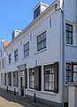
This is a category about rijksmonument number 26028
|
| Address |
|
Media in category "Dorpsstraat 28, Loenen aan de Vecht"
The following 8 files are in this category, out of 8 total.
-
 Achtergevel - Loenen aan de Vecht - 20141603 - RCE.jpg 1,200 × 955; 277 KB
-
 Achtergevel aanbouw - Loenen aan de Vecht - 20141614 - RCE.jpg 1,200 × 954; 327 KB
-
 Gedeelte voorgevel - Loenen aan de Vecht - 20141602 - RCE.jpg 1,200 × 960; 232 KB
-
 Gedeelte voorgevel - Loenen aan de Vecht - 20141615 - RCE.jpg 959 × 1,200; 172 KB
-
 Loenen aan de Vecht - Dorpsstraat 28 RM26028.JPG 2,320 × 3,201; 529 KB
-
 Overzicht - Loenen aan de Vecht - 20141600 - RCE.jpg 1,200 × 955; 234 KB
-
 Voorgevel - Loenen aan de Vecht - 20141601 - RCE.jpg 956 × 1,200; 221 KB
-
 Voorgevels - Loenen aan de Vecht - 20141599 - RCE.jpg 809 × 1,200; 139 KB


