Category:Downhill, County Londonderry
Jump to navigation
Jump to search
village in County Londonderry, Northern Ireland, UK  | |||||
| Upload media | |||||
| Instance of | |||||
|---|---|---|---|---|---|
| Location | Northern Ireland | ||||
 | |||||
English: Downhill (originally known in Irish as Dún Bó) is a small village near Castlerock in County Londonderry, Northern Ireland.
Subcategories
This category has the following 2 subcategories, out of 2 total.
D
- Downhill Beach (26 F)
- Downhill railway station (3 F)
Media in category "Downhill, County Londonderry"
The following 118 files are in this category, out of 118 total.
-
 A cloudy sky at Downhill - geograph.org.uk - 4105090.jpg 640 × 480; 141 KB
-
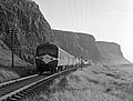
 A passing train, Bennares - geograph.org.uk - 6182726.jpg 1,024 × 685; 355 KB
-
 A2 approaching Downhill - geograph.org.uk - 4027337.jpg 640 × 480; 261 KB
-
 A2 Seacoast Road, Downhill - geograph.org.uk - 3095006.jpg 640 × 480; 51 KB
-
 A2, Benone - geograph.org.uk - 4027328.jpg 640 × 480; 253 KB
-
 Abandoned buildings - geograph.org.uk - 4021848.jpg 3,648 × 2,736; 3.7 MB
-
 Angling, Downhill - geograph.org.uk - 4105097.jpg 640 × 480; 151 KB
-
 Apartments, Downhill - geograph.org.uk - 3043564.jpg 640 × 443; 123 KB
-
 Approaching Downhill on Bishops Road - geograph.org.uk - 3095016.jpg 640 × 480; 62 KB
-
 Basalt crags near Downhill - geograph.org.uk - 4027322.jpg 640 × 853; 506 KB
-
 Beach at Castlerock - geograph.org.uk - 5565814.jpg 640 × 481; 390 KB
-
 Beach at Downhill - geograph.org.uk - 4105084.jpg 640 × 480; 158 KB
-
 Beach at Downhill - geograph.org.uk - 5028226.jpg 1,024 × 682; 114 KB
-
 Beach, Downhill - geograph.org.uk - 4027344.jpg 640 × 480; 277 KB
-
 Bennarees Townland - geograph.org.uk - 3094803.jpg 640 × 480; 71 KB
-
 Benone Strand - geograph.org.uk - 3675587.jpg 3,648 × 2,736; 3.3 MB
-
 Benone Strand to Magilligan Point - geograph.org.uk - 3675592.jpg 3,648 × 2,736; 4.56 MB
-
 Bishops Road, Bennarees - geograph.org.uk - 3094798.jpg 640 × 480; 54 KB
-
 Bishops Road, Bennarees - geograph.org.uk - 3094806.jpg 640 × 480; 58 KB
-
 Boulders, water and sand, Downhill beach - geograph.org.uk - 4105078.jpg 640 × 480; 170 KB
-
 Car park entrance off Mussenden Road - geograph.org.uk - 4028028.jpg 640 × 480; 289 KB
-
 Castelrock strand - geograph.org.uk - 3551534.jpg 3,595 × 2,635; 5.92 MB
-
 Cliffs, Downhill - geograph.org.uk - 2477702.jpg 640 × 480; 41 KB
-
 Coastguard, Downhill - geograph.org.uk - 4105071.jpg 640 × 480; 202 KB
-
 Crossing a stream at Downhill Beach - geograph.org.uk - 3094971.jpg 640 × 480; 55 KB
-
 Dipping toes, Downhill Beach - geograph.org.uk - 6182715.jpg 1,024 × 685; 330 KB
-
 Docks and daisies, Downhill Beach - geograph.org.uk - 6239923.jpg 1,024 × 685; 443 KB
-
 Dog on Downhill Beach with Mussenden Temple.jpg 5,440 × 3,616; 3.94 MB
-
 Dog walker, Downhill Beach - geograph.org.uk - 6182689.jpg 1,024 × 685; 330 KB
-
 Downhill - geograph.org.uk - 4027353.jpg 640 × 480; 292 KB
-
 Downhill Beach - geograph.org.uk - 3491229.jpg 640 × 480; 31 KB
-
 Downhill beach - geograph.org.uk - 4105123.jpg 640 × 480; 178 KB
-
 Downhill Beach - geograph.org.uk - 4391594.jpg 640 × 480; 141 KB
-
 Downhill Beach - geograph.org.uk - 4926997.jpg 640 × 480; 177 KB
-
 Downhill Beach - geograph.org.uk - 5565810.jpg 640 × 480; 324 KB
-
 Downhill Beach - geograph.org.uk - 5836841.jpg 1,024 × 768; 135 KB
-
 Downhill Beach information board - geograph.org.uk - 3094962.jpg 640 × 480; 49 KB
-
 Downhill Beach, Bennares - geograph.org.uk - 6182696.jpg 1,024 × 685; 401 KB
-
 Downhill Forest - geograph.org.uk - 3551581.jpg 3,192 × 2,068; 562 KB
-
 Downhill Hostel - geograph.org.uk - 3029788.jpg 640 × 434; 98 KB
-
 Downhill Hotel, Downhill - geograph.org.uk - 2345145.jpg 640 × 480; 77 KB
-
 Downhill Northern Ireland.jpg 4,032 × 3,024; 3.42 MB
-
 Downhill Railway Runnel - geograph.org.uk - 1197950.jpg 640 × 480; 94 KB
-
 Downhill railway tunnel - geograph.org.uk - 3029791.jpg 640 × 441; 146 KB
-
 Downhill railway tunnel - geograph.org.uk - 3116133.jpg 640 × 426; 123 KB
-
 Downhill Strand - geograph.org.uk - 1812898.jpg 640 × 480; 42 KB
-
 Downhill Strand - geograph.org.uk - 1812910.jpg 640 × 480; 33 KB
-
 Downhill Strand - geograph.org.uk - 2023670.jpg 640 × 480; 61 KB
-
 Downhill, cliff - geograph.org.uk - 5836689.jpg 668 × 1,024; 141 KB
-
 Downhill, railway bridge - geograph.org.uk - 5836833.jpg 1,024 × 768; 115 KB
-
 Driftwood, Downhill Beach - geograph.org.uk - 6182730.jpg 1,024 × 685; 406 KB
-
 Driving in posts, Downhill Beach - geograph.org.uk - 6182662.jpg 1,024 × 685; 414 KB
-
 Drumagully Road, Bennarees - geograph.org.uk - 3094809.jpg 640 × 480; 45 KB
-
 Exercising the horse, Downhill - geograph.org.uk - 1812904.jpg 640 × 480; 66 KB
-
 Flying a drone, Downhill Beach - geograph.org.uk - 6239935.jpg 1,024 × 685; 400 KB
-
 Freight train at Downhill - 1977 (geograph 3462144).jpg 1,024 × 768; 410 KB
-
 Freight train at Downhill - 1979 (geograph 3462139).jpg 977 × 743; 510 KB
-
 Horses at Downhill - geograph.org.uk - 1812913.jpg 640 × 480; 61 KB
-
 Kites, Downhill Desmene - geograph.org.uk - 4027332.jpg 640 × 480; 192 KB
-
 Lifeguard jetski, Downhill beach - geograph.org.uk - 4105116.jpg 640 × 480; 151 KB
-
 Lifeguard station, Downhill - geograph.org.uk - 4105127.jpg 640 × 480; 172 KB
-
 Lifeguard warning banner, Downhill - geograph.org.uk - 4105072.jpg 640 × 480; 182 KB
-
 Lifeguard, Downhill beach - geograph.org.uk - 4105126.jpg 640 × 480; 148 KB
-
 Lion Gate, Downhill Demesne, Seacoast Road, Castlerock - geograph.org.uk - 4137036.jpg 2,048 × 1,360; 490 KB
-

-
 Mussenden Temple - geograph.org.uk - 2520722.jpg 640 × 477; 60 KB
-
 Railway bridge, Bennares - geograph.org.uk - 6182670.jpg 1,024 × 685; 385 KB
-
 Railway bridge, Downhill - geograph.org.uk - 3094946.jpg 640 × 480; 51 KB
-
 Railway bridge, Downhill - geograph.org.uk - 4105068.jpg 640 × 480; 173 KB
-
 Railway milepost, Downhill (1) - geograph.org.uk - 3117403.jpg 640 × 433; 67 KB
-
 Railway milepost, Downhill (2) - geograph.org.uk - 3117416.jpg 640 × 492; 59 KB
-
 Railway overbridge, Downhill - geograph.org.uk - 3116060.jpg 640 × 437; 129 KB
-
 Railway track at Downhill - geograph.org.uk - 3029665.jpg 640 × 514; 120 KB
-
 Reflections, Downhill Beach - geograph.org.uk - 4391597.jpg 640 × 480; 112 KB
-
 Ripples in the sand, Downhill Beach - geograph.org.uk - 6182720.jpg 1,024 × 685; 327 KB
-
 RNLI Lifeguard Station, Downhill - geograph.org.uk - 3029801.jpg 640 × 416; 54 KB
-
 RNLI Rescue board, Downhill - geograph.org.uk - 3029821.jpg 640 × 510; 76 KB
-
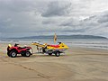 RNLI Rescue vehicles, Downhill - geograph.org.uk - 3094999.jpg 640 × 480; 34 KB
-
 Road and rail at Downhill - geograph.org.uk - 5028223.jpg 1,024 × 682; 140 KB
-
 Rock and reflections, Downhill Beach - geograph.org.uk - 6182728.jpg 1,024 × 685; 382 KB
-
 Rocks and pool, Downhill Beach - geograph.org.uk - 6239928.jpg 1,024 × 685; 366 KB
-
 Rocky stream across Downhill beach - geograph.org.uk - 6182684.jpg 1,024 × 685; 420 KB
-
 Ruins of Downhill Demesne - geograph.org.uk - 4019030.jpg 3,648 × 2,736; 3.8 MB
-
 Seacoast Road - geograph.org.uk - 3095009.jpg 640 × 480; 58 KB
-
 Seacoast Road at Downhill - geograph.org.uk - 4926995.jpg 640 × 480; 155 KB
-
 Seacoast Road, Downhill - geograph.org.uk - 4105066.jpg 640 × 480; 168 KB
-
 Shifting sands, Downhill beach - geograph.org.uk - 4923834.jpg 3,264 × 2,448; 2.31 MB
-
 Small boulders, Downhill Beach - geograph.org.uk - 6182703.jpg 1,024 × 685; 380 KB
-
 Special train at Downhill - 1990 (geograph 3600382).jpg 950 × 721; 486 KB
-
 Special train at Downhill - geograph.org.uk - 2360009.jpg 640 × 480; 74 KB
-
 Steam Train approaching Downhill - geograph.org.uk - 344529.jpg 640 × 426; 124 KB
-
 Stream and sand, Downhill Beach - geograph.org.uk - 6182709.jpg 1,024 × 685; 341 KB
-
 Stream Downhill Beach - geograph.org.uk - 6182707.jpg 1,024 × 685; 424 KB
-
 Stream, Downhill - geograph.org.uk - 3116069.jpg 640 × 389; 85 KB
-
 Surf Rescue team, Downhill Beach - geograph.org.uk - 6239932.jpg 1,024 × 685; 334 KB
-
 Surfers enjoying the waves, Downhill - geograph.org.uk - 4105106.jpg 640 × 481; 124 KB
-
 Surfers, Downhill - geograph.org.uk - 4105101.jpg 640 × 480; 132 KB
-
 Survey Marker - geograph.org.uk - 4019044.jpg 3,648 × 2,736; 4.33 MB
-
 Telephone call box, Downhill - geograph.org.uk - 3029783.jpg 640 × 604; 134 KB
-
 The Bishop's Road, Downhill - geograph.org.uk - 3116044.jpg 640 × 383; 86 KB
-
 The Mussenden Temple - geograph.org.uk - 4019038.jpg 3,648 × 2,736; 3.83 MB
-
 The Mussenden Temple, Downhill (2) - geograph.org.uk - 3373156.jpg 640 × 401; 75 KB
-
 The Mussenden Temple, Downhill - geograph.org.uk - 3117311.jpg 640 × 449; 79 KB
-
 Tide marks on Downhill Beach - geograph.org.uk - 6182678.jpg 1,024 × 685; 391 KB
-
 Tourist, Downhill beach - geograph.org.uk - 4105073.jpg 640 × 480; 175 KB
-
 Tourists, Downhill - geograph.org.uk - 4105131.jpg 640 × 480; 175 KB
-
 Tracks in the sand, Downhill Beach - geograph.org.uk - 6239929.jpg 1,024 × 685; 305 KB
-
 Train at Musseden Temple.jpg 486 × 640; 94 KB
-
 Trotting at Downhill Beach - geograph.org.uk - 5564738.jpg 640 × 480; 314 KB
-
 Umbra level crossing near Downhill.jpg 525 × 286; 47 KB
-
 Uphill - geograph.org.uk - 4027349.jpg 640 × 480; 302 KB
-
 Volcanic rocks, Downhill (1) - geograph.org.uk - 3116118.jpg 640 × 389; 105 KB
-
 Volcanic rocks, Downhill (2) - geograph.org.uk - 3117409.jpg 640 × 383; 107 KB
-
 Waterfalls, Downhill - geograph.org.uk - 3029811.jpg 640 × 427; 107 KB
-
 Waves at Downhill (1) - geograph.org.uk - 3117317.jpg 640 × 406; 69 KB
-
 Waves at Downhill (2) - geograph.org.uk - 3117321.jpg 640 × 424; 78 KB
-
 Whale flying over Downhill - geograph.org.uk - 4027338.jpg 640 × 480; 186 KB
-
 WWII buildings, Bennarees - geograph.org.uk - 3094796.jpg 640 × 480; 65 KB


.jpg)
.jpg)


_-_geograph.org.uk_-_3117403.jpg)
_-_geograph.org.uk_-_3117416.jpg)


.jpg)


_-_geograph.org.uk_-_3373156.jpg)


_-_geograph.org.uk_-_3116118.jpg)
_-_geograph.org.uk_-_3117409.jpg)

_-_geograph.org.uk_-_3117317.jpg)
_-_geograph.org.uk_-_3117321.jpg)

