Category:Drainage basin maps of Japan
Jump to navigation
Jump to search
Media in category "Drainage basin maps of Japan"
The following 16 files are in this category, out of 16 total.
-
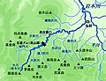
 Chikugo River basin major facilities.svg 480 × 360; 1.95 MB
-
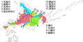
 First class river systems on Kyushu.svg 299 × 386; 681 KB
-
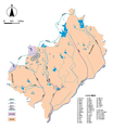
 Hokkaido river map.png 848 × 430; 44 KB
-
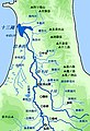
 Improved map of Shinano river basin (Japan) in Russian.svg 599 × 708; 283 KB
-
 Iwakigawa-river-downstream-outline.jpg 300 × 439; 116 KB
-
 Iwakigawa-river-Hirakawa-basin-outline.jpg 300 × 199; 61 KB
-
 Iwakigawa-river-upstream-outline.jpg 300 × 230; 67 KB
-
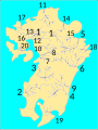 Japan first class rivers Kyushu map.svg 257 × 341; 752 KB
-
 Japan first class rivers Shikoku map.svg 291 × 207; 83 KB
-
 Map of Shinano river basin - Japan (in Russian).svg 539 × 802; 198 KB
-
 Map of the Main Rivers and the Basins in Midori Ward Nagoya 2015.png 3,330 × 2,490; 1.31 MB
-
 Map of the Main Rivers and the Basins in Nagoya City 2023.svg 1,967 × 2,004; 2.54 MB
-
 Map of the Main Rivers and the Basins in Toyoake City 2018.png 2,810 × 3,250; 930 KB
-
 Map of the Main Rivers and the Basins in Toyota City 2019.png 4,028 × 2,820; 837 KB
-
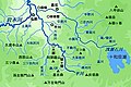
 Osm高浜川 (愛知県)水系流域図.png 518 × 526; 424 KB
-
 境川水系 (愛知県)流域図.png 561 × 583; 623 KB


_in_Russian.svg)


.svg)


%E6%B0%B4%E7%B3%BB%E6%B5%81%E5%9F%9F%E5%9B%B3.png)
%E6%B5%81%E5%9F%9F%E5%9B%B3.png)