Category:Driehoek 32, Ede
Jump to navigation
Jump to search
| Object location | | View all coordinates using: OpenStreetMap |
|---|
farmhouse in Ede, Netherlands  | |||||
| Upload media | |||||
| Instance of | |||||
|---|---|---|---|---|---|
| Location | Ede, Gelderland, Netherlands | ||||
| Street address |
| ||||
| Located on street |
| ||||
| Heritage designation |
| ||||
 | |||||
Nederlands: In de Driehoek
|
This is a category about rijksmonument number 14451
|
| Address |
|
Media in category "Driehoek 32, Ede"
The following 7 files are in this category, out of 7 total.
-
 Aanzicht - Ede - 20066879 - RCE.jpg 1,200 × 1,193; 255 KB
-
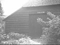 Achtergevel (nu museumboerderij 'oud-Ede') nr. ED1-A - Ede - 20473124 - RCE.jpg 1,200 × 900; 122 KB
-
 Achtergevel - Ede - 20066880 - RCE.jpg 1,200 × 1,188; 379 KB
-
 Boerderij en bakhuis.JPG 3,008 × 2,000; 3.01 MB
-
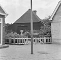
 Exterieur OVERZICHT LINKER ZIJGEVEL - Ede - 20288848 - RCE.jpg 1,190 × 1,200; 368 KB
-
 Exterieur OVERZICHT LINKER ZIJGEVEL EN ACHTERGEVEL - Ede - 20288849 - RCE.jpg 1,185 × 1,200; 476 KB
-
 Exterieur VOORGEVEL - Ede - 20288847 - RCE.jpg 1,181 × 1,200; 315 KB

_nr._ED1-A_-_Ede_-_20473124_-_RCE.jpg)


