Category:Droxford
Jump to navigation
Jump to search
village and civil parish in Hampshire, England  | |||||
| Upload media | |||||
| Instance of | |||||
|---|---|---|---|---|---|
| Location | City of Winchester, Hampshire, South East England, England | ||||
| Population |
| ||||
 | |||||
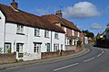
English: Droxford is a village in Hampshire, England, lying in the Meon valley, and lies around 6 km east of Bishop's Waltham within the new South Downs National Park. The A32 passes through the village between Gosport and Alton. Local ammenities include a post office, two garages, two pubs and a village hall.
Nederlands: Droxford is een dorp in het Engelse graafschap Hampshire, gelegen in het dal van de Meon.
Subcategories
This category has the following 8 subcategories, out of 8 total.
B
- Bakers Arms, Droxford (2 F)
D
- Droxford railway station (40 F)
- Droxford Village Hall (3 F)
M
- The Manor House, Droxford (2 F)
W
- White Horse Inn, Droxford (2 F)
Media in category "Droxford"
The following 200 files are in this category, out of 330 total.
(previous page) (next page)-
 "The Baker's Arms" PH in Droxford - geograph.org.uk - 4290202.jpg 800 × 600; 121 KB
-
 A few poppies alongside Hacketts Lane - geograph.org.uk - 3054568.jpg 3,872 × 2,592; 4.68 MB
-

-

-

-

-

-

-

-

-

-

-

-

-

-

-

-

-

-

-

-

-

-

-

-

-

-

-

-

-
 A32 looking north - geograph.org.uk - 3113845.jpg 640 × 481; 66 KB
-
-
 Allotments at Droxford - geograph.org.uk - 592509.jpg 427 × 640; 112 KB
-

-
 B2150 approaching A32 junction - geograph.org.uk - 3113841.jpg 640 × 480; 61 KB
-
 B2150 approaching Brockbridge - geograph.org.uk - 457036.jpg 640 × 480; 132 KB
-
 Bowl in the valley side west of Droxford - geograph.org.uk - 6085809.jpg 1,024 × 683; 196 KB
-

-
 Chestnut Rise, Droxford - geograph.org.uk - 5020143.jpg 2,048 × 1,536; 1.57 MB
-
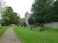
 Church of St Mary and All Angels, Droxford - geograph.org.uk - 6085480.jpg 1,024 × 683; 245 KB
-
 Droxford - Millers Cottage - 20220928150037.jpg 5,184 × 3,456; 12.6 MB
-

-
 Droxford church - geograph.org.uk - 6041322.jpg 1,024 × 768; 366 KB
-
 Droxford fire station - geograph.org.uk - 279887.jpg 640 × 426; 203 KB
-
 Droxford Fire Station - geograph.org.uk - 5020128.jpg 2,048 × 1,536; 1.5 MB
-
 Droxford Ford - geograph.org.uk - 3748265.jpg 3,872 × 2,592; 4.82 MB
-
 Droxford geograph-4114275-by-Ben-Brooksbank.jpg 2,384 × 1,247; 3.19 MB
-
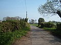
 Droxford Road - geograph.org.uk - 6402955.jpg 1,024 × 684; 348 KB
-
 Dundridge Lane - geograph.org.uk - 5875576.jpg 640 × 480; 73 KB
-
 Dundridge Lane - geograph.org.uk - 5875596.jpg 640 × 480; 68 KB
-
 Early growth, field east of Shepherds Farm Lane - geograph.org.uk - 6041412.jpg 1,024 × 768; 258 KB
-

-
 Entering Brockbridge - geograph.org.uk - 5020150.jpg 2,048 × 1,536; 1.57 MB
-
 Entering Droxford on the A32 - geograph.org.uk - 3668099.jpg 640 × 472; 79 KB
-
 Farm access road - geograph.org.uk - 5875577.jpg 640 × 480; 94 KB
-

-
 Field of oil-seed rape - geograph.org.uk - 6041410.jpg 1,024 × 768; 255 KB
-
 Fields above Mayhill Lane - geograph.org.uk - 6584035.jpg 1,024 × 683; 192 KB
-
 Fly tipping on Peak Lane footpath - geograph.org.uk - 3507230.jpg 640 × 427; 141 KB
-

-
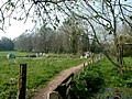
 Footbridge over River Meon, Droxford - geograph.org.uk - 6041335.jpg 1,024 × 768; 494 KB
-
 Footpath across the Meon, Droxford - geograph.org.uk - 6041341.jpg 1,024 × 768; 336 KB
-
 Footpath along field edge west of Droxford - geograph.org.uk - 6085810.jpg 1,024 × 683; 209 KB
-
 Footpath climbing Peak Down - geograph.org.uk - 3507130.jpg 427 × 640; 207 KB
-
 Footpath entering small copse on Fir Down - geograph.org.uk - 6085815.jpg 1,024 × 683; 393 KB
-
 Footpath on Fir Down - geograph.org.uk - 3507391.jpg 640 × 427; 106 KB
-
 Footpath on Peak Down - geograph.org.uk - 3507160.jpg 640 × 427; 142 KB
-

-
 Footpath to Peak Down in Park Lane - geograph.org.uk - 2384136.jpg 640 × 480; 62 KB
-
 Former water mill, Droxford - geograph.org.uk - 6085483.jpg 1,024 × 683; 306 KB
-
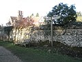
 Gateway to cemetery - geograph.org.uk - 4290213.jpg 800 × 600; 163 KB
-
 Harvested field - geograph.org.uk - 5875575.jpg 640 × 480; 76 KB
-
 High Street Droxford - geograph.org.uk - 5023558.jpg 1,960 × 1,412; 1.09 MB
-
 High Street Droxford - geograph.org.uk - 5023607.jpg 2,048 × 1,536; 996 KB
-
 High Street, Droxford - geograph.org.uk - 592548.jpg 640 × 427; 96 KB
-
 High Street, Droxford - geograph.org.uk - 594724.jpg 640 × 427; 101 KB
-
 High Street, Droxford - geograph.org.uk - 6041349.jpg 1,024 × 768; 209 KB
-
 High Street, Droxford - geograph.org.uk - 6085477.jpg 1,024 × 683; 159 KB
-
 Horse in field below Midlington Farm - geograph.org.uk - 6584022.jpg 1,024 × 683; 181 KB
-
 Horses in field above Swanmore Road - geograph.org.uk - 6584029.jpg 1,024 × 683; 216 KB
-
 Horsey fields on Swanmore Barn Farm - geograph.org.uk - 3507225.jpg 640 × 427; 129 KB
-
 Houses on Union Lane, Droxford - geograph.org.uk - 5020099.jpg 2,048 × 1,536; 1.55 MB
-
 Housing at South Hill, Droxford - geograph.org.uk - 3507497.jpg 640 × 427; 149 KB
-
 Junction of three lanes - geograph.org.uk - 4290209.jpg 800 × 600; 103 KB
-
 Lone tree in field north of Cott Street Farm - geograph.org.uk - 6584012.jpg 1,024 × 683; 204 KB
-

-

-
-
 Looking north across Sheep Pond Lane - geograph.org.uk - 4290225.jpg 800 × 545; 135 KB
-
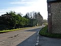
 Looking north on High Street - geograph.org.uk - 4290196.jpg 800 × 600; 123 KB
-

-
-
 Looking up Midlington Hill - geograph.org.uk - 4290700.jpg 800 × 600; 151 KB
-
 Lycroft Farm - geograph.org.uk - 400786.jpg 640 × 480; 70 KB
-
 Mayhill Cottage - geograph.org.uk - 355731.jpg 640 × 480; 100 KB
-
 Mayhill Lane - geograph.org.uk - 6402958.jpg 1,024 × 684; 395 KB
-
 Memorial Seat on Peak Down - geograph.org.uk - 3507371.jpg 640 × 427; 137 KB
-
 Meon Valley south of Droxford - geograph.org.uk - 6085490.jpg 1,024 × 683; 186 KB
-
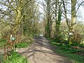
 Meon Valley Trail - geograph.org.uk - 355793.jpg 640 × 427; 154 KB
-
 Meringtons crossroads, Droxford - geograph.org.uk - 592520.jpg 640 × 427; 57 KB
-

-
 Midlington Hill looking eastwards - geograph.org.uk - 4290693.jpg 800 × 600; 137 KB
-
 Midlington Road, Droxford - geograph.org.uk - 5237306.jpg 1,849 × 1,385; 1.16 MB
-
 Midlington, Hampshire - geograph.org.uk - 2251714.jpg 3,504 × 2,336; 628 KB
-
 Mill Lane Droxford - geograph.org.uk - 400841.jpg 640 × 480; 89 KB
-
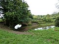
 Mill Pond Droxford - geograph.org.uk - 400825.jpg 640 × 480; 197 KB
-
 Mole highway^ - geograph.org.uk - 6085494.jpg 1,024 × 683; 262 KB
-

-
 Motocross track on Peak Down - geograph.org.uk - 2595803.jpg 640 × 427; 112 KB
-
 Motocross track on Peak Down - geograph.org.uk - 3507132.jpg 640 × 427; 113 KB
-
 Motocross track on Peak Down - geograph.org.uk - 3507138.jpg 640 × 427; 131 KB
-
 Motocross track on Peak Down - geograph.org.uk - 3507147.jpg 640 × 427; 131 KB
-
 Motocross track on Peak Down - geograph.org.uk - 3507153.jpg 640 × 427; 146 KB
-
 Murco service station, Droxford - geograph.org.uk - 592392.jpg 640 × 430; 108 KB
-
 Near the top of Midlington Hill - geograph.org.uk - 3908969.jpg 640 × 480; 211 KB
-
 North Lodge, Hazel Holt - geograph.org.uk - 1925267.jpg 427 × 640; 244 KB
-
 Office building on Union Lane, Droxford - geograph.org.uk - 5020090.jpg 2,048 × 1,536; 1.51 MB
-

-
 Old police station, Droxford - geograph.org.uk - 592561.jpg 427 × 640; 77 KB
-
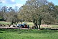 Old tractor taking a rest - geograph.org.uk - 6085801.jpg 1,024 × 683; 278 KB
-
 On Green Lane, descending through the wood - geograph.org.uk - 6584019.jpg 1,024 × 683; 295 KB
-
 On Shepherds Down - geograph.org.uk - 3266810.jpg 1,600 × 1,067; 239 KB
-
 Oxford Lane - geograph.org.uk - 6405853.jpg 1,024 × 768; 600 KB
-
 Park Lane - geograph.org.uk - 400769.jpg 640 × 480; 98 KB
-
 Park Lane, Droxford - geograph.org.uk - 5020062.jpg 2,048 × 1,536; 1.6 MB
-
 Path across bare field - geograph.org.uk - 6584014.jpg 1,024 × 683; 217 KB
-
 Path between fields to Droxford - geograph.org.uk - 6085813.jpg 1,024 × 683; 211 KB
-
 Path down to river, Droxford - geograph.org.uk - 6041329.jpg 1,024 × 768; 481 KB
-
 Police Station Lane, Droxford - geograph.org.uk - 592567.jpg 427 × 640; 114 KB
-
 Rainbow over Green Lane - geograph.org.uk - 6405825.jpg 1,024 × 768; 249 KB
-
 Revervoir atop Fir Down - geograph.org.uk - 3507217.jpg 640 × 427; 107 KB
-

-

-
 Ringwood Motocross event on Peak Down - geograph.org.uk - 3507167.jpg 640 × 432; 147 KB
-
 River Meon - geograph.org.uk - 6041338.jpg 1,024 × 768; 464 KB
-
 River Meon at Droxford - geograph.org.uk - 3909002.jpg 640 × 480; 143 KB
-
 River Meon at Droxford - geograph.org.uk - 400858.jpg 640 × 480; 186 KB
-
 River Meon south of Cut Bridge - geograph.org.uk - 6085499.jpg 1,024 × 683; 232 KB
-
 Road junction - geograph.org.uk - 5875582.jpg 640 × 480; 91 KB
-
 Sheep Pond - geograph.org.uk - 355772.jpg 640 × 427; 60 KB
-
 Sheep Pond - geograph.org.uk - 355784.jpg 640 × 427; 59 KB
-
 Shepherds Down Crossroads near Droxford - geograph.org.uk - 6449454.jpg 1,799 × 1,199; 452 KB
-
 Shepherds Down with horse - geograph.org.uk - 4269793.jpg 640 × 480; 99 KB
-
 Signpost in Droxford village centre - geograph.org.uk - 1123556.jpg 640 × 480; 57 KB
-
-
 Small copse in field south of Droxford - geograph.org.uk - 6085491.jpg 1,024 × 683; 250 KB
-

-

-

-

-

-

-

-

-

-

-

-

-
-

-

-

-

-
-

-

-

-

-

-

-

-

-

-

-

-

-
-

-

-

-

-

-

-

-

-

-

-

-

-

-

-

-

-

-

-

-

-

-

-


_-_geograph.org.uk_-_6169538.jpg)
_-_geograph.org.uk_-_6172585.jpg)
_-_geograph.org.uk_-_6172586.jpg)
_-_geograph.org.uk_-_6172589.jpg)
_-_geograph.org.uk_-_6172591.jpg)
_-_geograph.org.uk_-_6172593.jpg)
_-_geograph.org.uk_-_6172596.jpg)
_-_geograph.org.uk_-_6172600.jpg)
_-_geograph.org.uk_-_6172602.jpg)
_-_geograph.org.uk_-_6172604.jpg)
_-_geograph.org.uk_-_6172610.jpg)
_-_geograph.org.uk_-_6169540.jpg)
_-_geograph.org.uk_-_6172611.jpg)
_-_geograph.org.uk_-_6172613.jpg)
_-_geograph.org.uk_-_6172615.jpg)
_-_geograph.org.uk_-_6172616.jpg)
_-_geograph.org.uk_-_6172618.jpg)
_-_geograph.org.uk_-_6172620.jpg)
_-_geograph.org.uk_-_6172621.jpg)
_-_geograph.org.uk_-_6172623.jpg)
_-_geograph.org.uk_-_6172624.jpg)
_-_geograph.org.uk_-_6169542.jpg)
_-_geograph.org.uk_-_6172566.jpg)
_-_geograph.org.uk_-_6172568.jpg)
_-_geograph.org.uk_-_6172569.jpg)
_-_geograph.org.uk_-_6172571.jpg)
_-_geograph.org.uk_-_6172579.jpg)
_-_geograph.org.uk_-_6172582.jpg)


_-_geograph.org.uk_-_5269120.jpg)


_-_geograph.org.uk_-_2653698.jpg)
_-_geograph.org.uk_-_2653703.jpg)
_-_geograph.org.uk_-_2653706.jpg)
_-_geograph.org.uk_-_2653708.jpg)
_-_geograph.org.uk_-_2653712.jpg)
_-_geograph.org.uk_-_2653713.jpg)
_-_geograph.org.uk_-_2653725.jpg)
_-_geograph.org.uk_-_2653731.jpg)
_-_geograph.org.uk_-_2653734.jpg)
_-_geograph.org.uk_-_2653743.jpg)
_-_geograph.org.uk_-_2653746.jpg)
_-_geograph.org.uk_-_2653750.jpg)
_-_geograph.org.uk_-_2653759.jpg)
_-_geograph.org.uk_-_2653769.jpg)
_-_geograph.org.uk_-_2653772.jpg)
_-_geograph.org.uk_-_2653779.jpg)
_-_geograph.org.uk_-_2681610.jpg)
_-_geograph.org.uk_-_2681613.jpg)
_-_geograph.org.uk_-_2684089.jpg)
_-_geograph.org.uk_-_2684091.jpg)
_-_geograph.org.uk_-_2684100.jpg)
_-_geograph.org.uk_-_2684108.jpg)
_-_geograph.org.uk_-_2684113.jpg)
_-_geograph.org.uk_-_2686047.jpg)
_-_geograph.org.uk_-_2686049.jpg)
_-_geograph.org.uk_-_2693181.jpg)
_-_geograph.org.uk_-_2693184.jpg)
_-_geograph.org.uk_-_2693189.jpg)
_-_geograph.org.uk_-_2693196.jpg)
_-_geograph.org.uk_-_2693192.jpg)
_-_geograph.org.uk_-_2693199.jpg)
_-_geograph.org.uk_-_2693201.jpg)
_-_geograph.org.uk_-_2693212.jpg)
_-_geograph.org.uk_-_2693307.jpg)
_-_geograph.org.uk_-_2693310.jpg)
_-_geograph.org.uk_-_2693313.jpg)
_-_geograph.org.uk_-_2693318.jpg)
_-_geograph.org.uk_-_2693327.jpg)
_-_geograph.org.uk_-_2693331.jpg)
_-_geograph.org.uk_-_2693336.jpg)
_-_geograph.org.uk_-_2693322.jpg)
_-_geograph.org.uk_-_2696291.jpg)
_-_geograph.org.uk_-_2696324.jpg)
_-_geograph.org.uk_-_2696328.jpg)
_-_geograph.org.uk_-_2696333.jpg)
_-_geograph.org.uk_-_2696337.jpg)
_-_geograph.org.uk_-_2696339.jpg)
_-_geograph.org.uk_-_2696342.jpg)
_-_geograph.org.uk_-_2696346.jpg)
_-_geograph.org.uk_-_2698223.jpg)
_-_geograph.org.uk_-_2698224.jpg)
_-_geograph.org.uk_-_2698227.jpg)
_-_geograph.org.uk_-_2698229.jpg)
_-_geograph.org.uk_-_2698230.jpg)