Category:Druk Yul Park, Vienna
Jump to navigation
Jump to search
| Object location | | View all coordinates using: OpenStreetMap |
|---|
park in Vienna, Austria  | |||||
| Upload media | |||||
| Instance of | |||||
|---|---|---|---|---|---|
| Location | |||||
 | |||||
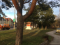
English: The Druk Yul park is a small park in Liesing, Vienna between Speisingerstraße and Rosenhügelstraße. It is related to Bhutan. Chörten 2010 and Mani wall 2012.
Deutsch: Der Druk Yul Park ist ein kleiner Park in Wien-Liesing, zwischen Speisingerstraße und Rosenhügelstraße. Der Name Druk Yul (Land des Donnerdrachens) bezieht sich auf Bhutan. Chörten 2010 und Mani Wand 2012. [1]
 |
|
Media in category "Druk Yul Park, Vienna"
The following 18 files are in this category, out of 18 total.
-
 Druk Yul Park 01, Vienna - info board.jpg 3,048 × 4,856; 7.56 MB
-
 Druk Yul Park 02, Vienna - chörten.jpg 4,808 × 3,168; 6.5 MB
-
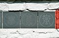
 Druk Yul Park 03, Vienna - mani wall.jpg 4,928 × 3,264; 7.8 MB
-
 Druk Yul Park 04, Vienna - mani wall.jpg 4,732 × 3,214; 6.75 MB
-
 Druk Yul Park 05, Vienna - mani wall.jpg 4,818 × 3,058; 5.08 MB
-
 Druk Yul Park 06, Vienna - mani wall.jpg 4,713 × 3,080; 4.85 MB
-
 Druk Yul Park 07, Vienna - mani wall.jpg 4,818 × 3,075; 5 MB
-
 Druk Yul Park 08, Vienna - birds' bath.jpg 4,565 × 3,162; 7.35 MB
-
 Druk-Yul-Park Wien.jpg 2,958 × 2,958; 7.44 MB
-
 Wien 23 Druk-Yul-Park a.jpg 3,000 × 1,688; 3.48 MB
-
 Wien 23 Druk-Yul-Park b.jpg 3,000 × 1,687; 3.24 MB
-
 Wien 23 Druk-Yul-Park c.jpg 3,000 × 1,687; 2.94 MB
-
 Wien 23 Druk-Yul-Park d.jpg 3,000 × 1,687; 2.99 MB
-
 Wien 23 Druk-Yul-Park e.jpg 3,000 × 1,687; 3 MB
-
 Wien 23 Druk-Yul-Park f.jpg 3,000 × 1,688; 3.44 MB
-
 Wien 23 Druk-Yul-Park g.jpg 2,000 × 2,000; 2.47 MB
-
 Übersichtsaufnahme des Druk-Yul-Park.jpg 3,811 × 2,713; 3.66 MB
-
 Übersichtsaufnahme Druk-Yul-Park.png 3,676 × 2,756; 13.75 MB


